Near Blue Earth in Faribault County, Minnesota — The American Midwest (Upper Plains)
The Prairie's Gifts
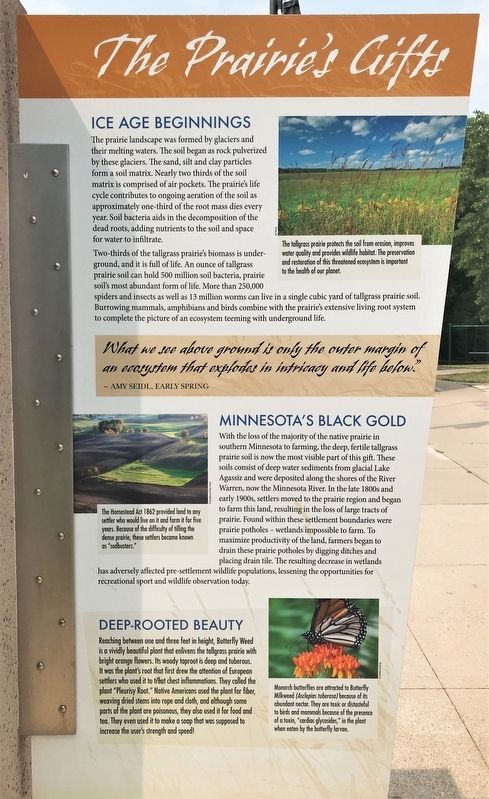
The prairie landscape was formed by glaciers and their melting waters. The soil began as rock pulverized by these glaciers. The sand, silt and clay particles form a soil matrix. Nearly two thirds of the soil matrix is comprised of air pockets. The prairie's life cycle contributes to ongoing aeration of the soil as approximately one-third of the root mass dies every year. Soil bacteria aids in the decomposition of the dead roots, adding nutrients to the soil and space for water to infiltrate.
Two-thirds of the tallgrass prairie's biomass is underground, and it is full of life. An ounce of tallgrass prairie soil can hold 500 million soil bacteria, prairie soil's most abundant form of life. More than 250,000 spiders and insects as well as 13 million worms can live in a single cubic yard of tallgrass prairie soil. Burrowing mammals, amphibians and birds combine with the prairie's extensive living root system to complete the picture of an ecosystem teeming with underground life.
Caption:
The tallgrass prairie protects the soil from erosion, improves water quality and provides wildlife habitat. The preservation and restoration of this threatened ecosystem is important to the health of our planet.
What we see above ground is only the outer margin of an ecosystem that explodes in intricacy and life below."
~ Amy Seidl, Early Spring
Minnesota's Black Gold
With the loss of the majority of the native prairie in southern Minnesota to farming, the deep, fertile tallgrass prairie soil is now the most visible part of this gift. These soils consist of deep water sediments from glacial Lake Agassiz and were deposited along the shores of the River Warren, now the Minnesota River. In the late 1800s and early 1900s, settlers moved to the prairie region and began to farm this land, resulting in the loss of large tracts of prairie. Found within these settlement boundaries were prairie potholes – wetlands impossible to farm. To maximize productivity of the land, farmers began to drain these prairie potholes by digging ditches and placing drain tile. The resulting decrease in wetlands has adversely affected pre-settlement wildlife populations, lessening the opportunities for recreational sport and wildlife observation today.
Caption:
The Homestead Act 1862 provided land to any settler who would live on it and farm it for five years. Because of the difficulty of tilling the dense prairie, these settlers became known as "sodbusters."
Deep-Rooted Beauty
Reaching between one and three feet in height, Butterfly Weed is a vividly beautiful plant that enlivens the tallgrass prairie with bright orange flowers. Its woody taproot is deep and tuberous. It was the plant's root that first drew the attention of European settlers who used it to treat chest inflammations. They called the plant "Pleurisy Root." Native Americans used the plant for fiber, weaving dried stems into rope and cloth, and although some parts of the plant are poisonous, they also used it for food and tea. They even used it to make a soap that was supposed to increase the user's strength and speed!
Caption:
Monarch butterflies are attracted to Butterfly Milkweed (Asclepias tuberosa) because of its abundant nectar. They are toxic or distasteful to birds and mammals because of the presence of a toxin, "cardiac glycosides," in the plant when eaten by the butterfly larvae.
Tallgrass Prairie
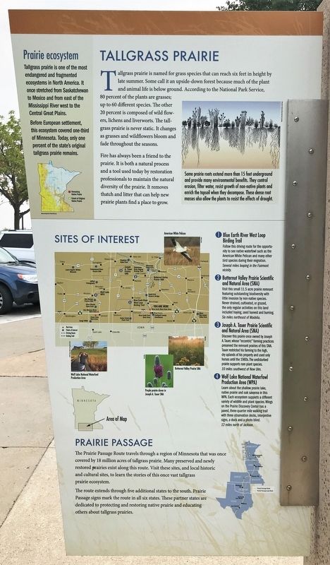
Tallgrass prairie is named for grass species that can reach six feet in height by late summer. Some call it an upside-down forest because much of the plant and animal life is below ground. According to the National Park Service, 80 percent of the plants are grasses; up to 60 different species. The other 20 percent is composed of wild flowers, lichens and liverworts. The tallgrass prairie is never static. It changes as grasses and wildflowers bloom and fade throughout the seasons.
Fire has always been a friend to the prairie. It is both a natural process and a tool used today by restoration professionals to maintain the natural diversity of the prairie. It removes thatch and litter that can help new prairie plants find a place to grow.
Caption:
Some prairie roots extend more than 15 feet underground and provide many environmental benefits. They control erosion, filter water, resist growth of non-native plants and enrich the topsoil when they decompose. These dense root masses also allow the plants to resist the effects of drought.
Prairie ecosystem
Tallgrass prairie is one of the most endangered and fragmented ecosystems in North America. It once stretched from Saskatchewan to Mexico and from east of the Mississippi River west to the Central Great Plains.
Before European settlement, this ecosystem covered one-third of Minnesota. Today, only one percent of the state's original tallgrass prairie remains.
Sites of Interest
1 Blue Earth River West Loop Birding Trail
Follow this driving route for the opportunity to see native waterfowl such as the American White Pelican and many other bird species during their migration.
Several miles looping in the Fairmont vicinity.
2 Butternut Valley Prairie Scientific and Natural Area (SNA)
Visit this small 11.5 acre prairie remnant featuring outstanding biodiversity with little invasion by non-native species. Never drained, cultivated, or grazed, the only regular activities on this land included haying, seed harvest and burning.
Six miles northeast of Madelia.
3 Joseph A. Tauer Prairie Scientific and Natural Area (SNA)
Discover this prairie once owned by Joseph A. Tauer, whose "eccentric" farming practices preserved the remnant prairies of this SNA. Tauer restricted his farming to the high, dry uplands of his property and used only horses until the 1980s. The undisturbed prairie supports rare plant species.
10 miles southwest of New Ulm.
4 Wolf Lake National Waterfowl Production Area (WPA)
Learn about the shallow prairie lake, native prairie and oak savanna in this WPA. Each ecosystem supports a different variety of wildlife and plant species. Wings on the Prairie Discovery Center has a paved, three-quarter mile walking trail with three observation decks, interpretive signs, a dock and a photo blind.
12 miles north of Jackson.
Prairie Passage
The Prairie Passage Route travels through a region of Minnesota that was once covered by 18 million acres of tallgrass prairie. Many preserved and newly restored prairies exist along this route. Visit these sites, and local historic and cultural sites, to learn the stories of this once vast tallgrass prairie ecosystem.
The route extends through five additional states to the south. Prairie Passage signs mark the route in all six states. These partner states are dedicated to protecting and restoring native prairie and educating others about tallgrass prairies.
Topics. This historical marker is listed in these topic lists: Agriculture • Environment. A significant historical year for this entry is 1862.
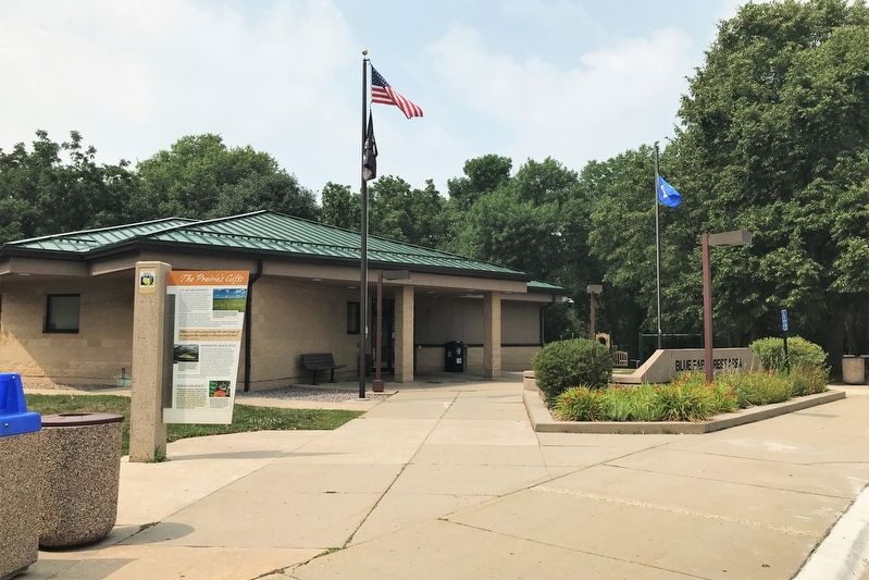
Location. 43° 39.804′ N, 94° 7.057′ W. Marker is near Blue Earth, Minnesota, in Faribault County. Marker can be reached from Interstate 90 at milepost 119,, one mile west of U.S. 169, on the right when traveling west. Located at the westbound Blue Earth Rest Area along Interstate 90. Touch for map. Marker is in this post office area: Blue Earth MN 56013, United States of America. Touch for directions.
Other nearby markers. At least 6 other markers are within 15 miles of this marker, measured as the crow flies. A Golden Dedication for I-90 / Minnesota Agriculture (within shouting distance of this marker); Water Wisdom (approx. 0.4 miles away); A Golden Dedication for I-90 (approx. 0.4 miles away); Exploring Southwestern Minnesota (approx. 0.4 miles away); Pixley (approx. 10.6 miles away); Nashville Center (approx. 14.8 miles away).
Credits. This page was last revised on April 23, 2022. It was originally submitted on April 23, 2022. This page has been viewed 329 times since then and 91 times this year. Photos: 1, 2, 3. submitted on April 23, 2022.


