Near Sharpsburg in Washington County, Maryland — The American Northeast (Mid-Atlantic)
Ferry Hill Place
Chesapeake and Ohio Canal National Historical Park
— National Park Service, U.S. Department of the Interior —
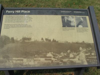
Blackford owned stock in the C&O Canal Company. When the canal came through in 1834 he had easy shipping access for his farm products to market.
Erected by National Park Service, U.S. Department of the Interior.
Topics and series. This historical marker is listed in these topic lists: African Americans • Agriculture • Industry & Commerce • Roads & Vehicles • Waterways & Vessels. In addition, it is included in the Chesapeake and Ohio (C&O) Canal series list. A significant historical year for this entry is 1810.
Location. 39° 26.29′ N, 77° 47.886′ W. Marker is near Sharpsburg, Maryland, in Washington County. Marker can be reached from Shepherdstown Pike (Maryland Route 34) when traveling south. Located on the grounds of a Chesapeake and Ohio Canal Park Administrative area. The entrance to the area is on the opposite side of the road from the intersection between Shepherdstown Pike and Canal Road. Touch for map. Marker is in this post office area: Sharpsburg MD 21782, United States of America. Touch for directions.
Other nearby markers. At least 8 other markers are within walking distance of this marker. Ferry Hill (here, next to this marker); Swearingen’s Ferry and Pack Horse Ford (about 400 feet away, measured in a direct line); Blackford’s Ford (about 400 feet away); The James Rumsey Bridge / The Battle of Antietam or Sharpsburg (about 400 feet away); A View into the Past (about 600 feet away); Shepherdstown (approx. 0.2 miles away); a different marker also named Blackford's Ford (approx. 0.2 miles away); a different marker also named Ferry Hill Place (approx. 0.2 miles away). Touch for a list and map of all markers in Sharpsburg.
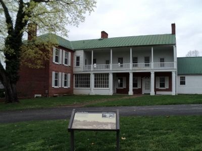
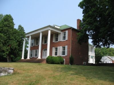
More about this marker. The marker has a background using a picture of Ferry Hill as it existed in the 19th Century. A portrait of John Blackford carries the caption, “John Blackford, shown with one of his children, operated a diversified farm at Ferry Hill until his death on January 15, 1839.” A portrait of Henry Kyd Douglas is captioned, “Henry Kyd Douglas lived here with his parents before the Civil War. Douglas was the youngest staff officer in the Civil War, serving with Confederate General Thomas (Stonewall) Jackson.”
Also see . . .
1. A Study of John Blackford's Operations at Ferry Hill Place. Documenting the American South website entry (Submitted on August 3, 2007, by Craig Swain of Leesburg, Virginia.)
2. Henry Kyd Douglas. National Park Service website entry (Submitted on February 24, 2022, by Larry Gertner of New York, New York.)
Additional commentary.
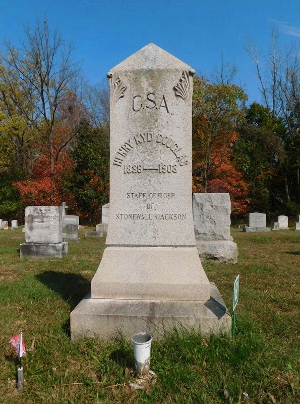
1. Henry Kyd Douglas
Douglas is one of those individuals who seem to be at all the important events of the Civil War. He is noted for writing, "I Rode With Stonewall" detailing much about the staff of both Generals Jackson and Lee. He is often cited as the most likely culprit in the "Lost Order" incident during the Antietam Campaign.
Just before the war in 1859, Douglas helped a man, named Isaac Smith, cross the covered bridge here at Ferry Hill Place on a rainy day. Douglas went as far to help Smith's wagon up the muddy slope of the Shepherdstown Pike. Later Douglas learned Smith was in reality John Brown, and the wagon had been loaded with pikes used in the seizure of Harpers Ferry later that year.
— Submitted August 3, 2007, by Craig Swain of Leesburg, Virginia.
Photographed By Craig Swain, July 28, 2007
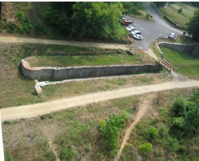
5. Lock Number 38
Seen from the Rumsey Bridge, which crosses the Potomac near the site of the ferry. Contrasting with the text of the marker, other sources state Blackford had issues with the C&O Canal, fearing it would take business from his ferry operations. Regardless, the issue became moot later when a covered bridge was built across the Potomac just to the south of the present day Rumsey Bridge.
Credits. This page was last revised on February 25, 2022. It was originally submitted on August 3, 2007, by Craig Swain of Leesburg, Virginia. This page has been viewed 3,560 times since then and 21 times this year. Photos: 1. submitted on August 3, 2007, by Craig Swain of Leesburg, Virginia. 2. submitted on April 12, 2011, by Bill Coughlin of Woodland Park, New Jersey. 3. submitted on August 3, 2007, by Craig Swain of Leesburg, Virginia. 4. submitted on March 15, 2021, by Bradley Owen of Morgantown, West Virginia. 5. submitted on August 3, 2007, by Craig Swain of Leesburg, Virginia. • J. J. Prats was the editor who published this page.
