Lawrenceville in Gwinnett County, Georgia — The American South (South Atlantic)
Lake Lanier is Born
Photographed by Duane and Tracy Marsteller, May 6, 2022
1. Lake Lanier is Born Marker (left panel)
[Left panel]
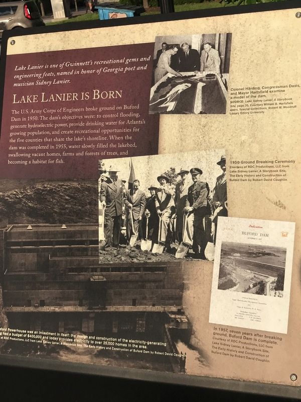
Lake Lanier is one of Gwinnett 's recreational gems and engineering feats, named in honor of Georgia poet and musician Sidney Lanier.
The U.S. Army Corps of Engineers broke ground on Buford Dam in 1950. The dam's objectives were: to control flooding, generate hydroelectric power, provide drinking water for Atlanta's growing population, and create recreational opportunities for the five counties that share the lake's shoreline. When the dam was completed in 1955, water slowly filled the lakebed, swallowing vacant homes, farms and forests of trees, and becoming a habitat for fish.
[Captions (clockwise from top right)]
• Colonel Harding, Congressman Davis, and Mayor Hartsfield examine a model of the dam. Source:Lake Sidney Lanier, A Storybook Site, page 35, Courtesy William B. Hartsfiels papers, Special Collections, Robert W. Woodruff Library Emory University
• 1950 Ground Breaking Ceremony Courtesy of RDC Productions, LLC from Lake Sidney Lanier, A Storybook Site, The Early History and Construction of Buford Dam by Robert David Coughlin
• In 1957, seven years after breaking ground, Buford Dam is complete.
this page online
• Buford Powerhouse was an investment in itself: the design and construction of the electricity-generating [clipped] had a budget of $400,000 and today provides electricity to over 25,000 homes in the area. Courtesy of RDC Productions, LLC from Lake Sidney Lanier, A Storybook Site, The Early History and Construction of Buford Dam by Robert David Coughlin
[Right panel]
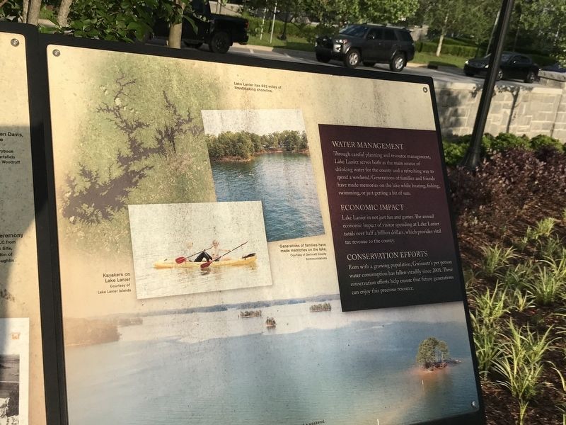
Water management
Through careful planning and resource management, Lake Lanier serves both as the main source of drinking water for the county and a refreshing way to spend a weekend. Generations of families and friends have made memories on the lake while boating, fishing, swimming, or just getting a bit of sun.
Economic impact
Lake Lanier in not just fun and games. The annual economic impact of visitor spending at Lake Lanier totals over half a billion dollars, which provides vital tax revenue to the county.
Conservation efforts
Even with a growing population, Gwinnett's per person water consumption has fallen steadily
Photographed by Duane and Tracy Marsteller, May 6, 2022
2. Lake Lanier is Born Marker (right panel)
[Captions]
• Lake Lanier has 692 miles of breathtaking shoreline.
• Generations of families have made memories on the lake. Courtesy of Gwinnett County Communications
• Kayakers on Lake Lanier. Courtesy of Lake Lanier Islands
Erected 2018 by Gwinnett County.
Topics. This historical marker is listed in these topic lists: Environment • Parks & Recreational Areas • Waterways & Vessels. A significant historical year for this entry is 1950.
Location. 33° 57.288′ N, 83° 59.307′ W. Marker is in Lawrenceville, Georgia, in Gwinnett County. It can be reached from the intersection of South Clayton Street (Georgia Route 20) and Luckie Street, on the right when traveling south. Marker is at the northeast corner of Gwinnett County Bicentennial Plaza. Touch for map. Marker is at or near this postal address: 275 S Perry St, Lawrenceville GA 30046, United States of America. Touch for directions.

Regionally, this marker is in Georgia’s Piedmont and in Metro Atlanta. It is also in the American South and specifically in the Deep South. Globally, it is in North America, the Western Hemisphere, the Western World, and the Anglosphere. Historically, it finds itself in what was once the territory of the Mississippian Culture, one of the original Thirteen Colonies, one of the Confederate States of America, and the Antebellum South.
Other nearby markers. At least 8 other markers are within walking distance of this marker: African American Roles in the Community (a few steps from this marker); The History of Peachtree (within shouting distance of this marker); Gwinnett County Bicentennial Time Capsule (within shouting distance of this marker); The Land We Love (within shouting distance of this marker); Unsurpassed Quality of Life (within shouting distance of this marker); Gwinnett: A Great Investment (within shouting distance of this marker); Fort Daniel and the Georgia Frontier (within shouting distance of this marker); The Land Lottery of 1820 (within shouting distance of this marker). Touch for a list and map of all markers in Lawrenceville.
Credits. This page was last revised on January 4, 2023. It was originally submitted on May 12, 2022, by Duane and Tracy Marsteller of Murfreesboro, Tennessee. This page has been viewed 1,040 times since then and 49 times this year. Photos: 1, 2. submitted on May 12, 2022, by Duane and Tracy Marsteller of Murfreesboro, Tennessee.
