Tysons in Fairfax County, Virginia — The American South (Mid-Atlantic)
A Union Spy of Color?
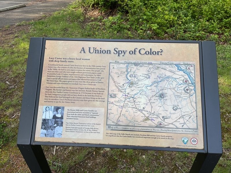
Lucy Carter was a brave local woman with deep family roots.
A multiracial family named Carter lived near here in the 19th century. Lucy Carter was a free woman of color, but because of manumission laws passed in the 1800s, she had to carry papers to prove her status. Free people who were not white and who were caught without permission papers could be punished with 15 lashes, imprisonment and enslavement. In 1864, Lieutenant George Hollister of the 16th Regiment New York Cavalry gave Lucy a special official status and papers that allowed her access to Civil War front lines. The papers given to Lucy were like those given to Harriet Tubman and cause historians to conclude Lucy was a Union spy.
Lucy was descended from the Tauxenent (Dogue) Indian leader of Northern Virginia. The family's oral history says her ancestor, Keziah Hatton, burned down the first Fairfax County Courthouse in 1752 because it was built on her land. Indigenous people did not have deeds to the land they lived on. They believed the land belonged to the Creator, and those living on the land were its caretakers. Lucy's Powhatan ancestry may have
this page online
[Captions:]
The Boston Mills and Carter Families are intertwined and were recorded as "separate from both the white and black communities." Their inherited Tauxenent land holdings included Tysons.
Top: Helen Boston (Tauxenent) in front of the family's barn in Fairfax County and in her later years.
Bottom: Early photograph of Georgia Mills Boston (Pamunkey) and her in-laws, Mr. & Mrs. William Harvey Boston (Tauxenent), in front of the same barn.
This 1862 map of the Falls Church area includes Freedom Hill and the Carter family property. It is significant that the Carter family was considered important enough to be noted on the map.
Erected 2021 by Fairfax County Park Authority.
Topics. This historical marker is listed in these topic lists: African Americans • Communications • Indigenous Peoples and Communities • Law Enforcement • War, US Civil • Women. A significant historical year for this entry is 1864.
Location. 38° 55.034′ N, 77° 14.487′ W. Marker is in Tysons, Virginia, in Fairfax County. It is on Old Courthouse Road (Virginia Route
Photographed by Devry Becker Jones (CC0), May 20, 2022
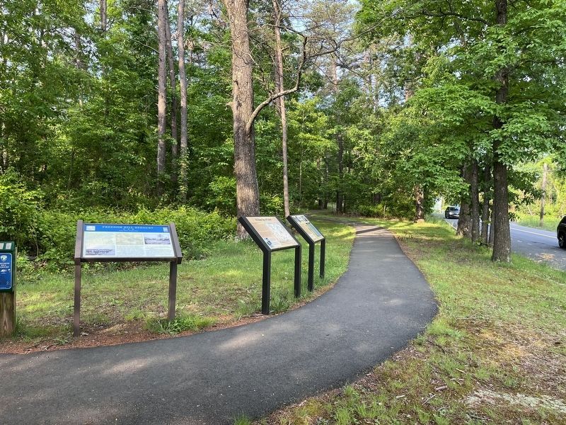
2. A Union Spy of Color? marker (middle of three). Freedom Hill Park marker set

Regionally, this marker is in the Washington Metropolitan Area and in Northern Virginia. It is also in the American South, specifically in the Upper South, in the Mid-Atlantic, and on the Eastern Seaboard. Globally, it is in the North Atlantic Region, North America, the Western Hemisphere, the Western World, and the Anglosphere. Historically, it finds itself in what was once the territory of the Mississippian Culture, one of the original Thirteen Colonies, one of the Confederate States of America, and the Antebellum South.
Other nearby markers. At least 8 other markers are within 2 miles of this marker, measured as the crow flies: Family Strength (here, next to this marker); Freedom Hill is a Droplet in an Ocean of History (within shouting distance of this marker); Defending the Nation's Capital (about 300 feet away, measured in a direct line); A Tent Design Inspired by Native Americans (about 300 feet away); Outpost Life (about 400 feet away); First Court House of Fairfax County (approx. 0.2 miles away); A Fairfax Legacy (approx. 1.1 miles away); Ash Grove (approx. 1.1 miles away). Touch for a list and map of all markers in Tysons.
Another marker is no longer nearby. Freedom Hill Redoubt (was a few steps from this marker but has been confirmed missing).
Credits. This page was last revised on May 20, 2022. It was originally submitted on May 20, 2022, by Devry Becker Jones of Washington, District of Columbia. This page has been viewed 886 times since then and 82 times this year. Photos: 1, 2. submitted on May 20, 2022, by Devry Becker Jones of Washington, District of Columbia.
