Tysons in Fairfax County, Virginia — The American South (Mid-Atlantic)
A Tent Design Inspired by Native Americans
Photographed by Devry Becker Jones (CC0), May 20, 2022
1. A Tent Design Inspired by Native Americans Marker
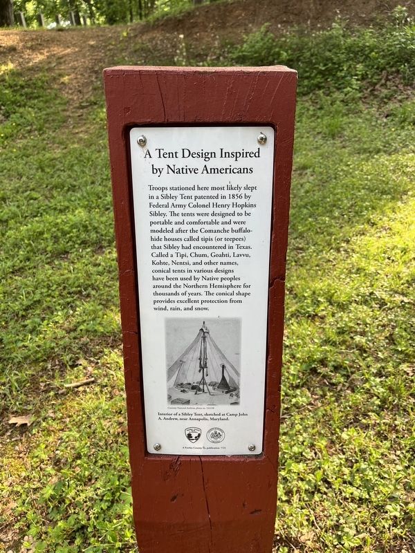
Troops stationed here most likely slept in a Sibley Tent patented in 1856 by Federal Army Colonel Henry Hopkins Sibley. the tents were designed to be portable and comfortable and were modeled after the Comanche buffalo-hide houses called tipis (or teepees) that Sibley had encountered in Texas. Called a Tipi, Chum, Goahti, Lavvu, Kohte, Nentsi, and other names, conical tents in various designs have been used by Native peoples around the Northern Hemisphere for thousands of years. The conical shape provides excellent protection from wind, rain, and snow.
[Caption:]
Interior of a Sibley Tent, sketched at Camp John A. Andrew, near Annapolis, Maryland.
Erected 2021 by Fairfax County Park Authority.
Topics and series. This historical marker is listed in these topic lists: Anthropology & Archaeology • Indigenous Peoples and Communities • War, US Civil. In addition, it is included in the Defenses of Washington series list. A significant historical year for this entry is 1856.
Location. 38° 55.005′ N, 77° 14.546′ W. Marker is in Tysons, Virginia, in Fairfax County. It can be reached from Old Courthouse Road (Virginia
this page online

Regionally, this marker is in the Washington Metropolitan Area and in Northern Virginia. It is also in the American South, specifically in the Upper South, in the Mid-Atlantic, and on the Eastern Seaboard. Globally, it is in the North Atlantic Region, North America, the Western Hemisphere, the Western World, and the Anglosphere. Historically, it finds itself in what was once the territory of the Mississippian Culture, one of the original Thirteen Colonies, one of the Confederate States of America, and the Antebellum South.
Other nearby markers. At least 8 other markers are within 2 miles of this marker, measured as the crow flies: Outpost Life (a few steps from this marker); Defending the Nation's Capital (a few steps from this marker); Freedom Hill is a Droplet in an Ocean of History (within shouting distance of this marker); A Union Spy of Color? (about 300 feet away, measured in a direct line); Family Strength
Photographed by Devry Becker Jones (CC0), May 20, 2022
2. A Tent Design Inspired by Native Americans Marker
Another marker is no longer nearby. Freedom Hill Redoubt (was about 400 feet away but has been confirmed missing).
Credits. This page was last revised on May 20, 2022. It was originally submitted on May 20, 2022, by Devry Becker Jones of Washington, District of Columbia. This page has been viewed 354 times since then and 34 times this year. Photos: 1, 2. submitted on May 20, 2022, by Devry Becker Jones of Washington, District of Columbia.
