Near Monroe in Monroe County, Michigan — The American Midwest (Great Lakes)
Monroe
Michigan
— "Early years along the Lake" —
Presettlement Times
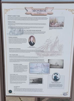
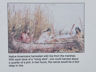
The area of Michigan known as Monroe was one of our state's earliest settled regions. Its location at the mouth of the River Raisin was strategic to both Native Americans and to the first Europeans who arrived here in the 17th century. By traveling up the river called Nummasepee, or "River of Sturgeon," travelers could portage to the Grand River, which completed a link from Lake Erie to Lake Michigan. This geography made it a popular route for Native Americans for both trade and their annual visits to the Lake Erie marshes to harvest wild rice. Although no permanent village was established here, the site was in constant use as a camping ground.
Frenchtown
This same route made it one of the first European trade outposts in the upper Great Lakes. In 1784, a Frenchman named Francois Navarre built a cabin along the river called the Raisin by the French, for its plentiful vines of wild grape. Soon a hundred French families moved down from Fort Detroit and Canada to escape the British who still ruled the Northwest Territory.
In August 1794, American General "Mad" Anthony Wayne led a frontier army against the Indians at the Battle of Fallen Timbers, near the present site of Toledo. Wayne's victory opened eastern and southern Ohio to settlement. In 1796, the British surrendered Detroit and the Straits of Mackinac, giving the Americans control of the Northwest Territory. Soon, more Americans began to settle along the River Raisin.
War of 1812 - The River Raisin Massacre
During the War of 1812, British forces attacked American troops stationed at Frenchtown (as Monroe was then named). The Americans surrendered after a pre-dawn British attack on January 22, 1813. The British led off all the able-bodied men as prisoners, but those Americans wounded were massacred the following day by Indians loyal to the British. The River Raisin Massacre became a rallying cry for the Americans.
Naming Monroe
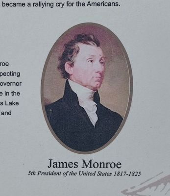
In 1816, James Monroe was elected president. The following summer, Monroe traveled to the frontier to inspect the newly acquired Northwest Territory. Expecting the president to dock at LaPlaisance Bay, the usual stop, Territorial Governor Lewis Cass named the recently surveyed county and its county seat Monroe in the president's honor. However, the president feeling ill from a stormy trip across Lake Erie, elected not to stop but merely waved to the waiting crowd on the dock and proceeded to Detroit. Nevertheless, the name Monroe stuck.
Immigration Expands
With the threat of war over, the opening of the Northwest Territory began.
The journey west was made less difficult by the completion of the Erie Canal in 1825. Now, pioneers could travel by water across New York to Buffalo and embark on a 10-day journey across Lake Erie. Because of the winds and strong current of the Detroit River, LaPlaisance Bay became the first and best stopping place for settlers from the East. Ships could put in at LaPlaisance Bay and settlers could travel up the muddy LaPlaisance Road three miles to the community of Frenchtown along the River Raisin.
The Toldedo War
In the spring of 1835, the Detroit Free Press headline read "War! War!"
Michigan and Ohio had raised armies in a border dispute over a narrow strip of land across what is now northern Indiana and Ohio. Michigan claimed this territory, which included Toledo and the mouth of the Maumee River, as part of Monroe County, and "made it a crime to enforce any Ohio laws."
Ohio, a state since 1803, had long used a boundary that lay eight miles to the north. Although the incident was called a "border war," no battles were fought and the most violent action occurred when a posse arrested an Ohio survey party near Adrian. On another occasion, bloodshed was avoided when Ohio officials, attempting to "hold court" to claim the strip in a Toledo tavern, received word the "dreaded wolverines were coming" and took flight.
But in 1836, Ohio's political weight was too much for the under-populated Michigan Territory, and the boundary was drawn giving the Toledo Strip to Ohio. As a consolation, Michigan received the Upper Peninsula and became the 26th state of the union in 1837.
Building a Canal
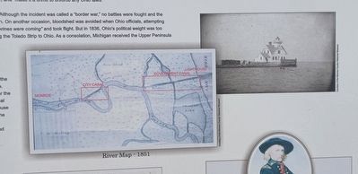
In 1834, the Army Corps of Engineers began plans to straighten the Raisin River creating a navigable canal from Lake Erie to Monroe. This docking area and canal would be a major improvement over the storm-battered docks at LaPlaisance Bay. The Government Canal cut through a number of river oxbows along the north side of House (Guytor's) Island. The city of Monroe financed one more canal, the "City Canal," which shortened the river even more.
The docks were completed in 1840 and a lighthouse was erected in 1849. This marked the begining of "Monroe Piers," one of Michigan's earliest recreation destinations.
The Floral City
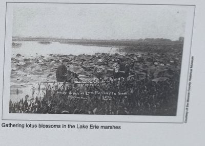
Blessed with miles of Lake Erie marshland that included enormous lotus beds, the townspeople of Monroe greeted an arriving train in 1852 with a banner proclaiming "The Floral City Welcomes You." Fifty young girls, all dressed in white, carried huge baskets brimming with white lotus flowers to promote a new steamship and railroad route between Buffalo and Chicago. The new Monroe docks, at the mouth of the River Raisin,
became a point of transfer. The famous lotus beds and the growing produce market brought about "The Floral City" title. Despite the eventual demise of the passenger steamships with the arrival of the railroad, the name Floral City lived on.
Dr. Edwuard Dorsch, a prominent citizen, later attempted to keep the floral symbol alive by replanting lotus tubers and seeds, reclaimed from the diffing of the government canal through Monroe's wild lotus beds.
Prohibition
Rum Runners
In 1918, Michigan "went dry," a year before the Eighteenth Amendment banned the sale, manufacture and distribution of liquor throughout the United States. Monroe initially became a bootlegger's highway as alcoholic beverages continued to flow into Detroit from Ohio. But when Ohio and the entire nation entered Prohibition in 1919, the marshes along Monroe's Lake Erie coastline became a favorite route for the rum runners who developed ingenious ways to smuggle booze in from Canada. Illegal liquor was the second biggest business in Detroit at $215 million a year in 1929, just behind automobiles. This underground business died overnight when the Eighteen Amendment was repealed in 1933.
Erected by Michigan Department of Natural Resources.
Topics. This historical marker is listed in these topic lists: Native Americans
• Settlements & Settlers • War of 1812 • Waterways & Vessels. A significant historical date for this entry is January 22, 1813.
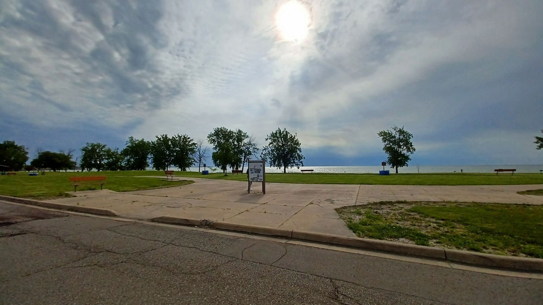
Location. 41° 54.613′ N, 83° 20.068′ W. Marker is near Monroe, Michigan, in Monroe County. Marker is on North Lakeshore Drive south of State Park Road, on the left when traveling south. Marker is in Sterling State Park and can be seen from the beach parking lot. Touch for map. Marker is at or near this postal address: 2800 State Park Road, Monroe MI 48162, United States of America. Touch for directions.
Other nearby markers. At least 8 other markers are within 2 miles of this marker, measured as the crow flies. Wm. C. Sterling State Park (here, next to this marker); Monroe Piers (here, next to this marker); Famous Waterfront (about 400 feet away, measured in a direct line); Sandy Creek Settlement (approx. 0.6 miles away); Capt. Norman W. Heck Jr (approx. 2 miles away); Monroe County Vietnam Veterans Memorial Tree (approx. 2 miles away); POW-MIA Chained Eagle (approx. 2 miles away); M29 81mm Mortar (approx. 2 miles away). Touch for a list and map of all markers in Monroe.
June 5, 2022
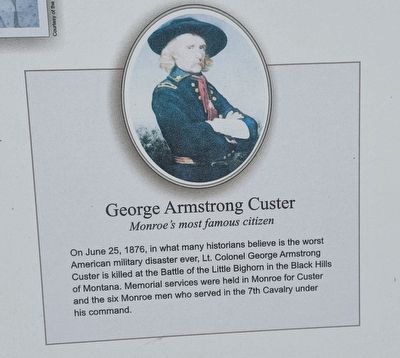
6. Monroe, Michigan: "Early years along the lake" Marker — bottom right image
Monroe's most famous citizen
Credits. This page was last revised on July 4, 2022. It was originally submitted on July 4, 2022, by Joel Seewald of Madison Heights, Michigan. This page has been viewed 329 times since then and 55 times this year. Photos: 1, 2, 3, 4, 5, 6, 7. submitted on July 4, 2022, by Joel Seewald of Madison Heights, Michigan.
