Westfield in Chautauqua County, New York — The American Northeast (Mid-Atlantic)
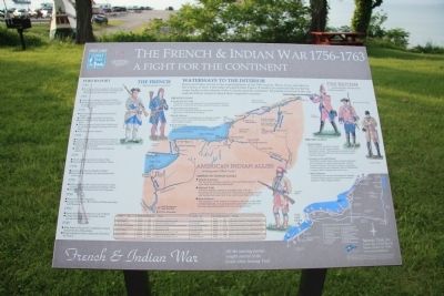
The French & Indian War 1756-1763
A Fight for the Continent
— French and Indian War —
Waterways to the Interior
Rivers and lakes served as the superhighways of the 18th century. Many rivers and lakes in the Colony of New York either bordered New France (Canada), or connected the bordering water bodies to the interior of the Colonies and the continent. All parties involved in the war exploited these routes to attack their respective enemies.
The French
"…defending their frontiers."
French Goals
• Control the Fur Trade
The French were not interested in colonizing the land, but wanted to control the fur trade with the American Indians.
• Build Alliances
The French sent out missionaries to attempt to build alliances and to convert the American Indians to their religious beliefs.
• Link Territories
The French wanted to link New France (Canada) with the Louisiana Territory, which was also under French control.
The British
"…protecting the colonies from Indian invasions."
British Goals
• Expand Empire
British colonists wanted to expand westward from the original coastal population centers. This expansion intruded on lands occupied and controlled by both the French and the American Indians.
• Increase Access and Defense
The British wanted more access to natural resources and increased fur trading opportunities with the American Indians. They also wanted to secure the frontiers and provide a defensive line of fortifications to protect their outlying cities and towns.
• Build Alliances
The British also sent out missionaries to attempt to build alliances and to convert the American Indians to their religious beliefs.
American Indian Allies
"…holding onto Tribal Lands."
American Indian Goals
• Stop the Expansion
The American Indians wanted to stop the British advance upon their traditionally held lands.
• Maintain Trade
American Indians wanted to maintain trade with the Europeans for access to firearms, ammunition, cooking utensils, and textiles that made their lives much easier than in the past.
• Form Alliances
The allegiance of the American Indians to one side or the other, or their neutrality, was all dependent upon what they felt was the most opportune position to be in at a given time.
Fort By Fort
1763
• The Treaty of Paris is signed, officially ending hostilities between the French and British and determining the fate of North America.
1760
• French fail in attempt
to recapture Quebec.
• Amherst captures French Fort Levis and forces the surrender of Montreal, ending the conflict in North America.
1759
• Sir William Johnson captures French Fort Niagara.
• Haldimand (Br.) rebuilds Fort Ontario
• French abandon Forts Presque Isle and le Boeuf.
• Amherst captures French Forts Carillon and St. Frederic and begins building Fort Crown Point.
• Wolfe (Br.) captures Quebec.
1758
• Bradstreet (Br.) destroys French Fort Frontenac.
• Amherst captures French Fortress Louisbourg.
• Forbes (Br.) captures French Fort Duquesne and begins building Fort Pitt.
• Abercromby (Br.) is defeated at French Fort Carillon.
1757
• French and Indians attack German Flats.
• Montcalm (Fr.) destroys Fort William Henry.
1756
• De Lery (Fr.) destroys British Fort Bull
• Montcalm (Fr.) destroys the three British forts at Oswego.
1755
• William Johnson (Br.) defeats the French at Lake George, and begins building Fort William Henry.
• Braddock (Br.) is defeated near Fort Duquesne.
1754
• French build Fort Duquesne.
• George Washington (Br.) builds and then surrenders Fort Necessity.
1753
• French build Forts Presque Isle and Le Boeuf.
• George Washington
demands the French evacuate the Ohio Valley.
1749
• Abbe Francois Picquet (Fr.) establishes mission fort at Fort de la Presentation.
• French explorer Celoron claims the Ohio River for France.
Erected by Great Lakes Seaway Trail.
Topics and series. This historical marker is listed in these topic lists: Colonial Era • Native Americans • War, French and Indian. In addition, it is included in the Great Lakes Seaway Trail National Scenic Byway series list. A significant historical year for this entry is 1763.
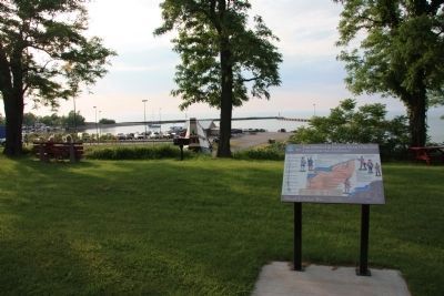
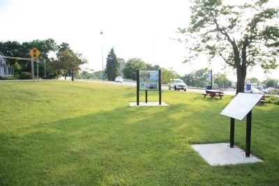
Location. 42° 20.485′ N, 79° 35.592′ W. Marker is in Westfield, New York, in Chautauqua County. Marker is on East Lake Road (New York State Route 5) east of North Portage Road (New York State Route 394), on the left when traveling east. The historic marker is on the coastal high ground of the Lake Erie shore, over looking the Barcelona Harbor of Westfield village. Touch for map. Marker is in this post office area: Westfield NY 14787, United States of America. Touch for directions.
Other nearby markers. At least 8 other markers are within 2 miles of this marker, measured as the crow flies. Barcelona Harbor (a few steps from this marker); Barcelona Light House (about 400 feet away, measured in a direct line); The Mack House (approx. 1.3 miles away); The Lincoln-Bedell Statue Park (approx. 1˝ miles away); In Memoriam (approx. 1.6 miles away); In Memory (approx. 1.6 miles away); McClurg Park (approx. 1.6 miles away); First Presbyterian Church and Society (approx. 1.6 miles away). Touch for a list and map of all markers in Westfield.
More about this marker. The historic marker is a "Great Lakes Seaway Trail" marker that is a display panel of historical information, illustrations, and maps regarding the events of the French & Indian War that occurred in this region.
Also see . . .
1. French and Indian War. This is a link to information provided by Wikipedia, the free encyclopedia. (Submitted on July 7, 2012, by Dale K. Benington of Toledo, Ohio.)
2. French & Indian War. This is a link to information provided by the Great Lakes Seaway Trail website. (Submitted on July 7, 2012, by Dale K. Benington of Toledo, Ohio.)
Credits. This page was last revised on July 6, 2022. It was originally submitted on July 7, 2012, by Dale K. Benington of Toledo, Ohio. This page has been viewed 1,483 times since then and 54 times this year. Last updated on July 6, 2022, by Carl Gordon Moore Jr. of North East, Maryland. Photos: 1, 2, 3. submitted on July 7, 2012, by Dale K. Benington of Toledo, Ohio. • Devry Becker Jones was the editor who published this page.


