Wharton Township near Farmington in Fayette County, Pennsylvania — The American Northeast (Mid-Atlantic)
Building Fort Necessity
Fort Necessity National Battlefield
— National Park Service, U.S. Department of the Interior —
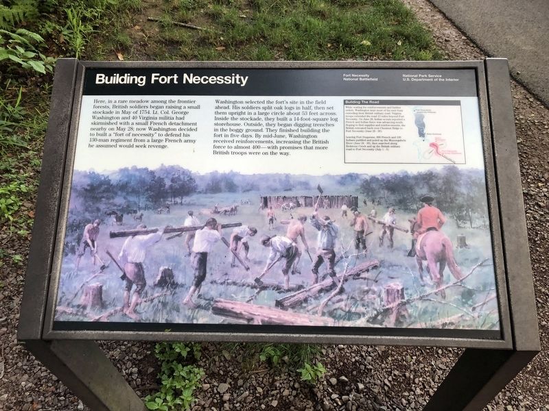
Here, in a rare meadow among the frontier forests, British soldiers began raising a small stockade in May of 1754. Lt. Col. George Washington and 40 Virginia militia had skirmished with a small French detachment nearby on May 28; now Washington decided to built a "fort of necessity" to defend his 130-man regiment from a large French army he assumed would seek revenge.
Washington selected the fort's site in the field ahead. His soldiers split oak logs in half, then set them upright in a large circle about 53 feet across. Inside the stockade, they built a 14-foot-square log storehouse. Outside, they began digging trenches in the boggy ground. They finished building the fort in five days. By mid-June, Washington received reinforcements, increasing the British force to almost 400 — with promises that more British troops were on the way.
[Sidebar:]
Building The Road
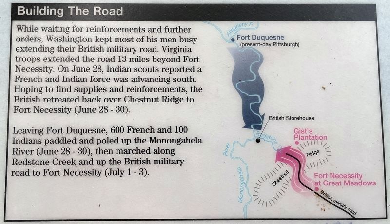
While waiting for reinforcements and further orders, Washington kept most of his men busy extending their British military road. Virginia troops extended the road 13 miles beyond Fort Necessity. On June 28, Indian scouts reported a French and Indian force was advancing south. Hoping to find supplies and reinforcements, the British retreated back over Chestnut Bridge to Fort Necessity (June 28 - 30).
Leaving Fort Duquesne, 600 French and 100 Indians paddled and pooled up the Monongahela River (June 28 - 30), then marched along Redstone Creek and up the British military road to Fort Necessity (July 1 - 3).
Erected by National Park Service, U.S. Department of the Interior.
Topics. This historical marker is listed in these topic lists: Colonial Era • Forts and Castles • Roads & Vehicles • War, French and Indian. A significant historical date for this entry is May 28, 1754.
Location. 39° 48.876′ N, 79° 35.301′ W. Marker is near Farmington, Pennsylvania, in Fayette County. It is in Wharton Township. Marker can be reached from Washington Parkway, 0.4 miles south of National Pike (U.S. 40), on the right when traveling west. Touch for map. Marker is in this post office area: Farmington PA 15437, United States of America. Touch for directions.
Other nearby markers. At least 8 other markers are within walking distance of this marker. British Defenses (within shouting distance of this marker); The French Attack (within shouting distance of this marker); Surrender Negotiations (within shouting distance of this marker); Fort Necessity (about 300 feet away, measured in a direct line); Civilian Conservation Corps at Fort Necessity (about 500 feet away); Do you measure up in Washington's Army? / Are you dressed for the campaign? (about 500 feet away); The Great Meadows Campaign (about 600 feet away); Fort Necessity National Battlefield (about 700 feet away). Touch for a list and map of all markers in Farmington.
Photographed By Craig Swain, October 6, 2022
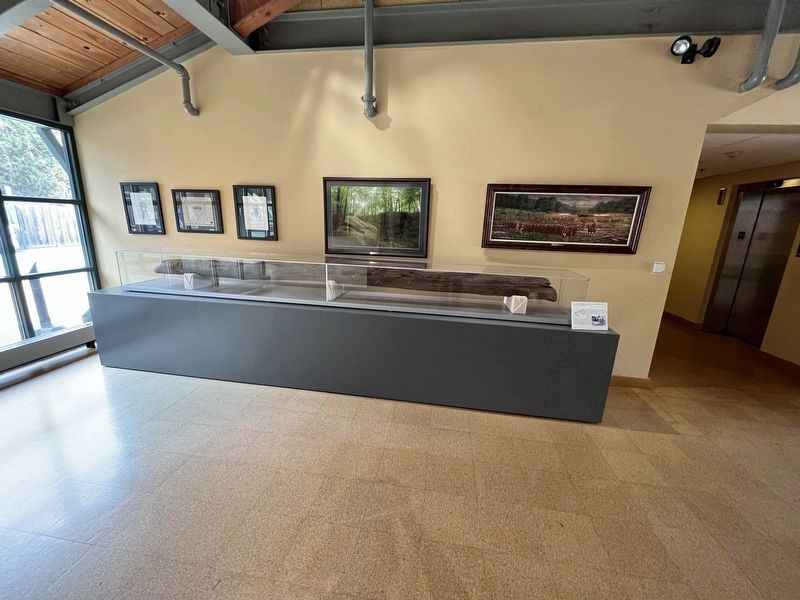
4. White Oak Log From the Fort
Inside the park visitor center and museum is this white oak log, the largest material artifact remaining of Fort Necessity. The log was uncovered in 1953 as part of an archeological investigation. It was excavated on the northwest trench of the fort. Likely it was used to construct the breastworks of the outer trenches.
Photographed By Craig Swain, October 6, 2022
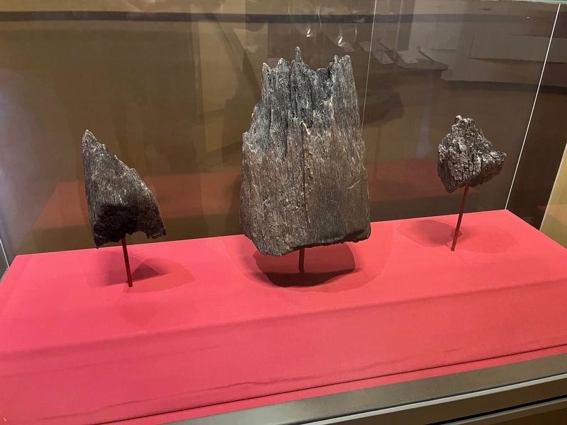
5. Burnt Stockade Posts
These charred post ends were excavated in the 1950s by archeologists and are remains of the original work mentioned in the marker. The French burned Fort Necessity on July 4, 1754, burning the stockade to the ground. Being buried below ground, these remained preserved.
Credits. This page was last revised on February 7, 2023. It was originally submitted on July 13, 2020, by Devry Becker Jones of Washington, District of Columbia. This page has been viewed 243 times since then and 18 times this year. Last updated on July 6, 2022, by Carl Gordon Moore Jr. of North East, Maryland. Photos: 1. submitted on July 13, 2020, by Devry Becker Jones of Washington, District of Columbia. 2. submitted on October 9, 2022, by Craig Swain of Leesburg, Virginia. 3. submitted on July 13, 2020, by Devry Becker Jones of Washington, District of Columbia. 4, 5. submitted on October 9, 2022, by Craig Swain of Leesburg, Virginia.
