Harrisonville in Cass County, Missouri — The American Midwest (Upper Plains)
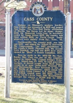
Cass County
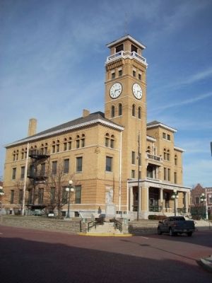
Harrisonville, the county seat, was laid out 1837, and named for Albert G. Harrison, Mo. Congressman. The 1897 courthouse is the county's third. Pleasant Hill, the second town founded, was laid out 1844 near store opened by "Blois," a French Canadian, 1833.
Torn by strife in the 1854-59 Mo.-Kan. Border War, Cass was one of the counties named in Thomas Ewing's Order No. 11. Issued Aug. 25, 1863, to curb guerrilla warfare, it forced people from their homes except in or near Union~held Pleasant Hill and Harrisonville. Near Freeman is the site of the "Battle of Morristown," where about 500 men under Union Colonel H.P. Johnson, who was killed, routed some 100 State Guards led by Col. H.I. Irvin, Sept., 1861. Resettlement brought the county a 19,296 pop. by 1870.
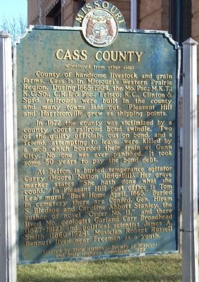
County of handsome livestock and grain farms, Cass is in Missouri's Western Prairie Region. During 1865~1904, the Mo.Pac.; M.K.T; K.C.So.; C.R.I. & Pac.; Frisco; K.C., Clinton & Spfd. railroads were built in the county and many towns were laid out. Pleasant Hill and Harrisonville grew as shipping points.
In 1872 the county was victimized by a county court railroad bond swindle. Two of the guilty officials, out on bond, and a friend, attempting to leave, were killed by a mob which boarded their train at Gunn City. No one was ever punished. It took some 50 years to pay off the bond debt.
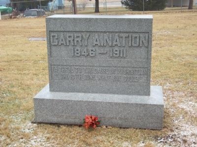
At Belton is buried temperance agitator Carry (Moore) Nation (1846~1911). Her grave marker states "She hath done what she could." In Pleasant Hill post office is Tom Lea's mural "Back Home April, 1865." Buried in cemetery there are Confed. Gen. Hiram S. Bledsoe and Caroline Abbott Stanley, the author of novel "Order No. 11," and there lived Mo. geologist Garland Carr Broadhead (1827~1912) and political scientist James A. Smith (1860~1924). Musician Robert Russell Bennett lived near Freeman as a youth.
Erected 1959 by State Historical Society of Missouri and State Highway Commission.
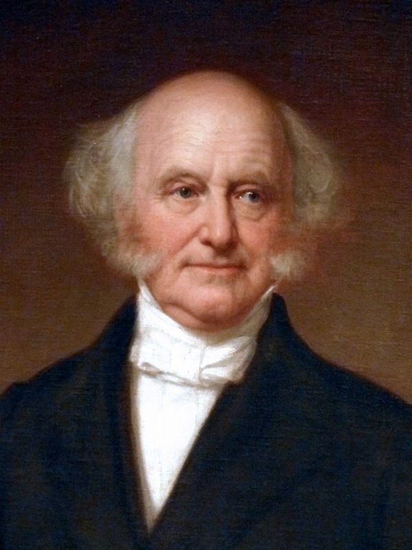
Topics and series. This historical marker is listed in these topic lists: Agriculture • Native Americans • Railroads & Streetcars • Settlements & Settlers • War, US Civil. In addition, it is included in the Former U.S. Presidents: #08 Martin Van Buren, and the Missouri, The State Historical Society of series lists. A significant historical month for this entry is April 1865.
Location.
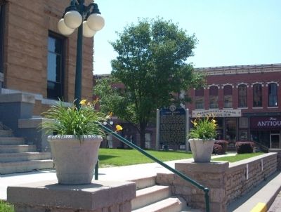
38° 39.281′ N, 94° 20.911′ W. Marker is in Harrisonville, Missouri, in Cass County. Marker is on East Wall Street, on the left when traveling east. The marker is at the Northwest corner of the Courthouse Square in Harrisonville. Touch for map. Marker is at or near this postal address: 102 East Wall Street, Harrisonville MO 64701, United States of America. Touch for directions.
Other nearby markers. At least 8 other markers are within 3 miles of this marker, measured as the crow flies. Harrisonville WWI Memorial (a few steps from this marker); United We Stand Divided We Fall (within shouting distance of this marker); General Order No. 11 (within shouting distance of this marker); Jennison’s Jayhawks raid Harrisonville Square (within shouting distance of this marker); Lest We Forget (approx. 0.9 miles away); The Burnt District Monument (approx. 1.1 miles away); a different marker also named Burnt District Monument (approx. 1.1 miles away); Wayside Rest (approx. 2.8 miles away). Touch for a list and map of all markers in Harrisonville.
Also see . . . Cass County, Missouri. This is the official link to Cass County Missouri. (Submitted on June 26, 2009, by Thomas Onions of Olathe, Kansas.)
Credits. This page was last revised on April 27, 2022. It was originally submitted on June 26, 2009, by Thomas Onions of Olathe, Kansas. This page has been viewed 2,611 times since then and 36 times this year. Photos: 1, 2, 3, 4. submitted on June 26, 2009, by Thomas Onions of Olathe, Kansas. 5. submitted on June 2, 2019, by Allen C. Browne of Silver Spring, Maryland. 6. submitted on June 3, 2019, by Allen C. Browne of Silver Spring, Maryland. 7. submitted on June 26, 2009, by Thomas Onions of Olathe, Kansas. • Craig Swain was the editor who published this page.
