Lorton in Fairfax County, Virginia — The American South (Mid-Atlantic)
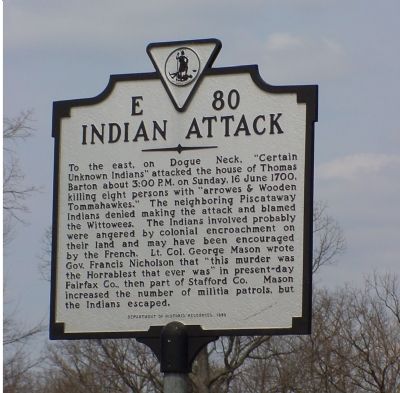
Indian Attack
Erected 1999 by Department of Historic Resources. (Marker Number E-80.)
Topics and series. This historical marker is listed in these topic lists: Colonial Era • Native Americans • Settlements & Settlers. In addition, it is included in the Virginia Department of Historic Resources (DHR) series list. A significant historical date for this entry is June 16, 1700.
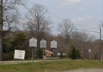
Location. 38° 41.254′ N, 77° 12.528′ W. Marker is in Lorton, Virginia, in Fairfax County. Marker is at the intersection of Gunston Road (Virginia Route 242) and Old Colchester Road (County Route 611), on the left when traveling east on Gunston Road. Marker is half a mile east of Richmond Highway (U.S. 1). Touch for map. Marker is in this post office area: Lorton VA 22079, United States of America. Touch for directions.
Other nearby markers. At least 5 other markers are within walking distance of this marker. Lewis Chapel / Cranford Memorial Methodist Church (here, next to this marker); Gunston Hall (here, next to this marker); Lewis Chapel (within shouting distance of this marker); Elizabeth Hartwell Mason Neck National Wildlife Refuge / Explore a Trail Network (approx. 0.3 miles away); Gunston Hall / Pohick Bay Regional Park and Golf Course (approx. 0.3 miles away). Touch for a list and map of all markers in Lorton.
More about this marker. The 1985 Edition of Margaret T. Peters's A Guidebook to Virginia Historical Markers lists a marker with this same number located on Richmond Highway (U.S. 1) but four miles north, at Fort Belvoir. The guidebook indicates that the marker was missing at that time, but prints the title and text of the original marker, which is a bit different than what is on this marker today: INDIAN MASSACRE. To the east, in Dogue Neck, Piscataway Indians attacked the house of Thomas Barton, killing eight persons, June 16, 1700. George Mason (2nd) described this as the "horriblest murder that ever was in Stafford."
Also see . . . Possible Original Location of This Marker on Route 1
. (Submitted on March 25, 2006, by J. J. Prats of Powell, Ohio.)
Credits. This page was last revised on July 14, 2019. It was originally submitted on March 25, 2006, by J. J. Prats of Powell, Ohio. This page has been viewed 3,646 times since then and 84 times this year. Photos: 1, 2. submitted on March 25, 2006, by J. J. Prats of Powell, Ohio.

