Winchester in Frederick County, Virginia — The American South (Mid-Atlantic)
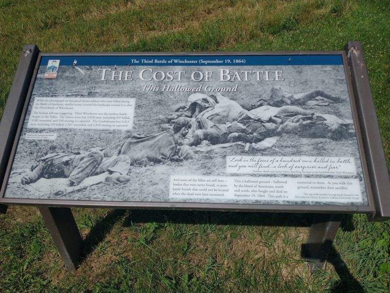
The Cost of Battle
This Hollowed Ground
— The Third Battle of Winchester (September 19, 1864) —
The human toll was staggering. Third Winchester was the costliest battle fought in the Valley. The Union army lost 5,018 men, including 697 killed, 3,983 wounded and 338 missing or captured. The Confederates lost 3,611 men, including 226 killed, 1,567 wounded, and 1,818 missing or captured.
And some of the fallen are still here — bodies that were never found, or post-battle burial that could not be located when the dead were later reinterred.
This is hallowed ground — hallowed by the blood of Americans, north and south, who fought and died on September 19, 1864. This park is a memorial to them. As you walk this ground, remember their sacrifice.
(captions)
Dead on the Antietam Battlefield. Image courtesy Library of Congress
"Look into the faces of a hundred men killed in battle, and you will find...a look of surprise and fear." - Northern sketch artist James Taylor, describing the dead on the battlefield after Third WInchester
Erected by Millbrook High School Cross Country Team.
Topics. This historical marker is listed in these topic lists: Cemeteries & Burial Sites • War, US Civil. A significant historical date for this entry is September 19, 1864.
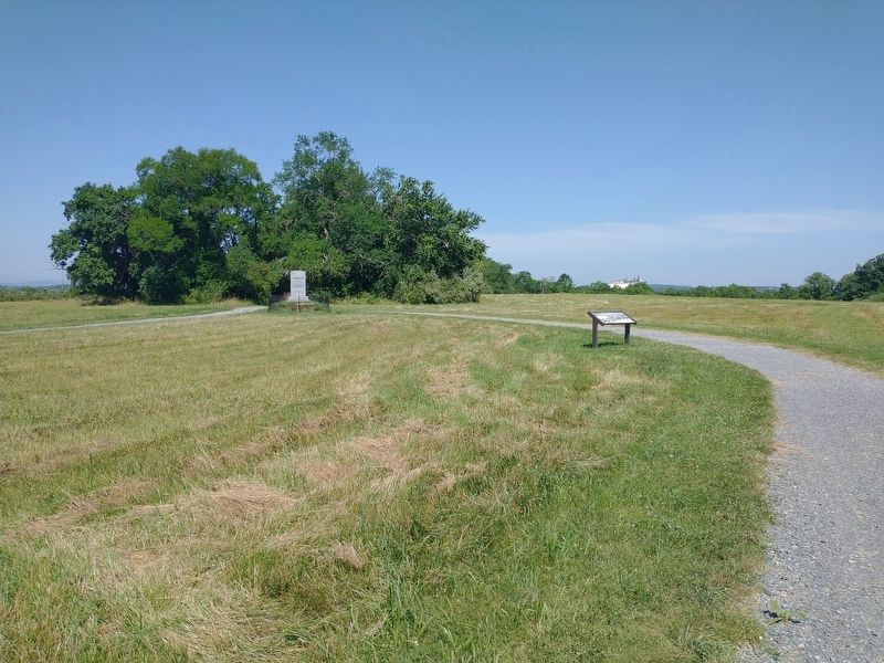
Location. 39° 11.952′ N, 78° 7.598′ W. Marker is in Winchester, Virginia, in Frederick County. Marker can be reached from Redbud Road (Route 661) 0.9 miles east of Martinsburg Pike (U.S. 11), on the right when traveling east. Located 1.1 miles south of the parking lot on the Third Battle of Winchester Trail south of Redbud Run. Touch for map. Marker is at or near this postal address: 541 Redbud Rd, Winchester VA 22603, United States of America. Touch for directions.
Other nearby markers. At least 8 other markers are within walking distance of this marker. Alabama (within shouting distance of this marker); A Perfect Sheet Of Lead (about 400 feet away, measured in a direct line); Maine (about 500 feet away); Molineux's Stand (about 600 feet away); Ten Thousand Devils (approx. 0.2 miles away); Bloody Repulse (approx. 0.2 miles away); Sheridan Renews The Attack (approx. 0.2 miles away); Hackwood And Patton (approx. ¼ mile away). Touch for a list and map of all markers in Winchester.
Also see . . . Third Winchester Battlefield Park. Shenandoah Valley Battlefields Foundation (Submitted on August 18, 2022.)
Credits. This page was last revised on August 18, 2022. It was originally submitted on August 18, 2022, by Craig Doda of Napoleon, Ohio. This page has been viewed 119 times since then and 31 times this year. Photos: 1, 2. submitted on August 18, 2022, by Craig Doda of Napoleon, Ohio. • Bernard Fisher was the editor who published this page.

