Coltons Point in St. Mary's County, Maryland — The American Northeast (Mid-Atlantic)
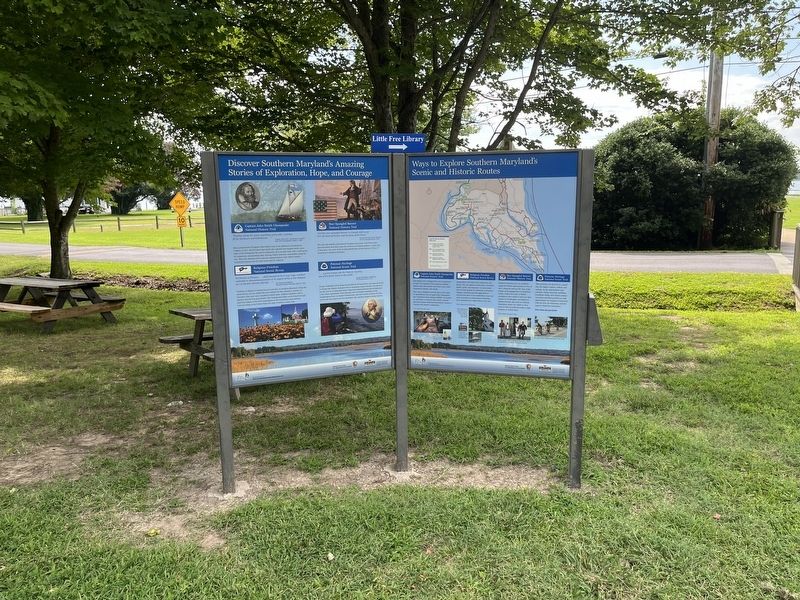
Ways to Explore Southern Maryland's Scenic and Historic Routes

Photographed by Devry Becker Jones (CC0), August 26, 2022
1. Ways to Explore Southern Maryland's Scenic and Historic Routes Marker
Captain John Smith Chesapeake National Historic Trail
This unique trail is designed for you to experience by boat. It is America's first waterway national historic trail and includes more than 3,000 miles explored by Captain John Smith.
The route is marked as several sites on the water by special buoys that are part of the Chesapeake Bay Interpretive Buoy System (CBIS). Accessible by cell phone or internet, these buoys transmit data that includes historical information related to Captain John Smith's explorations.
Religious Freedom National Scenic Byway
Automobile is the best way to experience this byway. You can explore various sites—churches, homes, parks, and museums—to learn about the very first attempt in American to introduce religious toleration and separation of church from state. If you would like to tour any of the churches, we recommend contacting their administrative offices before you visit.
Star-Spangled Banner National Historic Trail
Southern Maryland was an attractive target for British raids during the War of 1812. Along the trail are the sites of the largest naval engagement in Maryland waters.
this page online
Potomac Heritage National Scenic Trail
This evolving trail network is a portal into the region's history, culture, and ecology. As the metropolitan area expands, hiking, bicycling, paddling, horseback riding, and related outdoor recreation activities provide you with opportunities for intimate connections with the river, its tributaries, and the region's distinctive landscapes.
Erected by Destination Southern Maryland; National Park Service, U.S. Department of the Interior; Maryland Heritage Area Authority.
Topics and series. This historical marker is listed in these topic lists: Abolition & Underground RR • African Americans • Colonial Era • Exploration • War of 1812 • Waterways & Vessels. In addition, it is included in the Captain John Smith Chesapeake National Historic Trail series list. A significant historical year for this entry is 1812.
Location. 38° 13.521′ N, 76° 45.071′ W.
Photographed by Devry Becker Jones (CC0), August 26, 2022
2. Ways to Explore Southern Maryland's Scenic and Historic Routes Marker

Regionally, this marker is in Southern Maryland. It is also in the American South, specifically in the Upper South, in the Mid-Atlantic, in the Tidewater, in the Chesapeake Bay Region, and on the Eastern Seaboard. Globally, it is in the North Atlantic Region, North America, the Western Hemisphere, the Western World, and the Anglosphere. Historically, it finds itself in what was once one of the original Thirteen Colonies and also the Antebellum South.
Other nearby markers. At least 8 other markers are within walking distance of this marker: Discover Southern Maryland's Amazing Stories of Exploration, Hope, and Courage (here, next to this marker); Stuffed Ham (here, next to this marker); St. Clement's Island Museum (within shouting distance of this marker); Charlotte Hall School (within shouting distance of this marker); Dory Boats (about 300 feet away, measured in a direct line); With Great Emotion of Soul (about 300 feet away); Journey to an Island (about 300 feet away); The Black Diamond Incident (about 300 feet away). Touch for a list and map of all markers in Coltons Point.
Another marker is no longer nearby. Potomac River Dory Boat (was about 300 feet away but has been replaced with another marker now near it).
Credits. This page was last revised on August 26, 2022. It was originally submitted on August 26, 2022, by Devry Becker Jones of Washington, District of Columbia. This page has been viewed 232 times since then and 22 times this year. Photos: 1, 2. submitted on August 26, 2022, by Devry Becker Jones of Washington, District of Columbia.
