Danville in Caledonia County, Vermont — The American Northeast (New England)
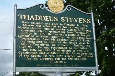
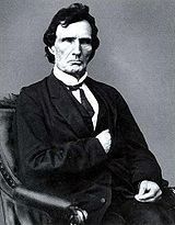
Thaddeus Stevens
Erected 2006 by Vermont Division for Historic Preservation.
Topics. This historical marker is listed in these topic lists: Abolition & Underground RR • Civil Rights • War, US Civil. A significant historical year for this entry is 1792.
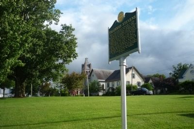
Location. 44° 24.682′ N, 72° 8.417′ W. Marker is in Danville, Vermont, in Caledonia County. Marker is at the intersection of Theodore Roosevelt Hwy (U.S. 2) and Peacham Road, on the right when traveling east on Theodore Roosevelt Hwy. Touch for map. Marker is in this post office area: Danville VT 05828, United States of America. Touch for directions.
Other nearby markers. At least 8 other markers are within 6 miles of this marker, measured as the crow flies. Danville Veterans Memorial (within shouting distance of this marker); Danville Civil War Memorial (within shouting distance of this marker); Greenbank's Hollow (approx. 2˝ miles away); First American Platform Scale (approx. 5.6 miles away); St. Johnsbury Trade School (approx. 5.7 miles away); Site of Camp Baxter (approx. 5.8 miles away); St. Johnsbury Athenaeum (approx. 5.9 miles away); Eugene “Geno” McDonough (approx. 5.9 miles away). Touch for a list and map of all markers in Danville.
Related markers. Click here for a list of markers that are related to this marker. To better understand the relationship, study each marker in the order shown.
Also see . . . Thaddeus Stevens. (Submitted on July 9, 2009, by Richard E. Miller of Oxon Hill, Maryland.)
Credits. This page was last revised on December 24, 2019. It was originally submitted on July 9, 2009, by Richard E. Miller of Oxon Hill, Maryland. This page has been viewed 1,888 times since then and 34 times this year. Photos: 1, 2, 3. submitted on July 9, 2009, by Richard E. Miller of Oxon Hill, Maryland. • Kevin W. was the editor who published this page.


