Near Boerne in Kendall County, Texas — The American South (West South Central)
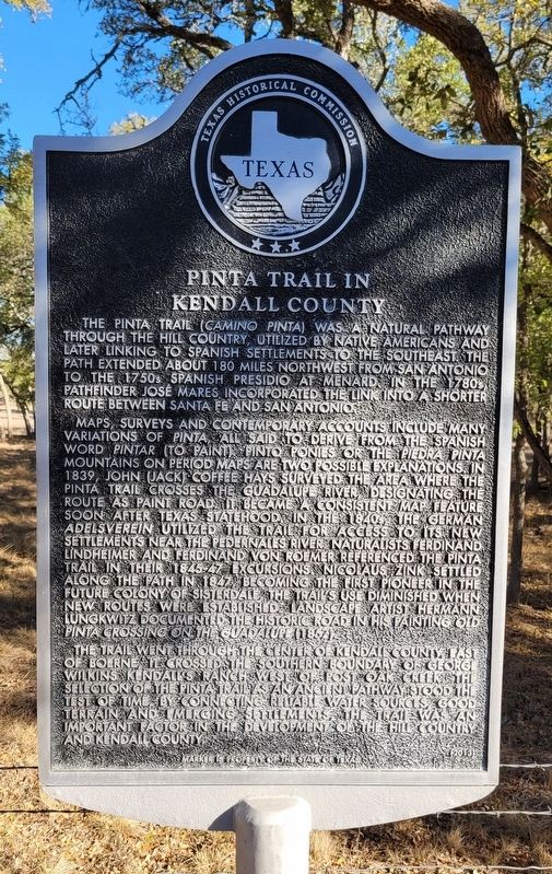
Pinta Trail in Kendall County
Maps, surveys and contemporary accounts include many variations of Pinta, all said to derive from the Spanish word Pintar (to paint). Pinto ponies or the Piedra Pinta Mountains on period maps are two possible explanations. In 1839, John (Jack) Coffee Hays surveyed the area where the Pinta Trail crosses the Guadalupe River, designating the route as Paint Road. It became a consistent map feature soon after Texas statehood. In the 1840s, the German Adelsverein utilized the trail for access to its new settlements near the Pedernales River. Naturalists Ferdinand Lindheimer and Ferdinand von Roemer referenced the Pinta Trail in their 1845-47 excursions. Nicolaus Zink settled along the path in 1847, becoming the first pioneer in the future colony of Sisterdale. The trail's use diminished when new routes were established. Landscape artist Hermann Lungkwitz documented the historic road in his painting Old Pinta crossing on the Guadalupe (1857).
The trail went through the center of Kendall County, east of Boerne, it crossed the southern boundary of George Wilkins Kendall's ranch west of Post Oak Creek. The selection of the Pinta Trail as an ancient pathway stood the test of time. By connecting reliable water sources, good terrain and emerging settements, the trail was, an important factor in the development of the Hill Country and Kendall County.
Erected 2013 by Texas Historical Commission. (Marker Number 17601.)
Topics. This historical marker is listed in these topic lists: Colonial Era • Hispanic Americans • Native Americans • Roads & Vehicles. A significant historical year for this entry is 1839.
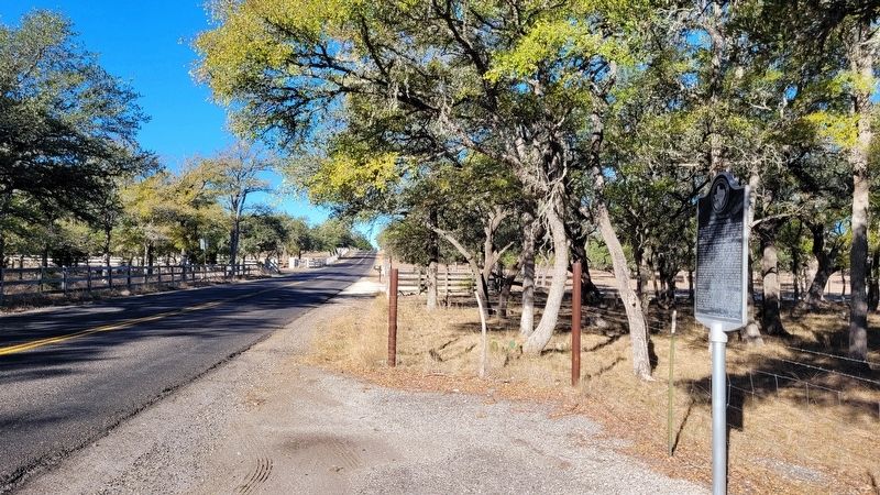
Location. 29° 47.146′ N, 98° 38.97′ W. Marker is near Boerne, Texas, in Kendall County. Marker is on Ammann Road, 2.4 miles east of River Road (State Highway 46), on the left when traveling east. The marker is located along the north side of the road. Touch for map. Marker is in this post office area: Boerne TX 78006, United States of America. Touch for directions.
Other nearby markers. At least 8 other markers are within 5 miles of this marker, measured as the crow flies. Cascade Cavern (approx. 2.4 miles away); Dr. Ferdinand Ludwig von Herff (approx. 4 miles away); Boerne (approx. 4.6 miles away); Julius A. and Anna Phillip House (approx. 4.6
miles away); Kendall Masonic Lodge No. 897 (approx. 4.6 miles away); Boerne Chapter No. 200 - O.E.S. (approx. 4.7 miles away); SA and AP (approx. 4.7 miles away); Lott Lines (approx. 4.7 miles away). Touch for a list and map of all markers in Boerne.
Also see . . . Pinta Trail. Texas State Historical Association
The Pinta Trail was used by natives, explorers, and settlers to travel between today's San Antonio and the vicinity of today's Fredericksburg. It was probably part of the trail network used by Jumanos in the seventeenth century to journey and trade among New Mexico, Central Texas, La Junta de los Ríos, and East Texas. After Spaniards established the San Antonio de Bexár Presidio in 1718 and the villa of San Fernando de Bexár in 1731, the Pinta Trail was one route used to explore to the north. It was also a north-south route for Apaches, who migrated southward into the Texas Hill Country not long before Spaniards crossed the Rio Grande and began exploring Texas. The trail was one route to the short-lived Spanish mission and presidio at San Sabá, and was part of the return path taken on a 1767 frontier inspection by the Marqués de Rubí.(Submitted on October 27, 2022, by James Hulse of Medina, Texas.)
Credits. This page was last revised on October 27, 2022. It was originally submitted on October 26, 2022, by James Hulse of Medina, Texas. This page has been viewed 206 times since then and 60 times this year. Photos: 1, 2. submitted on October 27, 2022, by James Hulse of Medina, Texas.

