Lower Township near Cape May in Cape May County, New Jersey — The American Northeast (Mid-Atlantic)
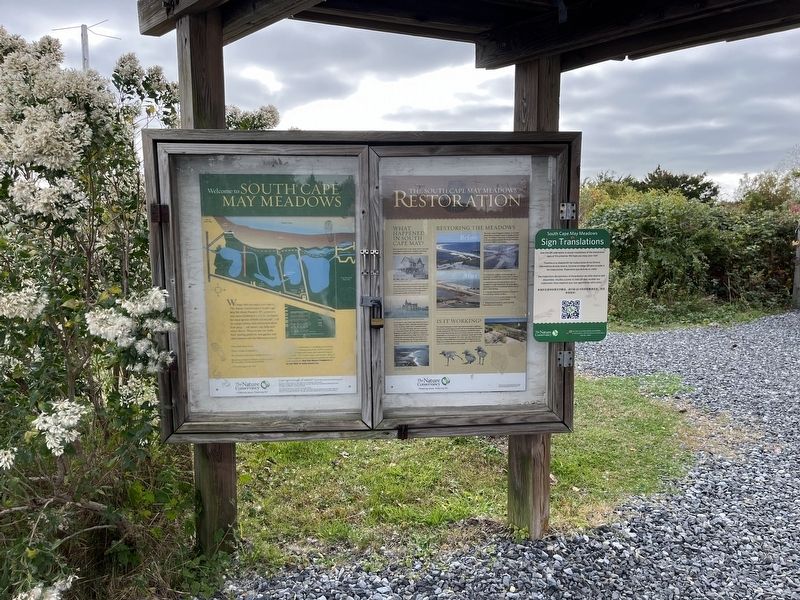
The South Cape May Meadows Restoration
Photographed by Devry Becker Jones (CC0), October 30, 2022
1. The South Cape May Meadows Restoration Marker
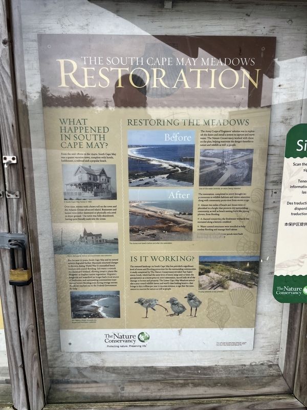
What Happened in South Cape May?
From the mid-1800s to the 1940s, South Cape may was a quaint vacation town complete with hotels, bathhouses, a railroad and a popular beach.
Over time, storms took a heavy toll on the town and the Atlantic Ocean advanced inland. Businesses and homes were either destroyed or physically relocated to dryer ground. The town was fully abandoned, having quite literally sunk into the ocean.
For the next 50 years, South Cape May and its natural systems degraded further. Manmade structural changes to the area during World War II intensified beach erosion and coastal flooding. Salt water overtook the dunes and wetland, allowing invasive plants like Phragmites to displace native vegetation. Migratory songbirds and waterfowl no longer had a local source of freshwater, and surrounding communities experienced severe flooding even during average storms. Residents reached out to the Federal Government for help.
Restoring the Meadows
The Army Corps of Engineers' solution was to replenish the dunes and install a system to capture and move water. The Nature Conservancy worked with them on the
this page online
The restoration, completed in 2007, brought improvements to wildlife habitats and visitor amenities along with community protection from storm surge:
∗ Almost two miles of beach and dunes were replenished to a height that protects the surrounding community, as well as beach nesting birds like piping plovers, from flooding.
∗ A channel connecting the freshwater wetlands was created along a historical creekbed.
∗ Water control structures were installed to help combat flooding and manage bird habitat.
Is It Working?
The restored landscape in South Cape May has provided a significant level of storm and flooding protection for the surrounding communities. A study completed by The Nature Conservancy revealed that Superstorm Sandy, which had the same level of storm surge and 15 times the precipitation as a storm prior to 2007 restoration, caused only 1% of the damage to homes and property. The Lower Cape May Meadows area is also a year-round wildlife haven and world-class birding location that brings in $313 million per year
Photographed by Devry Becker Jones (CC0), October 30, 2022
2. The South Cape May Meadows Restoration Marker
Erected by The Nature Conservancy.
Topics. This historical marker is listed in these topic lists: Animals • Environment • Parks & Recreational Areas • Settlements & Settlers • Waterways & Vessels. A significant historical year for this entry is 2007.
Location. 38° 56.272′ N, 74° 56.682′ W. Marker is near Cape May, New Jersey, in Cape May County. It is in Lower Township. It can be reached from Sunset Boulevard (County Road 606) east of West Drive, on the right when traveling east. Touch for map. Marker is at or near this postal address: 690 Sunset Blvd, Cape May NJ 08204, United States of America. Touch for directions.

Regionally, this marker is on the Jersey Shore. It is also in the American Northeast, in the Mid-Atlantic, and on the Eastern Seaboard. Globally, it is in the North Atlantic Region, North America, the Western Hemisphere, the Western World, and the Anglosphere. Historically, it finds itself in what was once New Netherland and also one of the original Thirteen Colonies.
Other nearby markers. At least 8 other markers are within walking distance of this marker: Historic West Cape May Remembers… (approx. 0.4 miles away); The Bunker Story (approx. ¾ mile away); Bats on the Move (approx. 0.8 miles away); Ridges, Rivers and Coastlines (approx. 0.8 miles away); Shorebirds Galore (approx. 0.8 miles away); Vietnam Veterans Memorial (approx. 0.8 miles away); Historic West Cape May Remembers… / West Cape May Sporting Events of the Past… (approx. 0.8 miles away); Korean Veterans Memorial (approx. 0.8 miles away).
Another marker is no longer nearby. What Is It? (was approx. ¾ mile away but has been permanently removed).
Credits. This page was last revised on February 7, 2023. It was originally submitted on November 3, 2022, by Devry Becker Jones of Washington, District of Columbia. This page has been viewed 328 times since then and 40 times this year. Photos: 1, 2. submitted on November 3, 2022, by Devry Becker Jones of Washington, District of Columbia.
