East Harlem in Manhattan in New York County, New York — The American Northeast (Mid-Atlantic)
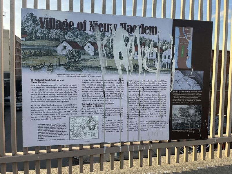
Village of Nieuw Haerlem
The Colonial Dutch Settlement of Nieuw Haerlem
Long before Europeans arrived in North America, indigenous peoples had been living on the island of Manhattan which boasted forest, fertile land, fresh water streams, and easy access to the ocean and to a major inland river. The Lenape Indians were thriving. One of their major trails, from southern Manhattan to the top of the island, provided access to the area that subsequently became the second official settlement on the island, Nieuw Haerlem.
By the mid 1600s, Dutch, German and Huguenot families had built farms near and around this area. Free and enslaved Africans, many of whom were highly skilled, constructed and improved the colony's infrastructure. In 1658, Director General Peter Stuyvesant ordered African workers to widen and improve the existing Lenape trail between New Amsterdam and Nieuw Haerlem.
In 1660, the First Reformed, Low Dutch Church and the village of Nieuw Haerlem received charters. Simple dirt lanes were laid out, modest houses were built, and garden and farm lots were established. Alongside their European owners and employers, African descended individuals managed farms and businesses, contributing to the settlement's growth. Within a few years, the rapidly growing Dutch Church community established a cemetery; it was eventually segregated with the waterfront section designated for the burial of free and enslaved Africans.
The Harlem African Burial Ground: Early-1700s to Mid-1800s
By the early 1700s, the church of Nieuw Haerlem operated two cemeteries, one for people of European descent and one for people of African descent. Segregation in cemeteries was a widely practiced colonial custom.
The northern and original cemetery (roughly between what are now East 127th-127th Streets) was designated for free and enslaved Africans. What was historically called the "Negro burying ground" tended to attract families of African descent who lived in areas now identified as West, Central and East Harlem and surrounding communities. Historians have used burial records to identify both individuals and families who buried at least three generations of loved ones in what evolved into a community burying ground.
During the first half of the 1800s, the landscape began to change and the Harlem community became more densely populated, land associated with this northern cemetery was leased by the Church as grazing pasture while it was still a functioning cemetery. Facing mounting financial difficulties, the Dutch Reformed Church decided to sell the "Negro burying ground" in 1853 though burials there continued until the late 1850s. The bodies of men, women and children of African

Photographed By Devry Becker Jones (CC0), November 4, 2022
2. Village of Nieuw Haerlem Marker
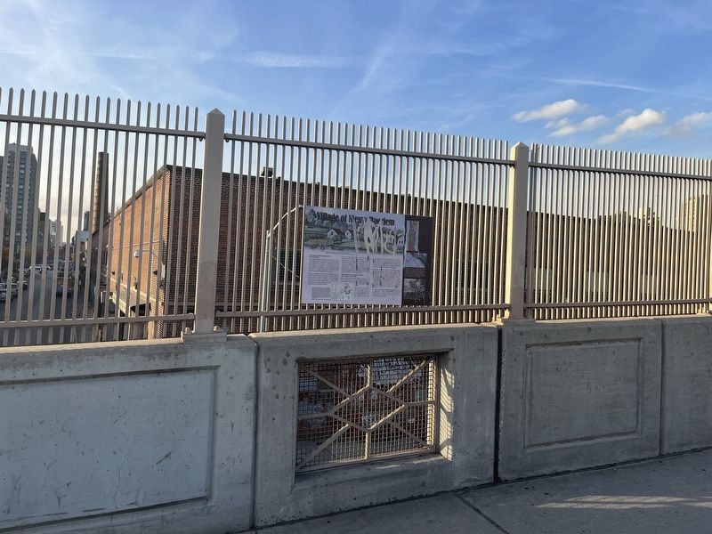
Unfortunately, the marker has been defaced.
The Elmendorf Reformed Church, the successor church to the original Dutch church of Nieuw Haerlem, observed its 350th anniversary in 2010, including a community wide celebration of the early cemetery—now referred to as the Harlem African Burial Ground.
[Captions:]
The village of Nieuw Haerlem later became New Harlem, then Harlem. This map shows roughly what the village looked like in 1670, over the modern street grid. The location of house, garden, and farm lots can be seen. Landfilling has pushed the shoreline out into the river so that a portion of the original Manhattan approach ramp to the Willis Avenue Bridge (shown here in green) rests on manmade land.
(Adapted from Pierce, New Harlem: Past and Presen, 1903)
In 1819-1820 a survey was made showing the location of old farm houses in New Harlem as well as the proposed new street grid system voted in by the City in 1811. The new plan set the streets and avenues at a 45-degree angle to the colonial street system, eliminating the remains of original lanes and house lots. The streets were not laid out and not all houses were removed until the late 19th century.
Topics. This historical marker is listed in these topic lists: African Americans • Agriculture • Cemeteries & Burial Sites • Churches & Religion • Colonial Era • Native Americans • Settlements & Settlers. A significant historical year for this entry is 1658.
Location. 40° 48.152′ N, 73° 55.847′ W. Marker has been reported damaged. Marker is in Manhattan, New York, in New York County. It is in East Harlem. Marker is on Willis Avenue Bridge Path, 0.1 miles north of Dr. Martin Luther King Jr. Boulevard, on the left when traveling north. Touch for map. Marker is at or near this postal address: 1257 1st Ave, New York NY 10035, United States of America. Touch for directions.
Other nearby markers. At least 8 other markers are within walking distance of this location. Willis Avenue Bridge (about 300 feet away, measured in a direct line); Swing Bridges (about 800 feet away); Roundhouse (approx. 0.3 miles away); Alice Kornegay Triangle (approx. 0.4 miles away); Pleasant Village Community Garden (approx. 0.4 miles away); GreenThumb (approx. 0.4 miles away); Harlem Art Park (approx. 0.4 miles away); PFC Carlos J. Lozada Playground (approx. half a mile away). Touch for a list and map of all markers in Manhattan.
Credits. This page was last revised on January 31, 2023. It was originally submitted on November 6, 2022, by Devry Becker Jones of Washington, District of Columbia. This page has been viewed 85 times since then and 25 times this year. Photos: 1, 2. submitted on November 6, 2022, by Devry Becker Jones of Washington, District of Columbia.
