
Near Talmage in Union County, Iowa — The American Midwest (Upper Plains)
Mt. Pisgah – Mormon Pioneer Way Station
⎯⎯⎯
Chief Pied Riche Tells the Spirit of Mt. Pisgah
Photographed by Thomas Onions, July 19, 2009
1. Mt. Pisgah – Mormon Pioneer Way Station Marker
Front of Main Marker
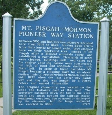
Mt. Pisgah - Mormon Pioneer Way Station
Between 300 and 400 Mormon pioneers perished here from 1846 to 1852. Having been driven from their homes by armed mobs, they stopped here on their westward trek, named it Mt. Pisgah after a Biblical mountain range, and established a way-station. Thousands of acres were cleared, buildings built, and caves dug for shelter until log cabins were constructed, but lack of food and adequate shelter took their toll. In spite of these hardships Mt. Pisgah became a stopping place for an almost endless train of westward-bound Mormon pioneers until 1852 when the last Latter-day Saints left and the site was bought by a Henry Peters and named Petersville.
The original community was located on the slope and flatlands east of this spot. The cemetery extended down the hill to the west, north and south beyond the railroad tracks. Headstones were long ago removed or destroyed by the elements, but the large monument was erected in 1888.
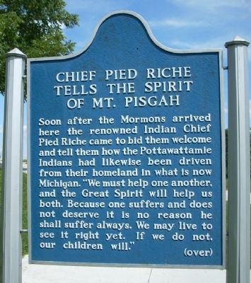
Chief Pied Riche Tells the Spirit of Mt. Pisgah
Soon after the Mormons arrived here the renowned Indian Chief Pied Riche came to bid them welcome and to
this page online
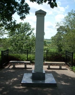
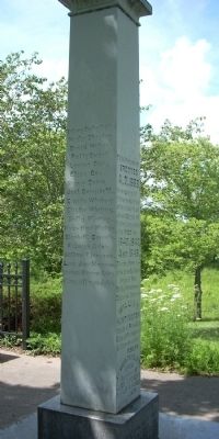
This Monument erected A.D 1888 in memory of those members of the church of Jesus Christ of Latter Day Saints who died in 1840, 1847, and 1848, denying their exodus to seek a home beyond the Rocky Mountains. Interred here is William Huntington, the first Presiding Elder of the temporary settlement called Pisgah. Lenora Charlotte Snow daughter of Elder Lorenzo & Charlotte Squires Snow
Son of Elder
Franklin D and Jane Snyder Richards
Ezra T.B.Adair • Nancy Workman • Samuel Workman • Samuel
Photographed by Thomas Onions, July 19, 2009
2. Mt. Pisgah – Mormon Pioneer Way Station Marker
Reverse of Main Marker
Hyrum Spencer • Alvah Hancock • Gardner Edmison • Philinda Galvin Jordin • Joseph Smith Billingsley • Elkano Keller • Mrs. Baldwin and Baby • Mr. Hess Mr. Hays) Buried on west side of river • Joseph Merryfield • Mr. Cook. Wife of Mr. Brown • Mr. Thompson • William Selvannies Bishop • Joseph Franklin Bishop • Angelin Carter • Stranger not in the book • Henry Judson • Alexander Guy • Benjamin Guy • Emma Jane Johnson • Martha A Dunn.
The Mormon Pioneer Trail
Beginning in February 1846, the vanguard of the Church of Jesus Christ of Latter-day Saints (the Mormons) struggled across southern Iowa on the way to their "New Zion" in the Rocky Mountains.
The trek from Nauvoo, Illinois to Kanesville (Council Bluffs), Iowa tested the endurance of humans, animals and equipment. The frozen landscape of an Iowa February soon turned a thawing mixture of mud and muck. Their
Photographed by Thomas Onions, July 19, 2009
3. Mt. Pisgah – Mormon Pioneer Way Station Marker
Front of Memorial Column
After wintering in the present-day Omaha/Council Bluffs district; the Saints continued across Nebraska and Wyoming to the Valley of the Great Salt Lake. Today, a marked 1,624 mile long auto tour route closely parallels this historic route.
The Mormon Pioneers struggled across the Iowa prairies, traversed the Great Plains of Nebraska, climbed the backbone of the continent at South Pass Wyoming, and descended the Pacific slope of the Rocky Mountains to the Great Salt Lake Valley of Utah.
What's in a Name?
In the Bible, Mount Pisgah is the place from which Moses saw the promised land. As Parley P. Pratt approached the crest of the hill upon which you are standing, he saw the beautiful Grand River Valley below him and felt he could see the Mormon "Zion".
Pratt was sent by the Pioneer party to find a location for the second semi-permanent camp in Iowa. Here, three thousand acres of land were cleared,
Photographed by Thomas Onions, July 19, 2009
4. Mt. Pisgah – Mormon Pioneer Way Station Marker
Side two of Memorial Column
Perhaps Pratt was not actually viewing the promised land from this hilltop, as the name Mount Pisgah suggests. However, the beauty and abundance of this site provided a welcome respite for the Pioneers after three and a half months of struggling through the Iowa mud.
The arrow indicates your present location and the dots mark the sites of other panels across the state. For a brochure with more detailed route information, contact the nearest tourist information office.
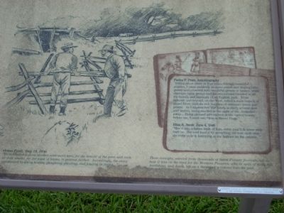
Parley P. Pratt, Autobiography
"Riding about three or four miles through beautiful prairies, I came suddenly to some round and sloping hills, grassy and crowned with beautiful groves of timber; while alternate open groves and forests seemed blended in all beauty and harmony of an English park. While beneath and beyond, on the West, rolled a main branch of grand River, with its rich bottoms of alternate forest and prairie. As I approached this lovely scenery, several deer and wolves, being startled at the sight of me... bounded away... Being pleased and excited at the varied beauty before me, I cried out, "this is Mount Pisga.""
Eliza R.Snow, June 4, 1846
"Mov'd into a house built of logs,some peal'd & some with bark on... the roof form'd by stretching the tent cloth over the ridge pole & fastening at the bottom of the outside..."
Orson Pratt May 19, 1846
"We concluded to form another settlement here, for the benefit of the poor, and such as were unable, for the want of teams, to proceed further. Accordingly, the camp commenced building houses, ploughing, planting, and fencing in farms..."
These excerpts, selected from thousands of faded Pioneer journals, tell us how it was on the trail for the Mormon Pioneers, who in spite of daily toil, hardships, and death, left us a thousand windows into the past.
Exhibits funded in part by the AMCA Humanities Board and the National Endowment for the Humanities.
Topics and series.
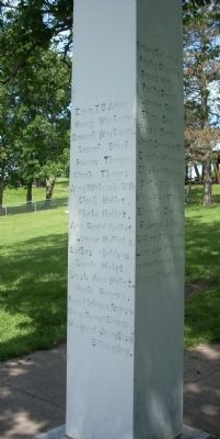
Photographed by Thomas Onions, July 19, 2009
5. Mt. Pisgah – Mormon Pioneer Way Station Marker
Side three of the Memorial Column
Location. 41° 3.055′ N, 94° 6.023′ W. Marker is near Talmage, Iowa, in Union County. It is on Mt Pisgah Road half a mile south of 170th Street, on the right when traveling south. Touch for map. Marker is in this post office area: Thayer IA 50254, United States of America. Touch for directions.

Regionally, this marker is in Southern Iowa. It is also in the American Midwest and in the Corn Belt. Globally, it is in North America, the Western Hemisphere, the Western World, and the Anglosphere. Historically, it finds itself in what was once the territory of the Mississippian Culture and also the Louisiana Purchase.
Other nearby markers. At least 2 other markers are within 6 miles of this marker, measured as the crow flies: Mt. Pisgah (within shouting distance of this marker); Veterans Memorial (approx.
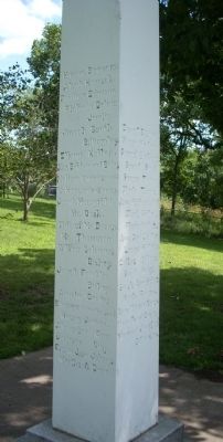
Photographed by Thomas Onions, July 19, 2009
6. Mt. Pisgah – Mormon Pioneer Way Station Marker
Side 4 of the Memorial Marker
More about this marker. These markers are in the Mt Pisgah Cemetery State Preserve.
Also see . . .
1. Mormon Pioneer National Historical Trail. This is the link from the National Park Service. (Submitted on July 21, 2009, by Thomas Onions of Olathe, Kansas.)
2. Mount Pisgah Iowa Wikipedia Entry. (Submitted on July 21, 2009, by Thomas Onions of Olathe, Kansas.)
Additional keywords. Mormon Trail
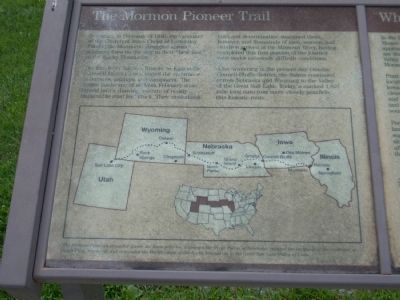
Photographed by Thomas Onions, July 19, 2009
7. Left side of the NPS Tablet
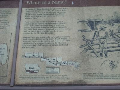
Photographed by Thomas Onions, July 19, 2009
8. Center of the NPS Tablet
Photographed by Thomas Onions, July 19, 2009
9. Right side of the NPS marker
Photographed by Thomas Onions, July 19, 2009
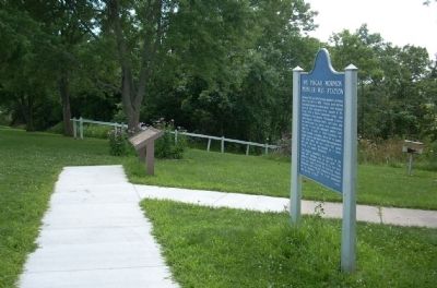
10. State marker & NPS Tablet
The Memorial Marker is down the hill from these two markers.
Photographed by Bill Kirchner, September 23, 2014
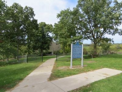
11. Mt. Pisgah – Mormon Pioneer Way Station/Chief Pied Riche Tells the Spirit of Mt. Pisgah Marker
Mt. Pisgah Cemetery Monument is down the sidewalk.
Credits. This page was last revised on November 21, 2025. It was originally submitted on July 21, 2009, by Thomas Onions of Olathe, Kansas. This page has been viewed 5,533 times since then and 115 times this year. Photos: 1, 2, 3, 4, 5, 6, 7, 8, 9, 10. submitted on July 22, 2009, by Thomas Onions of Olathe, Kansas. 11. submitted on October 18, 2014, by Bill Kirchner of Tucson, Arizona. • Syd Whittle was the editor who published this page.
