Rock Creek Park in Northwest Washington in Washington, District of Columbia — The American Northeast (Mid-Atlantic)
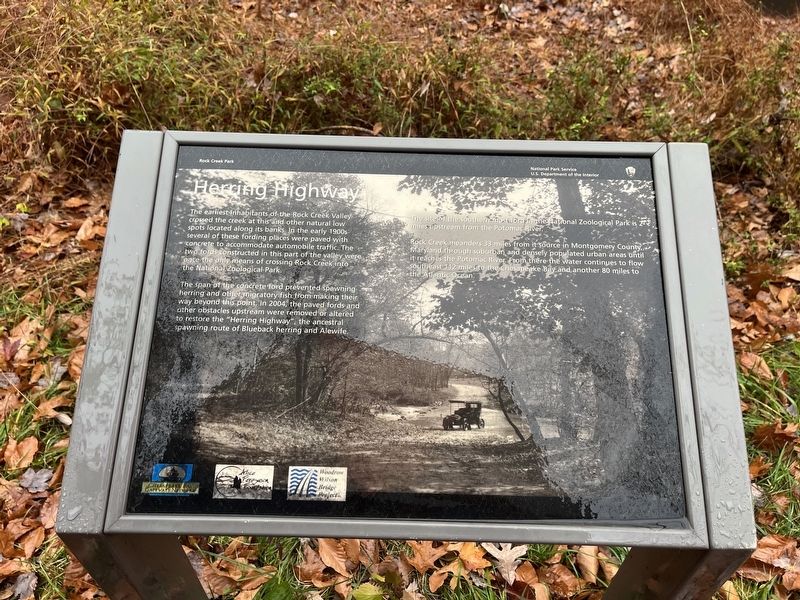
Herring Highway
Rock Creek Park
— National Park Service, U.S. Department of the Interior —
The earliest inhabitants of the Rock Creek Valley crossed the creek at this and other natural low spots located along its banks. In the early 1900s several of these fording places were paved with concrete to accommodate automobile traffic. The two fords constructed in this part of the valley were once the only means of crossing Rock Creek into the National Zoological Park.
The span of the concrete ford prevented spawning herring and other migratory fish from making their way beyond this point. In 2004, the paved fords and other obstacles upstream were removed or altered to restore the "Herring Highway", the ancestral spawning route of Blueback herring and Alewife.
The site of the southern most ford in the National Zoological park is 2 miles upstream from the Potomac River.
Rock Creek meanders 33 miles from it source in Montgomery County, Maryland through suburban and densely populated urban areas until it reaches the Potomac River. From there the water continues to flow southeast 112 miles to the Chesapeake Bay and another 80 miles to the Atlantic Ocean.
Erected by National Park Service, U.S. Department of the Interior; Chesapeake Bay Gateways Network; Alice Ferguson Foundation; Woodrow Wilson Bridge Project.
Topics. This historical marker is listed in these topic lists: Animals • Environment • Parks & Recreational Areas • Roads & Vehicles • Waterways & Vessels. A significant historical year for this entry is 2004.
Location. 38° 55.549′ N, 77° 2.961′ W. Marker is in Northwest Washington in Washington, District of Columbia. It is in Rock Creek Park. Marker is on Rock Creek Trail, 0.2 miles north of Beach Drive Northwest, on the left when traveling north. Touch for map. Marker is in this post office area: Washington DC 20008, United States of America. Touch for directions.
Other nearby markers. At least 8 other markers are within walking distance of this marker. Adams Mill (about 300 feet away, measured in a direct line); Million Dollar Bridge (about 600 feet away); Historic Cemetery (approx. 0.2 miles away); Rediscovery and Remembrance (approx. 0.2 miles away); Soldiers, Sailors, and Refugees of War (approx. 0.2 miles away); Seeking Freedom (approx. 0.2 miles away); Resilience and Resistance (approx. 0.2 miles away); Olmsted Walk (approx. 0.2 miles away). Touch for a list and map of all markers in Northwest Washington.
Credits. This page was last revised on January 30, 2023. It was originally submitted on November 11, 2022, by Devry Becker Jones of Washington, District of Columbia. This page has been viewed 54 times since then and 7 times this year. Photos: 1, 2. submitted on November 11, 2022, by Devry Becker Jones of Washington, District of Columbia.

