Near Sioux Falls in Lincoln County, South Dakota — The American Midwest (Upper Plains)
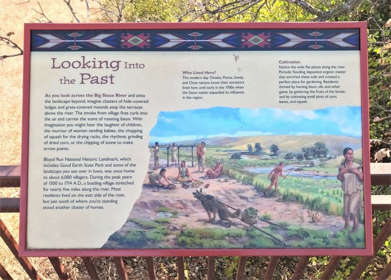
Looking Into the Past
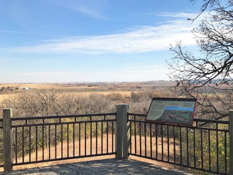
As you look across the Big Sioux River and onto the landscape beyond, imagine clusters of hide-covered lodges and grass-covered mounds atop the terraces above the river. The smoke from village fires curls into the air and carries the scent of roasting bison. With imagination you might hear the laughter of children, the murmur of women tending babies, the chopping of squash for the drying racks, the rhythmic grinding of dried corn, or the chipping of stone to make arrow points.
Blood Run National Historic Landmark, which includes Good Earth State Park and some of the landscape you see over in Iowa, was once home to about 6,000 villagers. During the peak years of 1500 to 1714 A.D., a bustling village stretched for nearly five miles along the river. Most residents lived on the east side of the river, but just south of where you're standing stood another cluster of homes.
Who Lived Here?
The modern-day Omaha, Ponca, Ioway, and Otoe nations know their ancestors lived here until early in the 1700s when the Sioux nation expanded its influence in the region.
Cultivation
Notice the wide flat places along the river. Periodic flooding deposited organic matter that enriched these soils and created a perfect place for gardening. Residents thrived by hunting bison, elk, and other game, by gathering the fruits of the forest, and by cultivating small plots of corn, beans, and squash.
Topics. This historical marker is listed in these topic lists: Anthropology & Archaeology • Native Americans • Waterways & Vessels. A significant historical year for this entry is 1500.
Location. 43° 28.522′ N, 96° 35.269′ W. Marker is near Sioux Falls, South Dakota, in Lincoln County. Marker can be reached from 480th Avenue (County Highway 135) ¼ mile south of 269th Street (County Highway 102), on the right when traveling north. The marker stands on an overlook deck on the Vista Loop Trail in Good Earth State Park. Touch for map. Marker is at or near this postal address: 26924 480th Ave, Sioux Falls SD 57108, United States of America. Touch for directions.
Other nearby markers. At least 8 other markers are within walking distance of this marker. A Trading Center (approx. 0.2 miles away); Bow Hunting (approx. ¼ mile away); Sacred Images (approx. 0.3 miles away); 1600s (approx. 0.3 miles away); 1714 (approx. 0.3 miles away); 1300s (approx. 0.3 miles away); 1870s (approx. 0.3 miles away); 1888 (approx. 0.4 miles away). Touch for a list and map of all markers in Sioux Falls.
Credits. This page was last revised on November 25, 2022. It was originally submitted on November 17, 2022. This page has been viewed 65 times since then and 10 times this year. Photos: 1, 2. submitted on November 17, 2022. • Devry Becker Jones was the editor who published this page.

