Lincoln Park in San Francisco City and County, California — The American West (Pacific Coastal)
Port of San Francisco
Canoes, Clipper Ships & Steamers
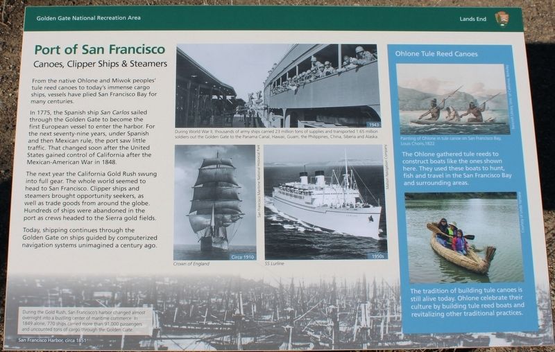
From the native Ohlone and Miwok peoples’ tule reed canoes to today’s immense cargo ships, vessels have plied San Francisco Bay for many centuries.
In 1775, the Spanish ship San Carlos sailed through the Golden Gate to become the first European vessel to enter the harbor. For the next seventy-nine years, under Spanish and then Mexican rule, the port saw little traffic. That changed soon after the United States gained control of California after the Mexican-American War in 1848.
The next year the California Gold Rush swung into full gear. The whole world seemed to head to San Francisco. Clipper ships and steamers brought opportunity seekers, as well as trade goods from around the globe. Hundreds of ships were abandoned in the port as crews headed to the Sierra gold fields.
Today, shipping continues through the Golden Gate on ships guided by computerized navigation systems unimagined a century ago.
Images, top to bottom:
During World War II, thousands of army ships carried 23 million tons of supplies and transported 1.65 million soldiers out the Golden Gate to the Panama Canal, Hawaii, Guam, the Philippines, China, Siberia and Alaska.
Crown of England
SS Lurline
During the Gold Rush, San Francisco’s harbor changed almost overnight into a bustling center of maritime commerce. In 1849 alone, 770 ships carried more than 91,000 passengers and uncounted tons of cargo through the Golden Gate.
Ohlone Tule Reed Canoes
The Ohlone gathered tule reeds to construct boats like the ones shown here. They used these boats to hunt, fish and travel in the San Francisco Bay and surrounding areas.
The tradition of building tule canoes is still alive today. Ohlone celebrate their culture by building tule reed boats and revitalizing other traditional practices.
Image:
Painting of Ohlone in tule canoe on San Francisco Bay.
Louis Choris, 1822
Erected by National Park Service - Golden Gate National Recreation Area - Lands End.
Topics. This historical marker is listed in these topic lists: Immigration • Native Americans • War, Mexican-American • Waterways & Vessels. A significant historical year for this entry is 177 CE.
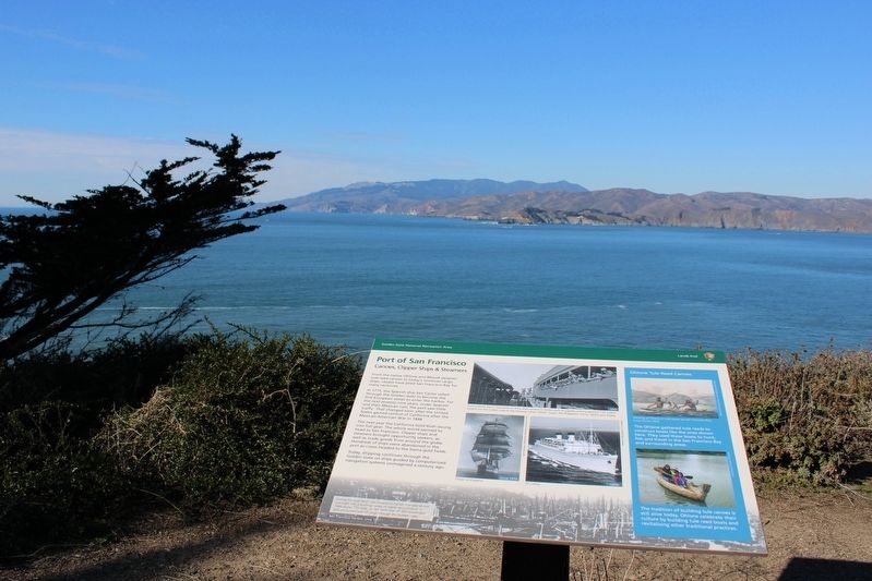
Location. 37° 46.998′ N, 122° 30.692′ W. Marker is in San Francisco, California, in San Francisco City and County. It is in Lincoln Park. Marker can be reached from El Camino Del Mar near Seal Rock Drive. The resin marker is mounted to a metal stand on the Lands End Loop Trail (also the Coastal Trail) at the Eastern Coastal Trail Overlook, below the
El Camino Del Mar parking lot. Touch for map. Marker is at or near this postal address: 2586 El Camino Del Mar, San Francisco CA 94121, United States of America. Touch for directions.
Other nearby markers. At least 8 other markers are within walking distance of this marker. The Golden Gate (here, next to this marker); Navigating the Golden Gate (within shouting distance of this marker); Lands End (within shouting distance of this marker); Death of a Sailor (within shouting distance of this marker); The Honored Dead (within shouting distance of this marker); This Memorial to Rear Admiral Daniel J. Callaghan (within shouting distance of this marker); FDR's Salute (within shouting distance of this marker); The Naval Battle of Guadalcanal (within shouting distance of this marker). Touch for a list and map of all markers in San Francisco.
Also see . . .
1. Golden Gate National Parks Conservancy: Lands End Lookout.
"The Lookout brings together the cultural and natural stories of Lands End, and serves as a starting point for exploring the trails that stretch out into the landscape."(Submitted on November 18, 2022, by Joseph Alvarado of Livermore, California.)
2. San Francisco Maritime History: From the Barbary Coast to Today's Embarcadero.
"From rousing sea chanteys to historical walking tours, the tale of San Francisco’s coming-of-age is most eloquently told in the history of its waterfront. Ever since majestic clipper ships transported hordes of 49ers to her shores, San Francisco has been a legendary port-of-call."(Submitted on November 18, 2022, by Joseph Alvarado of Livermore, California.)
Credits. This page was last revised on February 7, 2023. It was originally submitted on November 18, 2022, by Joseph Alvarado of Livermore, California. This page has been viewed 102 times since then and 12 times this year. Photos: 1, 2, 3, 4. submitted on November 18, 2022, by Joseph Alvarado of Livermore, California.


