Brunswick in Glynn County, Georgia — The American South (South Atlantic)
Wright Square
— City of Brunswick —
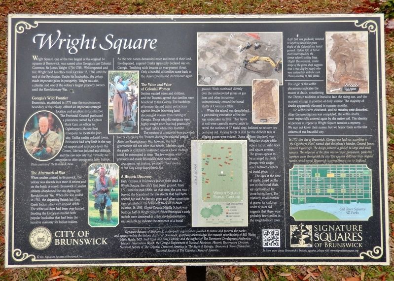
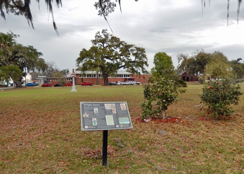
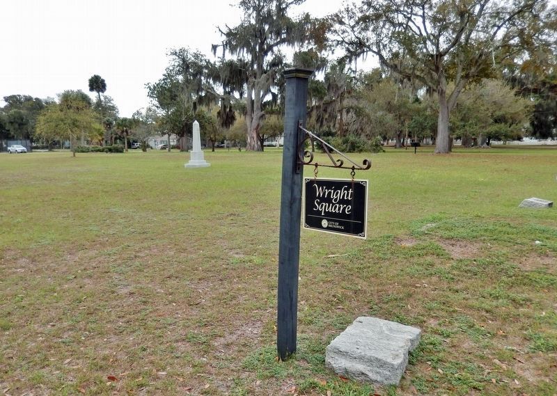
Wright Square, one of the two largest of the original 14 squares of Brunswick, was named after Georgia’s last Colonial Governor, Sir James Wright (1716-1785). Well-respected and fair, Wright held his office from October 13, 1760 until the end of the Revolution. Under his leadership, the colony made important gains in prosperity. Wright was also a planter and one of the colony’s largest property owners until the Revolutionary War.
Georgia’s Wild Frontier
Brunswick, established in 1771 near the southernmost boundary of the colony, offered an important strategic location and excellent natural harbor. The Provincial Council purchased a plantation owned by Captain Mark Carr, an officer in Oglethorpe’s Marine Boat Company, to locate the port city. Unlike earlier colonial towns, Brunswick had very little in the way of support and assistance from the Crown. Life was isolated and difficult, and the raw new city had virtually no amenities to offer immigrants from Europe.
The Aftermath of War
When settlers arrived in Brunswick, the colony was already in a state of unrest and on the brink of revolt. Brunswick’s Loyalist citizens abandoned the city during the Revolutionary War. When the war ended in 1781, the departing British left their Creek Indian allies with unpaid debts. The white tail deer had been over-hunted, flooding the European market with popular buckskins that had been the lucrative mainstay for Indian traitors. As the new nation demanded more and more of their land, the displaced, angered Creeks repeatedly declared war on Georgia. Terrifying raids became an ever-present threat. Only a handful of families came back to the deserted town and started over again.
The Value and Valor of Colonial Women
Settlers wanted wives and children, and the Trustees agreed that families were beneficial to the Colony. The hardships of frontier life and initial restrictions against females inheriting land discouraged women from coming to Georgia. Those who did emigrate were highly sought after, but had practically no legal rights when they married.
The services of a midwife were provided free of charge by the Trustees during the colonial period. After the Revolutionary War, however, the new government did not offer that benefit. Mothers faced the perils of childbirth unassisted unless a local midwife could be summoned in time. The few women who prevailed and made Brunswick their home were courageous, yet unsung, pioneers.
A Historic Discovery
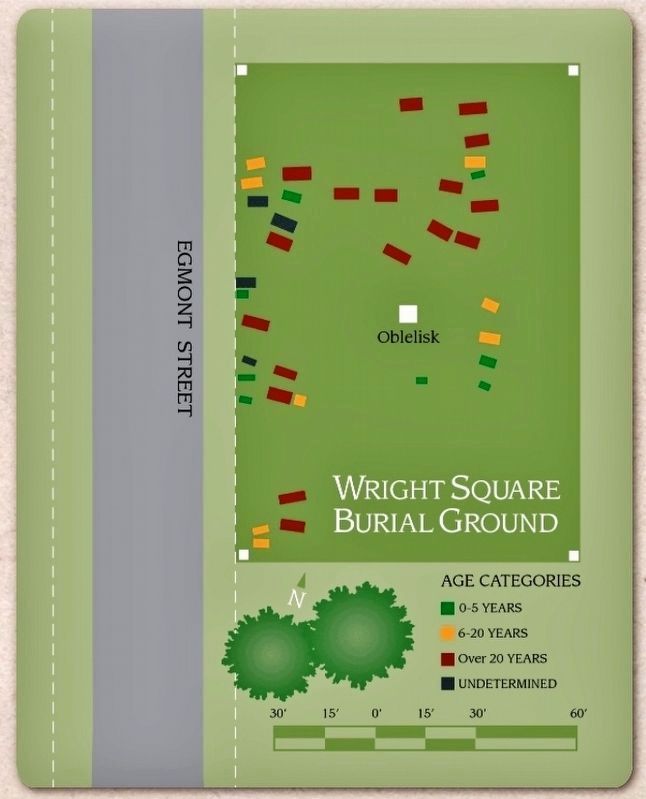
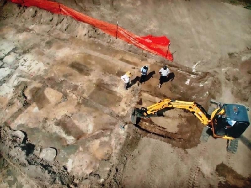
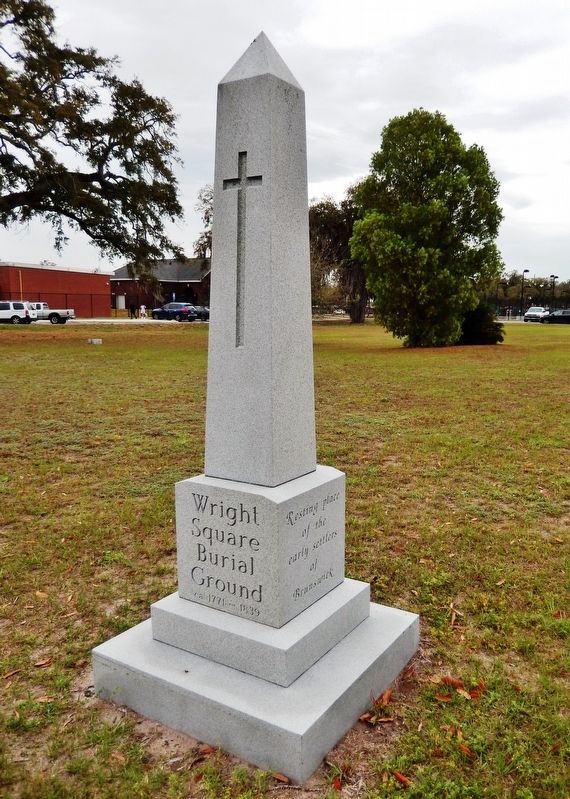
Early citizens of Brunswick buried their dead in Wright Square, the city’s first burial ground, from 1771 until the mid-1800s. At that time, the area was beyond the bounds of the few streets that had been opened for use. As the city grew and other cemeteries were established, the town lost track of its exact location. In 1953, Glynn County Middle School was built on half of Wright Square. Since Brunswick’s early records were destroyed in a fire, no documentation was available to indicate the existence of a burial ground. Work continued directly over the undiscovered graves as gas lines and other intrusions unintentionally crossed the burial shafts of Colonial settlers.
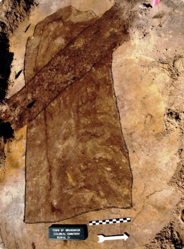
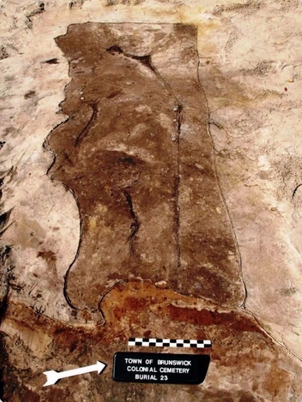
When the school was demolished, a painstaking excavation of the site was undertaken in 2012. Thin layers of soil were carefully moved aside to reveal the outlines of 37 burial sites, believed to the over two centuries old. Varying levels of skill for the difficult task of digging graves were evident. Some outlines displayed very irregular shapes while others had straight sides and square corners. The graves appear to be arranged in family groups, with ample space between clusters of burial plots.
The ages at the time of death, based on the size of the burial shaft, are approximate for those buried here. The relatively small number of graves for children under 6 years old suggests that there were probably few families in the rough frontier town. The angle of the coffin placements indicates the season of death, considering the Christian tradition of burial to face the rising sun, and the seasonal change of daily
sunrise. The majority of deaths apparently occurred in summer months.
No coffins were excavated, and no remains were disturbed. After the investigation was completed, the coffin shafts were respectfully covered again by the native soil. The identity of persons at repose in Wright Square remains a mystery. We may not know their names, but we honor them as the first citizens of our beautiful city.
National Society of the Colonial Dames of America.
To learn more about Brunswick’s historic squares, please visit www.signaturesquares.org
Erected 2014 by Signature Squares of Brunswick, Inc.
Topics and series. This historical marker is listed in these topic lists: Cemeteries & Burial Sites • Native Americans
• Settlements & Settlers • Women. In addition, it is included in the The Colonial Dames of America, National Society of series list. A significant historical year for this entry is 1771.
Location. 31° 8.689′ N, 81° 29.39′ W. Marker is in Brunswick, Georgia, in Glynn County. Marker is on Egmont Street just north of George Street, on the left when traveling south. Touch for map. Marker is in this post office area: Brunswick GA 31520, United States of America. Touch for directions.
Other nearby markers. At least 8 other markers are within walking distance of this marker. Sidney Lanier (about 800 feet away, measured in a direct line); Glynn Academy Vietnam Veterans Memorial (approx. 0.2 miles away); Hanover Square (approx. 0.2 miles away); a different marker also named Hanover Square (approx. 0.2 miles away); a different marker also named Hanover Square (approx. ¼ mile away); a different marker also named Hanover Square (approx. ¼ mile away); Queen Square (approx. ¼ mile away); a different marker also named Queen Square (approx. ¼ mile away). Touch for a list and map of all markers in Brunswick.
Also see . . .
1. Wright Square History.
For years, archaeologist William Weeks had studied the possibility that the location of the settlers’ burial ground might have been beneath the square. When the old school was demolished, he supervised a painstaking excavation of the site in 2012. Thin layers of soil were carefully moved aside to reveal the outlines of 37 burial sites, believed to be over two centuries old. It was discovered that gas lines and other intrusions had unintentionally crossed the burial shafts of Colonial settlers when the school was built.(Submitted on March 14, 2022, by Cosmos Mariner of Cape Canaveral, Florida.)
2. James Wright.
James Wright was a colonial lawyer and jurist who was the last British Royal Governor of the Province of Georgia. By 1778, Governor Wright convinced the [British] government to lend him enough troops to once again attempt to take Savannah. After some short but sharp fights, he regained control of Savannah on 29 December 1778. While never fully in control of the state, he did restore large areas within Georgia to colonial rule, making this the only colony that was regained by the British once they had been expelled. When the war was lost, he withdrew on 11 July 1782 and retired to England.(Submitted on March 14, 2022, by Cosmos Mariner of Cape Canaveral, Florida.)
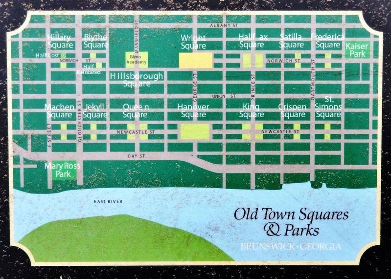
6. Marker detail: 1771 Town Plat • “the Oglethorpe Plan”
In 1771, the city of Brunswick, Georgia was laid out according to “the Oglethorpe plan,” named after the colony’s founder, General James Edward Oglethorpe. The design featured a grid of 14 large and 14 small squares. The intention of the plan was to create permanent, park-like common areas throughout the city. The squares still bear their original names, which reveal Brunswick’s strong historic ties to England.
Credits. This page was last revised on December 26, 2022. It was originally submitted on March 14, 2022, by Cosmos Mariner of Cape Canaveral, Florida. This page has been viewed 236 times since then and 38 times this year. Last updated on December 20, 2022, by Carl Gordon Moore Jr. of North East, Maryland. Photos: 1, 2, 3, 4, 5, 6, 7, 8, 9. submitted on March 14, 2022, by Cosmos Mariner of Cape Canaveral, Florida. • Bernard Fisher was the editor who published this page.
