Leesburg in Loudoun County, Virginia — The American South (Mid-Atlantic)
An Early Methodist Parsonage / The Archaeology of a Church

Photographed By Devry Becker Jones (CC0), January 21, 2023
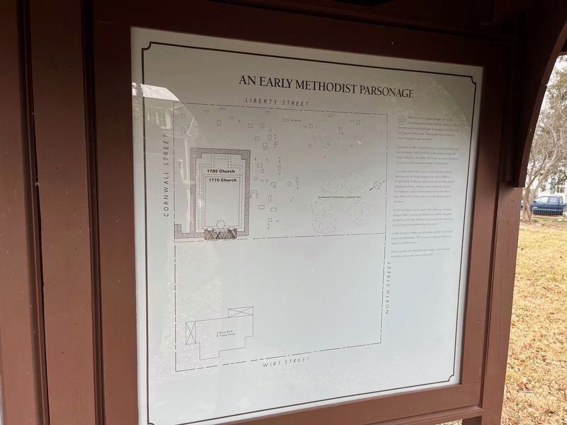
1. An Early Methodist Parsonage side of the marker
Years later, in 1816, Samuel Murrey, a Scottish merchant, and his wife Betsey "sold" the house to the trustees of the Old Stone Church for one dollar. The house was soon enlarged to serve as one of the early parsonages of Methodism.
Late in the nineteenth century, as the Old Stone Church declined, the parsonage property was sold in 1896 to Dr. Richard B. Fishburne and his wife, Bessie. They further enlarged the house, adding a room on the east side for Dr. Fishburne's office, later Leesburg's first town library, from 1907 to 1922. That room is now the dining room of the house.
In 1923 the house was deeded to the Fishburnes' daughter Margaret (Mrs. J. Armistead Welbourne), and her daughter, Elizabeth. In 1932 the Welbournes purchased the adjoining church property for additional garden space.
In 1961 Elizabeth Welbourne Seccombe sold the churchyard back to the Methodists. The Virginia Conference Historical Society is still the owner.
The house, this early Methodist parsonage, is still privately owned and not usually opened to the public.
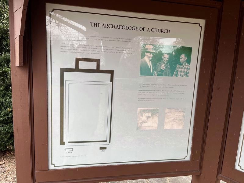
The Methodist Historical Society of Northern Virginia engaged the volunteer services of a professional archaeologist to examine the site. During October 1965 he, with local workers, excavated nine test trenches. He determined the exact location of the foundations of both the churches, c. 1770 and 1785, which successively stood on the site. The Society then placed granite markers which still identify the corners of the both foundations.
🕀 Also revealed were the doorway stones before both the church doors, as well as an early herringbone brick walkway leading to the church doorways.
Artifacts uncovered in the study were mostly domestic items and simple building materials — glass, pottery, nails. But one item discovered was a door-key which may have been the very symbol of disputed ownership in the late nineteenth century.
A brick walkway has been extended around the church site so that visitors may study the site of this shrine of early Methodism.

Photographed By Devry Becker Jones (CC0), January 21, 2023
2. The Archaeology of a Church side of the marker
Topics. This historical marker is listed in these topic lists: Anthropology & Archaeology • Architecture • Churches & Religion • Colonial Era. A significant historical month for this entry is October 1965.
Location. 39° 7.041′ N, 77° 33.958′ W. Marker is in Leesburg, Virginia, in Loudoun County. Marker is on Cornwall Street Northwest just west of Wirt Street Northwest, on the right when traveling west. Touch for map. Marker is at or near this postal address: 106 Liberty St, Leesburg VA 20176, United States of America. Touch for directions.
Other nearby markers. At least 8 other markers are within walking distance of this marker. Site of The Old Stone Church / Successors to the Old Stone Church (here, next to this marker); Highlights of History / The Old Stone Church in Nineteenth-Century Leesburg (here, next to this marker); In 2018 during the construction of new residences… (here, next to this marker); Old Stone Church Site (a few steps from this marker); Early Methodism in Leesburg (a few steps from this marker); In Memory of Richard Owings (a few steps from this marker); Mrs. Sarah Armat (within shouting distance of this marker); Capt. Wright Brickell (within shouting distance of this marker). Touch for a list and map of all markers in Leesburg.

Photographed By Devry Becker Jones (CC0), January 21, 2023
3. The Archaeology of a Church side of the marker
Credits. This page was last revised on January 21, 2023. It was originally submitted on January 21, 2023, by Devry Becker Jones of Washington, District of Columbia. This page has been viewed 78 times since then and 14 times this year. Photos: 1, 2, 3. submitted on January 21, 2023, by Devry Becker Jones of Washington, District of Columbia.