Midtown in San Antonio in Bexar County, Texas — The American South (West South Central)
Archaeology in Brackenridge Park
Photographed by James Hulse
1. Archaeology in Brackenridge Park Marker
Captions
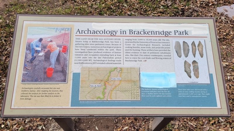
Lower Left: Archaeologists carefully excavated this site near Mulberry Avenue. After mapping the location, they collected the artifacts for further analysis in the laboratory. The site was then filled in to protect it from damage.
Courtesy: Center for Archaeological Research, University of Texas at San Antonio.
Lower Middle: The Mulberry Avenue archaeological excavation took place near the Paso de Tejas, a shallow ford in the San Antonio River used by early explorers and settlers.
Base Map: J.J. Olsen & Son, "City of San Antonio, Texas 1889." Courtesy: Center for Archaeological Research.
Lower Right: These stone adzes were discovered with a series of stone cooking hearths dating to approximately 5,000 years ago. They might have been used to manufacture canoes.
Courtesy: Center for Archaeological Research, University of Texas at San Antonio.
Topics.
this page online
Location. 29° 27.357′ N, 98° 28.506′ W. Marker is in San Antonio, Texas, in Bexar County. It is in Midtown. It is at the intersection of East Mulberry Avenue and Red Oak Road, on the left when traveling west on East Mulberry Avenue. The marker is located on the south side of the highway along the walkway. Touch for map. Marker is at or near this postal address: 941 East Mulberry Avenue, San Antonio TX 78209, United States of America. Touch for directions.

Regionally, this marker is in South Texas. It is also in the American South. Globally, it is in North America, a Gulf of Mexico state, the Western Hemisphere, the Western World, and the Anglosphere. Historically, it finds itself in what was once New Spain, the Republic of Texas, and one of the Confederate States of America.
Other nearby markers. At least 8 other markers are within walking distance of this marker: Water Works Channel (about 300 feet away, measured in

Photographed by James Hulse, December 30, 2022
2. The view of the Archaeology in Brackenridge Park Marker along the road
Also see . . . Brackenridge Park. Brackenridge Park Conservancy website homepage:
The casual visitor to Brackenridge Park is totally unaware that the 349-acre park, with its picnic areas, ball fields, museum, zoo, and golf course, occupies some of the most historically rich land in the City of San Antonio. Traffic and pavement abound, urban congestion and noise intrude, and interpretation is virtually nil. Nothing tells the visitor that the park represents a long timeline reaching back at least 12,000 years. It is a rich tapestry of history linked by the San Antonio River that rises from springs above and in the park and flows through the park on its southerly course.(Submitted on January 26, 2023, by James Hulse of Medina, Texas.)
Credits. This page was last revised on July 7, 2025. It was originally submitted on January 26, 2023, by James Hulse of Medina, Texas. This page has been viewed 321 times since then and 32 times this year. Photos: 1, 2. submitted on January 26, 2023, by James Hulse of Medina, Texas.
