Shockoe Slip in Richmond, Virginia — The American South (Mid-Atlantic)
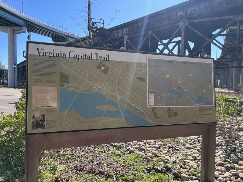
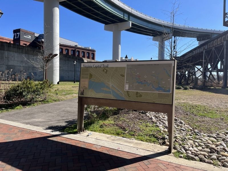
Virginia Capital Trail
Virginia Capital Trail and Richmond Canal Walk
In Richmond, the Capital Trail follows the Richmond Dock portion of the James River and Kanawha Canal from Great Ship Lock Park to the floodwall at 17th Street. On the other side of the floodwall, the trail connects to the Canal Walk, which continues to 5th Street and the American Civil War Center at the Tredegar Iron Works. Historical markers guide the way.
Richmond Slave Trail
You can also follow the Slave Trail, which chronicles the history of the trade of enslaved Africans from Africa to Virginia until 1775, and away from Virginia, especially Richmond, to other locations in the Americas until 1865.
Look Around You
The cross-section here of transportation routes — water, rail and road — is evidence of Richmond's role as a dynamic urban hub. The canal was built in the 1820s and improved in the 1850s. The railroad viaduct was constructed in 1900 and rebuilt in the 1950s. The highway bridges overhead date from the 1950s and 1970s. Each was an achievement in its time as is the massive floodwall, built in the 1990s.
50 Miles of History
The Virginia Capital Trail connects the Commonwealth's past and present capitals of Jamestown, Williamsburg and Richmond. It traverses more than 50 miles and 400 years rich in history along one of the first inland routes in North America. In Richmond, you can visit the Virginia Capitol, designed by Thomas Jefferson in 1785.
Visit virginiacapitaltrail.org for more information.
[Captions:]
Original Town Plan of Richmond, drawn for William Byrd II in 1737
You are standing where a strip of land ran between the creek and the river, opposite Lots A/B. In Byrd's plan, the land between the street grid and the James River was designated as Town Commons.
President Lincoln entering Richmond, April 4, 1865
When Lincoln arrived to tour Richmond the day after the Evacuation Fire, his launch landed at a wharf in the vicinity of 15th Street. From there he and his small party, including his son Tad, walked across the 17th Street Bridge, which at that time traversed the canal, and into the city. Crowds of former slaves quickly gathered and greeted them with enthusiastic cheers. Just 10 days later, President Lincoln was assassinated in Washington, D.C.
Topics. This historical marker is listed in these topic lists: African Americans • Government & Politics • Industry & Commerce • Railroads & Streetcars • Roads & Vehicles • Settlements & Settlers • War, US Civil • Waterways & Vessels. A significant historical date for this entry is April 4, 1865.
Location.
Other nearby markers. At least 8 other markers are within walking distance of this marker. Lincoln's Visit to Richmond (a few steps from this marker); Capital Trees (a few steps from this marker); Richmond Local Flood Protection (within shouting distance of this marker); Canal Walk / Historic Canals (within shouting distance of this marker); Chesapeake & Ohio Railway (about 300 feet away, measured in a direct line); African Americans and the Waterfront (about 400 feet away); In a wooden crate similar to this one… (about 500 feet away); Triple Crossing (about 500 feet away). Touch for a list and map of all markers in Richmond.
Additional keywords. human trafficking
Credits. This page was last revised on February 19, 2023. It was originally submitted on February 19, 2023, by Devry Becker Jones of Washington, District of Columbia. This page has been viewed 85 times since then and 22 times this year. Photos: 1, 2. submitted on February 19, 2023, by Devry Becker Jones of Washington, District of Columbia.

