Fredericksburg, Virginia — The American South (Mid-Atlantic)
The sandstone blocks…
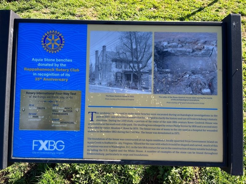
The sandstone blocks used to make these benches were excavated during archaeological investigations in the park in 2019—one of a series of studies that have helped to clarify the history and use of Fredericksburg's historic riverfront. During the 2019 study, a portion of the cellar of the mid-18th-century Rowe-Goolrick House was uncovered near the south end of the park. The dwelling was enlarged by owner Philip Terrier by 1818 and a second story was added by owner Absalom P. Rowe by 1859. The house was one of many in the city used as a hospital for wounded soldiers in December 1862 during the Civil War. The house was demolished in 1973.
The foundation of the house was constructed of cut Aquia sandstone, locally quarried from Government Island on Aquia Creek in Stafford County, Virginia. Valued for the ease with which it could be shaped and carved, much of this sandstone was sent to Washington, D.C. in the late 18th century for use in the construction of many notable buildings, including the U.S. Capitol and the White House. A number of examples of the stone can be found throughout Fredericksburg, particularly in steps
this page online
[Sidebar:]
Aquia Stone benches donated by the Rappahannock Rotary Club in recognition of its 35th Anniversary
of the things we think, say, or do
First Is it the truth?
Second Is it fair to all concerned?
Third Will it build good will and better friendships?
Fourth Will it be beneficial to all concerned?
Erected by City of Fredericksburg, Virginia.
Topics. This historical marker is listed in these topic lists: Anthropology & Archaeology • Architecture • Natural Resources • Science & Medicine • War, US Civil. A significant historical month for this entry is December 1862.
Location. 38° 18.091′ N, 77° 27.375′ W. Marker is in Fredericksburg, Virginia. It is on Sophia Street north of Charlotte Street, on the right when traveling north. Touch for map. Marker is at or near this postal address: 705 Sophia St, Fredericksburg VA 22401, United States of America. Touch for directions.

Regionally, this marker is in the Washington Metropolitan Area and in Northern Virginia. It is also in the American South and specifically in the Upper South. Globally, it is
Other nearby markers. At least 8 other markers are within walking distance of this marker: This natural rise in the landscape… (within shouting distance of this marker); 1846-47 / Philip Y. Wyatt (about 300 feet away, measured in a direct line); Shiloh Baptist Church (Old Site) (about 400 feet away); The African Baptist Church (about 400 feet away); a different marker also named Shiloh Baptist Church (Old Site) (about 400 feet away); 1950 Walker-Grant Protest (about 500 feet away); Thornton's Tavern (about 500 feet away); 1824 (about 500 feet away). Touch for a list and map of all markers in Fredericksburg.
Other markers no longer nearby. Ferries and Flats (was a few steps from this marker but has been permanently removed); a different marker also named Shiloh Baptist Church (Old Site) (was about 400 feet away but has been replaced with another marker now near it); African Baptist Church of Fredericksburg (was about 400 feet away but has been replaced with another marker now near it).
Credits. This page was last revised on March 4, 2023. It was originally submitted on March 4, 2023, by Devry Becker Jones of Washington, District of Columbia. This page has been viewed 358 times since then and 29 times this year. Photos: 1, 2. submitted on March 4, 2023, by Devry Becker Jones of Washington, District of Columbia.
