
Tzintzuntzan, Michoacán, Mexico — The Pacific Coast (and Central Highlands)
Lake Patzcuaro

Photographed by J. Makali Bruton, December 2, 2022
1. Lake Patzcuaro Marker

El tamaño del lago de Pátzcuaro ha cambiado mucho a lo largo de más de 500 años, pero se sabe que su volumen y profundidad dieron pie al rico intercambio comercial de Tzintzuntzan y la región.
Ari japonda kanikua no jachitia jucharhi itsi usandia ioni uexurinia ma irepita ka iumu ekuatsi ueshurini ka milikurhisti ka jauaniti ka istsi arhinarhini tsintsuntsani, iamindu japondaru ka puechani.
Did you know...?
The size of Lake Patzcuaro has changed a lot over more than 500 years, but it is known that its volume and depth gave rise to the rich commercial exchange of Tzintzuntzan and the region.
Erected by Instituto Nacional de Antropología e Historia (INAH).
Topics. This historical marker is listed in these topic lists: Colonial Era • Environment • Waterways & Vessels.
Location. 19° 37.438′ N, 101° 34.454′ W. Marker is in Tzintzuntzan, Michoacán. It can be reached from Avenida Las Yácatas, on the right when traveling east. The marker is on the grounds of the Tzintzuntzan Archeological Site. Touch for map.
this page online

Regionally, this marker is in Western Mexico, in the Bajío, and on the Pacific Coast. Globally, it is in North America, specifically in Mesoamerica, on the Ring of Fire, in the Pacific Rim, and in the Western Hemisphere. Historically, it finds itself in what was once New Spain, a Spanish colony, and the Aztec Empire.
Other nearby markers. At least 8 other markers are within walking distance of this marker: Imparting Justice (within shouting distance of this marker); Las Yácatas (about 180 meters away, measured in a direct line); Grain Storage (about 180 meters away); Terraces and the Great Platform (about 210 meters away); Substructure (about 210 meters away); Tzintzuntzan Archeological Zone (about 240 meters away); Tzintzuntzan: Politics and Government (approx. 0.3 kilometers away); Architecture of Farmers and Petroglyphs of Hunters (approx. 0.3 kilometers away). Touch for a list and map of all markers in Tzintzuntzan.
Photographed by J. Makali Bruton, December 2, 2022
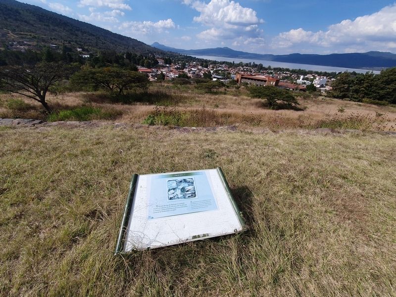
2. Lake Patzcuaro Marker
Lake Patzcuaro can be seen in the distance to the north.
Credits. This page was last revised on April 4, 2025. It was originally submitted on March 19, 2023, by J. Makali Bruton of Washington, District of Columbia. This page has been viewed 106 times since then and 15 times this year. Photos: 1, 2. submitted on March 19, 2023, by J. Makali Bruton of Washington, District of Columbia.
