Port Royal in Beaufort County, South Carolina — The American South (South Atlantic)
Emancipation Day
⎯⎯⎯
Camp Saxton Site
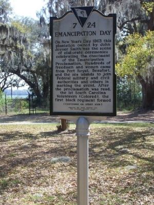
Photographed by Mike Stroud, March 2008
1. Emancipation Day Marker
Erected 1996 by Penn Center and The Michigan Support Group. (Marker Number 7-24.)
Topics. This historical marker is listed in these topic lists: African Americans • Civil Rights • Notable Events • War, US Civil. A significant historical year for this entry is 1863.
Location. 32° 23.393′ N,
this page online

Regionally, this marker is in the Lowcountry and on the Sea Islands. It is also in the American South, specifically in the Deep South, and on the Eastern Seaboard. Globally, it is in the North Atlantic Region, North America, the Western Hemisphere, the Western World, and the Anglosphere. Historically, it finds itself in what was once New Spain, the territory of the Mississippian Culture, one of the original Thirteen Colonies, one of the Confederate States of America, and the Antebellum South.
Other nearby markers. At least 8 other markers are within 2 miles of this marker, measured as the crow flies: "The Year of Jubilee Has Come!" (approx. 0.3 miles away); First South Carolina Infantry (approx. 0.3 miles away); Old Fort Plantation (approx. 0.3 miles away); Emancipation Day (approx. 0.3 miles
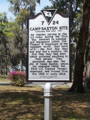
Photographed by Mike Stroud, March 2008
2. Camp Saxton Site Marker
Regarding Emancipation Day / Camp Saxton Site. Union occupation during the Civil War spared the Town of Port Royal from destruction. Gen. Thomas Sherman was quite content to ride out the war comfortably on Hilton Head Island. Consequently, except for a few unsuccessful forays a few miles north of Beaufort to attempt to sever the vital Confederate railway from Savannah to Charleston, the Greater Port Royal area remained a pleasant beachhead for the Union. Officers' families moved down form the North. The only evidence of war was the wounded who were collected and treated in the City of Beaufort. When the other - the fighting Sherman- came through some three years later burning and pillaging, he therefore spared the little historic town, destroying instead neighboring Hardeeville and
McPhersonville just to the north on his way to Columbia.( The Town of Port Royal
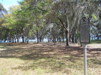
Photographed by Mike Stroud, 2008
3. Emancipation Day •Camp Saxton Site Marker
Related marker. Click here for another marker that is related to this marker. To better understand the relationship, study marker shown:1st South Carolina Volunteer Infantry Regiment
Also see . . .
1. Camp Saxton. The Camp Saxton Site is an approximately six-acre wooded and greenspaced site (Submitted on March 27, 2008, by Mike Stroud of Bluffton, South Carolina.)
2. Higginson, Thomas Wentworth. The Columbia Encyclopedia, Sixth Edition (Submitted on March 27, 2008, by Mike Stroud of Bluffton, South Carolina.)
3. United States Colored Troops Infantry. (Submitted on March 27, 2008, by Mike Stroud of Bluffton, South Carolina.)
4. Rufus Saxton. Medal of Honor recipient (Harper's Ferry, 1862); Military Governor, Department of the South. (Submitted on June 27, 2009, by Richard E. Miller of Oxon Hill, Maryland.)
Additional keywords. U.S. Colored Infantry; USCT.;1st South Carolina Volunteer Infantry Regiment
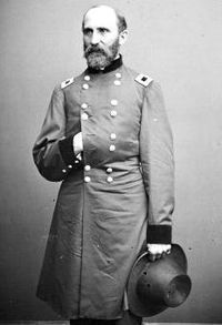
National Archives
4. Rufus Saxton
Brevet Major General, U.S. Volunteers; Brigadier General, U.S. Army.
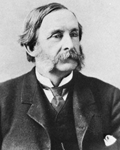
Library of Congress, Washington, D.C.
5. Col.Thomas W. Higginson
Photographed by Mike Stroud, March 27, 2008
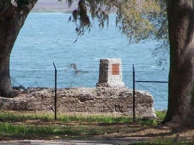
6. Ft Frederick Monument
Also at Camp Saxton site, this was a Revolutionary War Fort ruins along the Beaufort River, Located at U.S. Naval Hospital Port Royal, Beaufort, SC and remote...no available access to Monument
Credits. This page was last revised on March 20, 2023. It was originally submitted on March 27, 2008, by Mike Stroud of Bluffton, South Carolina. This page has been viewed 4,937 times since then and 106 times this year. Last updated on March 19, 2023, by Mark St. Martin of Kalamazoo, Michigan. Photos: 1, 2, 3. submitted on March 27, 2008, by Mike Stroud of Bluffton, South Carolina. 4. submitted on June 27, 2009, by Richard E. Miller of Oxon Hill, Maryland. 5, 6. submitted on March 27, 2008, by Mike Stroud of Bluffton, South Carolina. • Bernard Fisher was the editor who published this page.
