Roanoke Rapids in Halifax County, North Carolina — The American South (South Atlantic)
Roanoke Canal
"Duly Appreciated"
| — | Confederate Lifeline | — |
Photographed by Craig Swain, July 28, 2012
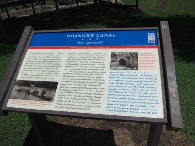
1. Roanoke Canal Marker
Four major railroads served Weldon, making the town a major transportation center by 1861. Because of the movement of troops and supplies was such a critical component of the Southern war effort, the
this page online
"The importance of the Roanoke River is apparent. [It is] navigable ... to Weldon, the importance of which place, both on account of its railway connections and communications with the rebel army in Virginia and its water connection with the North Carolina sounds, is evident. ... The fertililty of the Roanoke Valley is well known and duly appreciated by rebel authorities, who depend on it for large supplies for their armies, and who are now making strenuous efforts to provide against its being taken, by fortifications and concentration of troops." - Col. Jones Frankle, 2nd Mass. Artillery, Nov. 24, 1864
Erected by North Carolina Civil War Trails.
Topics and series. This historical marker
Photographed by Craig Swain, July 28, 2012
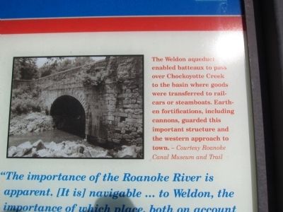
2. Weldon Aqueduct
The Weldon aqueduct enabled batteaux to pass over Chockoyotte Creek to the basin where goods were transferred to railcars or steamboats. Earthen fortifications, including cannons, guarded this important structure and the western approach to town. - Courtesy Roanoke Canal Museum and Trail.
Location. Marker has been reported missing. It was located near 36° 28.466′ N, 77° 38.878′ W. Marker was in Roanoke Rapids, North Carolina, in Halifax County. It was at the intersection of Jackson Street Extended and Roanoke Avenue (North Carolina Highway 48), on the right when traveling west on Jackson Street Extended. Located in front of the Roanoke Canal Museum. Touch for map. Marker was at or near this postal address: 15 Jackson St, Roanoke Rapids NC 27870, United States of America. Touch for directions.

Regionally, this marker was in the Coastal Plain. It was also in the American South and specifically in the Upper South. Globally, it was in North America, the Western Hemisphere, the Western World, and the Anglosphere. Historically, it found itself in what was once the territory of the Mississippian Culture, one of the original Thirteen Colonies, one of the Confederate States of America, and the Antebellum South.
Other nearby markers. At
Photographed by Craig Swain, July 28, 2012
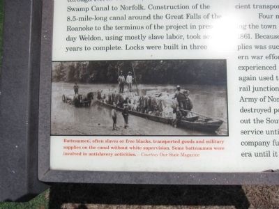
3. Batteaumen
Batteaumen, often slaves or free blacks, transported goods and military supplies on the canal without white supervision. Some batteaumen were involved in antislavery activities. - Courtesy Our State Magazine.
Also see . . . Roanoke Canal Museum and Trail. (Submitted on August 28, 2012, by Craig Swain of Leesburg, Virginia.)
Photographed by Craig Swain, July 28, 2012
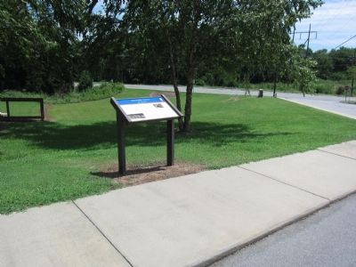
4. Roanoke Canal Marker
Photographed by Craig Swain, July 28, 2012
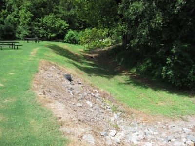
5. Portion of the Roanoke Canal
Photographed by Craig Swain, July 28, 2012
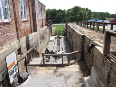
6. Canal Lock and Batteaux
The structure to the left of this view was built in later years to produce power off the canal's water.
Credits. This page was last revised on May 5, 2023. It was originally submitted on August 28, 2012, by Craig Swain of Leesburg, Virginia. This page has been viewed 1,068 times since then and 38 times this year. Last updated on May 5, 2023, by Michael Buckner of Durham, North Carolina. Photos: 1, 2, 3, 4, 5, 6. submitted on August 28, 2012, by Craig Swain of Leesburg, Virginia. • Bernard Fisher was the editor who published this page.
