Barrington in Bristol County, Rhode Island — The American Northeast (New England)
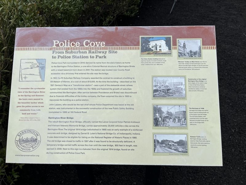
Police Cove
From Suburban Railway Site to Police Station to Park
"I remember the spectacular view of the Barrington River in the Spring and Summer; the boats were moored in the beautiful harbor which gave the police access to our community from both land and water."
- Police Officer Joseph E. Pine Jr.
Served from May 1975 to May 2002
Police Cove Park (completed in 2015) derived its name from the site's history as home to the Barrington Police Station, a one-story Colonial Revival structure of Barrington Bricks with a raised basement torn down in 2001. The station was located near County Road accessible via a driveway that entered the site near the bridge.
In 1903 the RI Suburban Railway Company awarded the contract to construct a building to EK Watson of Warren, at a cost of $13,000. At the time the building - described on the 1921 Sanborn Map as a "transformer station" - was a part of the statewide street railway system that existed from the 1890s into the 1930s and fostered the growth of suburban communities like Barrington. After service between Providence and Bristol was discontinued due financial difficulties of the trolley company, the Town acquired the site in 1930 to repurpose the building as a police station.
John Lazzaro, who would be the last chief whose Police Department was based at the old station, was instrumental in the successful construction of the new Public Safety Building (completed in 1999) at 100 Federal Road.
Barrington River Bridge
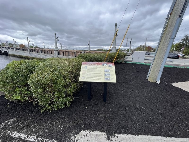
The rebuilt Barrington River Bridge, officially named the Lance Corporal Victor Andreozzi and Vietnam Veterans Memorial Bridge, carries approximately 20,000 vehicles a day across the Barrington River. The original 1914 bridge (refurbished in 1966) was an early example of a reinforced concrete arch bridge, designed by Daniel B. Luten's National Bridge Co. of Indianapolis, Indiana. It was determined to be eligible for listing on the National Register of Historic Places in 1989. The old bridge was closed to traffic in 1997 after it was found to be structurally deficient. A temporary bridge carried traffic across the river until the new bridge, 800 feet in length, was opened in 2009. Next to this sign is a baluster from the original 1914 bridge, found on site during construction of Police Cove Park.
[Captions:]
The Police Station building featured an eight-bay façade of arcaded windows, rough-hewn granite sills, and a corbelled cornice under a shallow brick roof. 1995 photo.
"Bloomer" Trolley on Main Street near Warren Town Hall. Trolleys carried passengers over the Warren and Barrington Bridges, by the RI Suburban Railroad power station, to Crescent Park, Riverside,
Construction of the original Barrington River Bridge in its early stages, at the water's edge in front of the Police Station when it served as a streetcar transformer station. It took four years to build. 1913 photo.
The Hurricane of 1938 damaged the bridge and nearby power lines by tossing boats out of the harbor onto the bridge. The old Police Station, with unpainted brick, is to the right. Balusters knocked loose can be seen on the bridge deck. 1938 photo.
Summer Traffic Jam on the Barrington Bridge. Looking south to Tyler Point with original lamp posts, that were used as a source for current lighting. 1950 photo.
Erected by Barrington Preservation Society.
Topics. This historical marker is listed in these topic lists: Bridges & Viaducts • Law Enforcement • Parks & Recreational Areas • Railroads & Streetcars • Roads & Vehicles • Waterways & Vessels. A significant historical month for this entry is May 1975.
Location. 41° 44.206′ N, 71° 17.829′ W. Marker is in Barrington, Rhode Island, in Bristol County. Marker is at the intersection of County Road (Rhode Island Route 103/114) and Mathewson Road, on the right when traveling west on County Road. Touch for map . Marker is at or near this postal address: 106 County Rd, Barrington RI 02806, United States of America. Touch for directions.
Other nearby markers. At least 8 other markers are within walking distance of this marker. New Meadow Neck (approx. 0.2 miles away); Barrington Center (approx. 0.3 miles away); The Warren Bridge (approx. half a mile away); William Schaff (approx. 0.7 miles away); The Oyster Industry (approx. ¾ mile away); Massasoit Park Sacred Circle Monument (approx. ¾ mile away); The Middle Passage (approx. 0.8 miles away); The First Methodist Church (approx. 0.8 miles away). Touch for a list and map of all markers in Barrington.
Credits. This page was last revised on May 10, 2023. It was originally submitted on May 10, 2023, by Devry Becker Jones of Washington, District of Columbia. This page has been viewed 310 times since then and 41 times this year. Photos: 1, 2. submitted on May 10, 2023, by Devry Becker Jones of Washington, District of Columbia.

