Orangeburg in Orangeburg County, South Carolina — The American South (South Atlantic)
Pewilburwhitcade New Farmers Camp
Photographed by Dave W, May 17, 2023
1. Pewilburwhitcade New Farmers Camp Marker, Side One
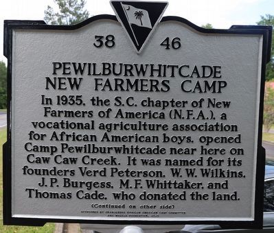
In 1935, the S.C. chapter of New Farmers of America (N.F.A.), a vocational agriculture association for African American boys, opened Camp Pewilburwhitcade near here on Caw Caw Creek. It was named for its founders Verd Peterson, W.W. Wilkins, J.P. Burgess, M.F. Whittaker, and Thomas Cade, who donated the land.
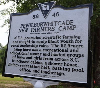
N.F.A. promoted scientific farming and sought to equip Black youth for rural leadership roles. The 62.5-acre camp here was a recreational and educational center and hosted groups of boys and girls from across S.C. It included cabins, a shower house, dining-recreation hall, bathing pool, office, and teacherage.
Erected 2020 by Orangeburg African American Camp Committee and WeGOJA Foundation. (Marker Number 38-46.)
Topics. This historical marker is listed in these topic lists: African Americans • Agriculture • Education • Parks & Recreational Areas • Science & Medicine. A significant historical year for this entry is 1935.
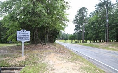
Location. 33° 32.52′ N, 80° 52.889′ W. Marker is in Orangeburg, South Carolina, in Orangeburg County. It is on Willington Drive Northeast 0.1 miles north of Prep Street,
this page online

Regionally, this marker is in the Lowcountry and in Santee Cooper Country. It is also in the American South and specifically in the Deep South. Globally, it is in North America, the Western Hemisphere, the Western World, and the Anglosphere. Historically, it finds itself in what was once the territory of the Mississippian Culture, one of the original Thirteen Colonies, one of the Confederate States of America, and the Antebellum South.
Other nearby markers. At least 8 other markers are within 4 miles of this marker, measured as the crow flies: Mattie E. Pegues New Homemakers Camp (approx. 1.4 miles away); Wilkinson High School (approx. 3.3 miles away); Episcopal Church of the Redeemer and Graveyard (approx. 3.4 miles away); Claflin College (approx. 3½ miles away); Civil Rights Meetings / Sit-in March (approx. 3½ miles away); Christ the King Catholic School (approx. 3½ miles away); Old Dixie Club Library (approx. 3½ miles away); Trinity United Methodist Church
Photographed by Dave W, May 17, 2023
2. Pewilburwhitcade New Farmers Camp Marker, Side Two
Photographed by Dave W, May 17, 2023
3. Pewilburwhitcade New Farmers Camp Marker
Credits. This page was last revised on May 26, 2023. It was originally submitted on May 18, 2023, by Dave W of Co, Colorado. This page has been viewed 283 times since then and 14 times this year. Photos: 1, 2, 3. submitted on May 18, 2023, by Dave W of Co, Colorado. • Devry Becker Jones was the editor who published this page.
