Bath in Beaufort County, North Carolina — The American South (South Atlantic)
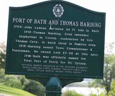
Port of Bath and Thomas Harding
1704-John Lawson surveyed 1st 71 lots in Bath.
1710-Thomas Harding, first recorded shipbuilder in Colony, contracted by Gov. Thomas Cary, to build sloop in Pamlico area.
1715-Harding named Town Commissioner & Vestryman. He owned Lots 27-28 at this spot.
1716-Bath was officially named the First Port of Entry for NC Colony.
Erected 2015 by National Society Daughters of the American Colonists / North Carolina State Regents Project-2015-2018 / Sarah Hepler Martin. NSDAC State Regent.
Topics. This historical marker is listed in these topic lists: Colonial Era • Exploration • Law Enforcement • Settlements & Settlers • Waterways & Vessels. A significant historical year for this entry is 1704.
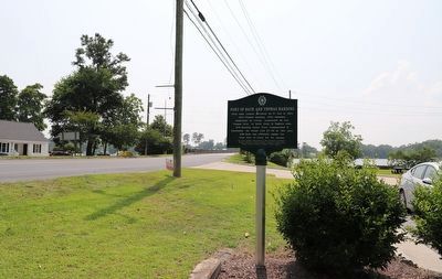
Location. 35° 28.663′ N, 76° 48.895′ W. Marker is in Bath, North Carolina, in Beaufort County. Marker is at the intersection of Cateret Street (North Carolina Route 92) and North Main Street, on the right when traveling west on Cateret Street. Touch for map. Marker is at or near this postal address: 101 N Main St, Bath NC 27808, United States of America. Touch for directions.
Other nearby markers. At least 8 other markers are within walking distance of this marker. Colonial Bath (about 300 feet away, measured in a direct line); Matthew Rowan (about 300 feet away); James Adams Floating Theatre (about 400 feet away); Palmer-Marsh House (about 400 feet away); First Public Library (about 500 feet away); First Post Road (approx. 0.2 miles away); a different marker also named Colonial Bath (approx. 0.2 miles away); Historic Bath (approx. 0.2 miles away). Touch for a list and map of all markers in Bath.
Credits. This page was last revised on June 19, 2023. It was originally submitted on June 19, 2023, by Dave W of Co, Colorado. This page has been viewed 83 times since then and 33 times this year. Photos: 1, 2. submitted on June 19, 2023, by Dave W of Co, Colorado. • Bernard Fisher was the editor who published this page.

