Deerfield in Franklin County, Massachusetts — The American Northeast (New England)
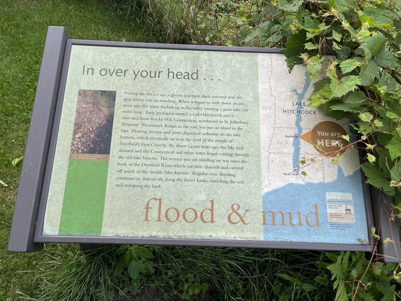
flood & mud
In over your head…
During the last ice age, a glacier one-mile thick towered over the spot where you are standing. When it began to melt about 16,000 years ago, the water backed up in the valley creating a giant lake 220 miles long. Early geologists named it Lake Hitchcock and it stretched from Rocky Hill, Connecticut, northward to St. Johnsbury, Vermont. Pocumtuck Ridge, to the east, was just an island in the lake. Flowing streams and rivers deposited sediment on the lake bottom, which eventually sat near the level of the steeple of Deerfield's First church. By about 14,000 years ago, the lake had drained and the Connecticut and other rivers began cutting through the old lake bottom. The terrace you are standing on was once the bank of the Deerfield River which cut new channels and carried off much of the muddy lake deposits. Regular river flooding continues to deposit silt along the river's banks, enriching the soil and reshaping the land.
Topics. This historical marker is listed in these topic lists: Anthropology & Archaeology • Natural Features • Science & Medicine • Waterways & Vessels.
Location. 42° 32.95′ N, 72° 36.425′ W. Marker is in Deerfield, Massachusetts, in Franklin County. Marker can be reached from Old Main Street near Academy Lane, on the left when traveling north. Touch for map. Marker is at or near this postal address: 89 Old Main St, Deerfield MA 01342, United States of America. Touch for directions.
Other nearby markers. At least 8 other markers are within walking distance of this marker. preservation (within shouting distance of this marker); nature & culture (within shouting distance of this marker); agriculture (about 300 feet away, measured in a direct line); river connections (about 400 feet away); farm & house (about 600 feet away); history (about 700 feet away); Moors House (approx. 0.2 miles away); Peter / Adam (approx. 0.2 miles away). Touch for a list and map of all markers in Deerfield.
Additional keywords. history of geology; history of science; history of natural science
Credits. This page was last revised on August 14, 2023. It was originally submitted on August 14, 2023, by Devry Becker Jones of Washington, District of Columbia. This page has been viewed 45 times since then and 9 times this year. Photos: 1, 2. submitted on August 14, 2023, by Devry Becker Jones of Washington, District of Columbia.

