Rocky Hill in Hartford County, Connecticut — The American Northeast (New England)
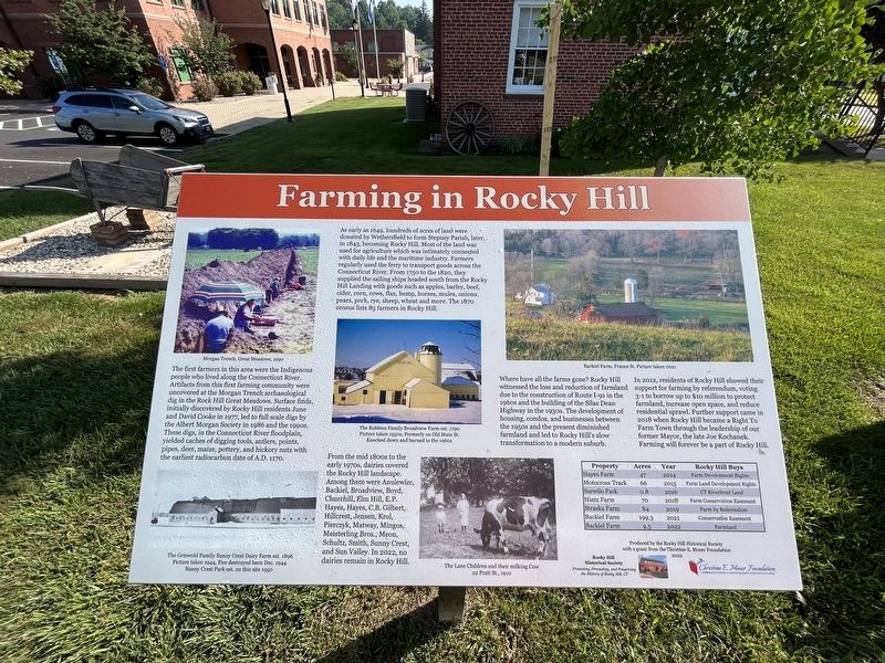
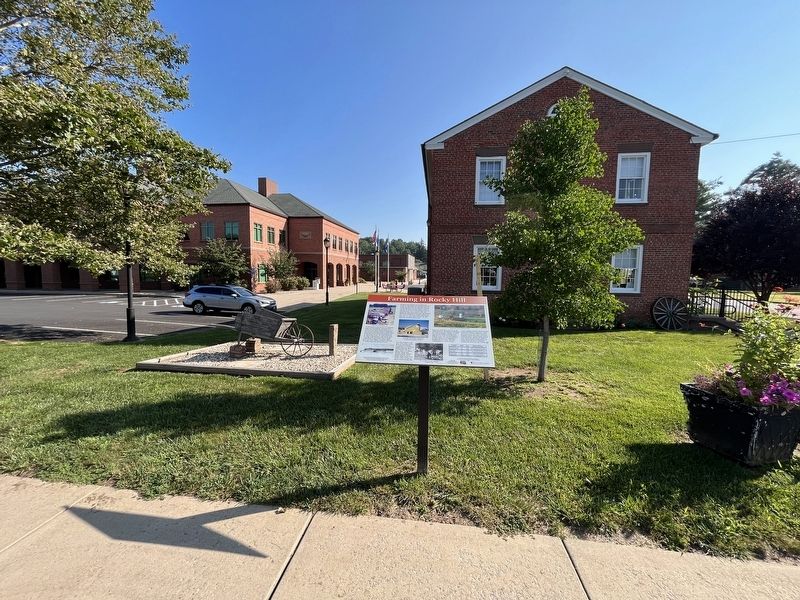
Farming in Rocky Hill
The first farmers in this area were the Indigenous people who lived along the Connecticut River. Artifacts from this first farming community were uncovered at the Morgan Trench archaeological dig in the rock Hill Great Meadows. Surface finds, initially discovered by Rocky Hill residents June and David Cooke in 1977, led to full scale digs by the Albert Morgan Society in 1986 and the 1990s. These digs, in the Connecticut River floodplain, yielded caches of digging tools, antlers, points, pipes, deer, maize, pottery, and hickory nuts with the earliest radiocarbon date of A.D. 1170.
As early as 1649, hundreds of acres of land were donated by Wethersfield to form Stepney Parish, later in 1843, becoming Rocky Hill. Most of the land was used for agriculture which was intimately connected with daily life and the maritime industry. Farmers regularly used the ferry to transport goods across the Connecticut River. From 1750 to the 1820, they supplied the sailing ships headed south from Rocky Hill Landing with goods such as apples, barley, beef, cider, corn, cows, flax, hemp, horses, mules, onions, pears, pork, rye, sheep, wheat and more. The 1870 census lists 85 farmers in Rocky Hill.
From the mid 1800s to the early 1970s, dairies covered the Rocky Hill landscape. Among them were Anulewizc, Backiel, Broadview, Boyd, Churchill, elm Hill, E.P. Hayes, Hayes, C.B. Gilbert, Hillcres, Jensen, Krol, Pierczyk, Matway, Mingos, Meisterling Bros., Meon, Schultz, Smith, Sunny Crest, and Sun Valley. In 2022, no dairies remain in Rocky Hill.
Where have all the farms gone? Rocky Hill witnessed the loss and reduction of farmland due to the construction of Route I-91 in the 1960s and the building of the Silas Dean Highway in the 1930s. The development of housing, condos, and businesses between the 1950s and the present diminished farmland and led to Rocky Hill's slow transformation to a modern suburb.
In 2012, residents of Rocky Hill showed their support for farming by referendum, voting 3-1 to borrow up to $10 million to protect farmland, increase open space, and reduce residential sprawl. Further support came in 2018 when Rocky Hill became a Right to Farm town through the leadership of our former Mayor, the late Joe Kochanek. Farming will forever be a part of Rocky Hill.
Property, Acres, Year, Rocky Hill Buys
Hayes Farm, 47, 2014, Farm Development Rights
Motocross Track, 66, 2015, Farm Land Development Rights
Surwilo Park, 0.8, 2016, CT Riverfront Land
Hintz Farm, 70, 2018, Farm Conservation Easement
Straska Farm, 84, 2019, Farm by Referendum
Backiel Farm, 199.3, 2021, Conservation Easement
Backiel Farm, 9.5, 2022, Farmland
[Captions:]
The Griswold Family Sunny Crest Dairy Farm est. 1896. Picture taken 1944, Fire destroyed barn Dec. 1944. Sunny Crest Park est. on this site 1950.
The Robbins Family Broadview Farm est. 1790. Picture taken 1950s, Formerly on Old Main St. Knocked down and burned in the 1960s.
Erected 2022 by Rocky Hill Historical Society with a grant from the Christine E. Moser Foundation.
Topics. This historical marker is listed in these topic lists: Agriculture • Anthropology & Archaeology • Colonial Era • Industry & Commerce • Roads & Vehicles • Settlements & Settlers. A significant historical month for this entry is December 1944.
Location. 41° 39.972′ N, 72° 38.313′ W. Marker is in Rocky Hill, Connecticut, in Hartford County. Marker is at the intersection of Church Street and Old Main Street, on the right when traveling north on Church Street. Touch for map. Marker is at or near this postal address: 785 Old Main St, Rocky Hill CT 06067, United States of America. Touch for directions.
Other nearby markers. At least 8 other markers are within walking distance of this marker. Academy Hall (a few steps from this marker); Rocky Hill - A CT River Town (within shouting distance of this marker); Rocky Hill Center Historic District (about 400 feet away, measured in a direct line); Rocky Hill (about 700 feet away); Elm Street Historic District (approx. 0.2 miles away); Rocky Hill World War II Monument (approx. 0.3 miles away); Rocky Hill Iraq Afghanistan Veterans Monument (approx. 0.3 miles away); Rocky Hill Vietnam Veterans Monument (approx. 0.3 miles away). Touch for a list and map of all markers in Rocky Hill.
Credits. This page was last revised on August 15, 2023. It was originally submitted on August 15, 2023, by Devry Becker Jones of Washington, District of Columbia. This page has been viewed 119 times since then and 64 times this year. Photos: 1, 2. submitted on August 15, 2023, by Devry Becker Jones of Washington, District of Columbia.

