Dayton's Bluff in Saint Paul in Ramsey County, Minnesota — The American Midwest (Upper Plains)
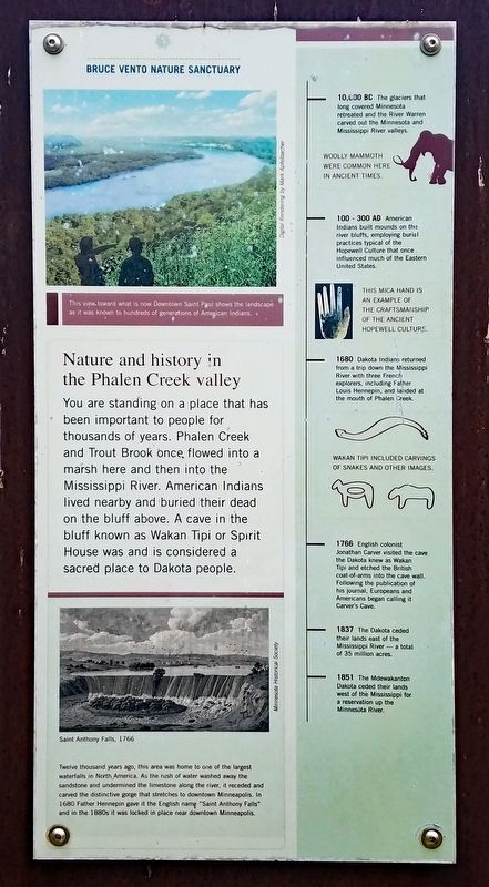
Nature and history in the Phalen Creek valley
Bruce Vento Nature Sanctuary
You are standing on a place that has been important to people for thousands of years. Phalen Creek and Trout Brook once flowed into a marsh here and then into the Mississippi River. American Indians lived nearby and buried their dead on the bluff above. A cave in the bluff known as Wakan Tipi or Spirit House was and is considered a sacred place to the Dakota people.
[Captions:]
This view toward what is now Downtown Saint Paul shows the landscape as it was known to hundreds of generations of American Indians.
Twelve thousand years ago, this area was home to one of the largest waterfalls in North America. As the rush of water washed away the sandstone and undermined the limestone along the river, it receded and carved the distinctive gorge that stretches to downtown Minneapolis. In 1680 Father Hennepin gave it the English name "Saint Anthony Falls" and in the 1880s it was locked in place near downtown Minneapolis.
[Timeline:]
10,000 BC The glaciers that long covered Minnesota retreated and the River Warren carved out the Minnesota and Mississippi River valleys.
Woolly mammoth were common here in ancient times.
100 - 300 AD American Indians built mounds on the river bluffs, employing burial practices typical of the Hopewell Culture that once influenced much of the Eastern United States.
This mica hand is an example of the craftsmanship of the ancient Hopewell Culture.
1680 Dakota Indians returned from a trip down the Mississippi River with three French explorers, included Father Louis Hennepin, and landed at the mouth of Phalen Creek.
Wakan Tipi included carvings of snakes and other images.
1766 English colonist Jonathan Carver visited the cave the Dakota knew as Wakan Tipi and etched the British coat-of-arms into the cave wall. Following the publication of his journal, Europeans and Americans began calling it Carver's Cave.
1837 The Dakota ceded their lands east of the Mississippi River — a total of 35 million acres.
1851 The Mdewakanton Dakota ceded their lands west of the Mississippi for a reservation up the Minnesota River.
Topics. This historical marker is listed in these topic lists: Anthropology & Archaeology • Cemeteries & Burial Sites • Exploration • Native Americans • Waterways & Vessels. A significant historical year for this entry is 100 CE.
Location. 44° 57.16′ N, 93° 4.458′ W. Marker is in Saint Paul, Minnesota, in Ramsey County. It is in Dayton's Bluff. Marker can be reached from 4th Street East west of Commercial Street, on the right. Marker is in Bruce Vento Nature Sanctuary, a short walk southeast from the parking lot. Touch for map. Marker is at or near this postal address: 590 4th Street E, Saint Paul MN 55106, United States of America. Touch for directions.
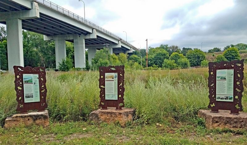
Other nearby markers. At least 8 other markers are within walking distance of this marker. Dakota life along Wakpa Tanka (here, next to this marker); A time of environmental and cultural change (here, next to this marker); Preserving history on the land (here, next to this marker); Remnants of a Former Rail Yard (approx. 0.2 miles away); Northern Pacific Railway Warehouse (approx. half a mile away); Saint Paul Rubber Company (approx. 0.6 miles away); Hackett Block (approx. 0.6 miles away); Welcome to Union Depot Station (approx. 0.7 miles away). Touch for a list and map of all markers in Saint Paul.
Credits. This page was last revised on August 20, 2023. It was originally submitted on August 16, 2023, by McGhiever of Minneapolis, Minnesota. This page has been viewed 64 times since then and 18 times this year. Photos: 1, 2. submitted on August 16, 2023, by McGhiever of Minneapolis, Minnesota. • Devry Becker Jones was the editor who published this page.

