Montgomery in Orange County, New York — The American Northeast (Mid-Atlantic)
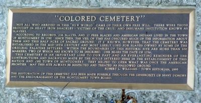
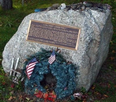
“Colored Cemetery"
According to records, 236 slaves, and 17 free blacks and American Indians lived in the Town of Montgomery in 1790. Since then, the veil of time has obscured much of the information about them and this half acre of sacred ground. It is known, however, that the cemetery was established in the mid-18th century and most likely used for slaves owned by some of the original Palatine settlers. Within the boundaries of this historic site are more than 100 markers; two of which are known to be inscribed. One bears the date of 1756.
This cemetery is an important link to our past and an everlasting reminder of the contributions and sacrifices made by the souls interred here in the establishment of this nation and the Town of Montgomery. They helped to open what was once the American frontier. May this site always be respected and treated as hallowed ground.
Robert L. Williams - Town Historian, 1995
The restoration of this cemetery has been made possible through the generosity of many donors and the encouragement of the Montgomery Town Board.
Erected by Town of Montgomery Historian.
Topics. This historical marker is listed in these topic lists: African Americans • Cemeteries & Burial Sites • Colonial Era • Native Americans. A significant historical year for this entry is 1790.
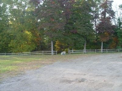
Location. 41° 30.299′ N, 74° 15.252′ W. Marker is in Montgomery, New York, in Orange County. Marker is on St Rte 416 (New York State Route 416) half a mile south of Union St. (New York State Route 211). Touch for map. Marker is at or near this postal address: St Rte 416 (WS), Montgomery, ny 12549, Montgomery NY 12549, United States of America. Touch for directions.
Other nearby markers. At least 8 other markers are within 4 miles of this marker, measured as the crow flies. German Town (approx. half a mile away); Montgomery House (approx. half a mile away); Site of Pleasure Ground (approx. 1.3 miles away); Ward’s Bridge (approx. 1.8 miles away); Mastadon Dig 1800 (approx. 2.6 miles away); Smith Homestead (approx. 3.4 miles away); Hamptonburgh World War I Memorial (approx. 3.4 miles away); The Town Of Hamptonburgh Vietnam War Memorial (approx. 3˝ miles away). Touch for a list and map of all markers in Montgomery.
Credits. This page was last revised on June 16, 2016. It was originally submitted on October 9, 2009, by Clifton Patrick of Chester, NY, United States. This page has been viewed 1,101 times since then and 16 times this year. Photos: 1, 2, 3. submitted on October 9, 2009, by Clifton Patrick of Chester, NY, United States. • Kevin W. was the editor who published this page.


