Parkin in Cross County, Arkansas — The American South (West South Central)
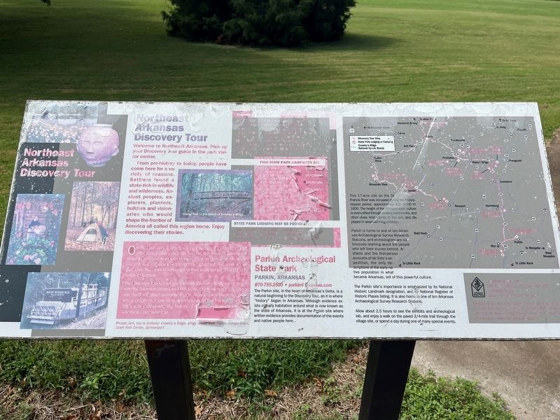
Northeast Arkansas Discovery Tour
Photographed by Thomas Smith, August 28, 2023
1. Northeast Arkansas Discovery Tour Marker
Welcome to Northeast Arkansas Pick up your Discovery our guide in the part visitor for center.
From pre-history to today, people have come here for a variety of reasons. Settlers found a state rich in wildlife and wilderness. Ancient peoples, and native people here, explorers, planters, builders and visionaries who would shape the frontier of America all called this region home. Enjoy discovering their stories.
Parkin Archeological State Park
Parkin, Arkansas
870-755-2500 • [email protected]
The Parkin site, in the heart of Arkansas's Delta, is a natural beginning to the Discovery Tour, as it is where "history" began in Arkansas. Although evidence exists of early habitation around what is now known as the state of Arkansas, it is at the Parkin site where written evidence provides documentation of the events and native people here.
This 17-acre site on the St. Francis river was occupied during the Mississippian period, approximately A. D. 1000 to 1600. The height of the Mississippian culture is exemplified through pottery, earthworks, and other clues held silently in the soil, and dis played in award winning
this page online
Parkin is home to one of ten Arkansas Archeological Survey Research Stations, and archeologists are continuously learning about the people who left their stories behind. Artifacts and the first-person accounts of de Soto's expedition, the only description of the native population in what became Arkansas, tell of this powerful culture.
The Parkin site's importance is emphasized by National Historic Landmark designation, and National Register of Historic Places listing is also home to one of ten Arkansas Archaeological Survey Research Station.
Allow about 2.5 hours to see the exhibits and archeological lab, and enjoy a walk on the paved 3/4-mile trail through the village site, or spend a day during one of many special events.
Topics. This historical marker is listed in these topic lists: Anthropology & Archaeology • Indigenous Peoples and Communities • Parks & Recreational Areas • Settlements & Settlers. A significant historical year for this entry is 1000 CE.
Location. 35° 16.621′ N, 90° 33.289′ W. Marker is in Parkin, Arkansas, in Cross County. It is at the intersection of State Highway 184 and U.S. 64 on State Highway 184. The marker stands on the grounds of Parkin Archeological State Park. Touch for map. Marker is at or near this postal address: 60 State Hwy 184, Parkin AR 72373, United States of America. Touch for directions.

Regionally, this marker is in Crowley’s Ridge, in the Mississippi Alluvial Plain, and in the Cherokee Heritage Region. It is also in the American South, specifically in the Upper South, in the Mississippi Delta, and in the Great River Road Region. Globally, it is in North America, the Western Hemisphere, the Western World, and the Anglosphere. Historically, it finds itself in what was once the territory of the Mississippian Culture, the Louisiana Purchase, one of the Confederate States of America, and the Antebellum South.
Other nearby markers. At least 8 other markers are within walking distance of this marker: Protecting Casqui's Capital (here, next to this marker); The Sawdust Hill Community (here, next to this marker); Mississippian Garden (within shouting distance of this marker); Welcome to the Village Trail (approx. ¼ mile away); A Hidden School Discovered (approx. ¼ mile away); Conducting the Research (approx. ¼ mile away); Class Is In Session (approx. ¼ mile away); The Northern Ohio School (approx. ¼ mile away). Touch for a list and map of all markers in Parkin.
Credits. This page was last revised on September 6, 2023. It was originally submitted on September 4, 2023, by Thomas Smith of Waterloo, Ill. This page has been viewed 251 times since then and 32 times this year. Photo 1. submitted on September 4, 2023, by Thomas Smith of Waterloo, Ill. • Devry Becker Jones was the editor who published this page.
Editor’s want-list for this marker. A wide shot of the marker in context. • Can you help?
