Stillwater in Washington County, Minnesota — The American Midwest (Upper Plains)
See You on the Trail / From Small Springs
— Brown's Creek State Trail —
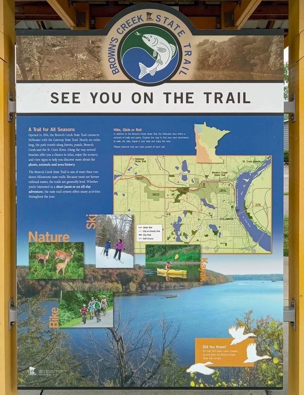
A Trail for All Seasons
Opened in 2014, the Brown's Creek State Trail connects Stillwater with the Gateway State Trail. Nearly six miles long, the path travels along forests, ponds, Brown's Creek and the St. Croix River. Along the way several benches offer you a change to relax, enjoy the scenery, and view signs to help you discover more about the plants, animals and area history.
The Brown's Creek State Trail is one of more than two dozen Minnesota state trails. Because most are former railroad routes, the trails are generally level. Whether you're interested in a short jaunt or an all-day adventure, the state trail system offers many activities throughout the year.
Did You Know?
For over 100 years, trains traveled up and down the Brown's Creek State Trail corridor.
[Reverse:]
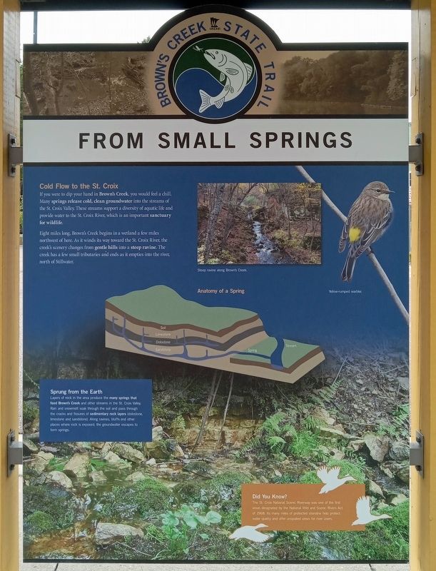
Cold Flow to the St. Croix
If you were to dip your hand in Brown's Creek, you would feel a chill. Many springs release cold, clean groundwater into the streams of the St. Croix Valley. These streams support a diversity of life and provide water to the St. Croix River, which is an important sanctuary for wildlife.
Eight miles long, Brown's Creek begins in a wetland a few miles northwest of here. As it winds its way toward the St. Croix River, the creek's scenery changes from gentle hills into a steep ravine. The creek has a few small tributaries and ends as it empties into the river, north of Stillwater.
Steep ravine along Brown's Creek.
Yellow-rumped warbler.
Anatomy of a Spring
Sprung from the Earth
Layers of rock in the area produce the many springs that feed Brown's Creek and other streams in the St. Croix Valley. Rain and snowmelt soak through the soil and pass through the cracks and fissures of sedimentary rock layers (dolostone, limestone and sandstone). Along ravines, bluffs and other places where rock is exposed, the groundwater escapes to form springs.
Did You Know?
The St. Croix National Scenic Riverway was one of the first areas designated by the National Wild and Scenic Rivers Act of 1968. Its many miles of protected shoreline help protect water quality and offer unspoiled views for river users.
Erected by Minnesota Department of Natural Resources.
Topics. This historical marker is listed in these topic lists: Environment • Parks & Recreational Areas • Railroads & Streetcars • Waterways & Vessels. A significant historical year for this entry is 2014.
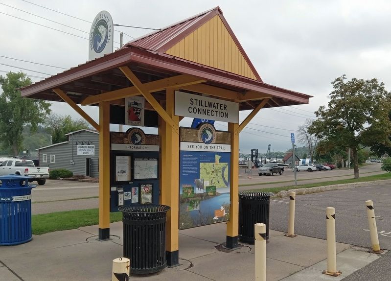
Location. 45° 3.693′ N, 92° 48.379′ W. Marker is in Stillwater, Minnesota, in Washington County. Marker is on Laurel Street east of Main Street North (Minnesota Route 95), on the right when traveling east. The marker is at the Stillwater Connection kiosk at the eastern terminus of the Brown's Creek State Trail. Touch for map. Marker is at or near this postal address: 401 Laurel Street E, Stillwater MN 55082, United States of America. Touch for directions.
Other nearby markers. At least 8 other markers are within walking distance of this marker. The Warden's House (within shouting distance of this marker); Indian Battleground (about 400 feet away, measured in a direct line); St. Croix Lumber Mills / Stillwater Manufacturing Company (about 700 feet away); 114 North Main Street (approx. 0.3 miles away); 1965 Easter Sunday Floodwater Crest (approx. 0.3 miles away); Connolly Shoe Company Building (approx. 0.3 miles away); 1884 Upper St. Croix River Log Jam (approx. 0.3 miles away); 226 East Myrtle Street (approx. 0.3 miles away). Touch for a list and map of all markers in Stillwater.
Credits. This page was last revised on September 27, 2023. It was originally submitted on September 25, 2023, by McGhiever of Minneapolis, Minnesota. This page has been viewed 54 times since then and 12 times this year. Photos: 1, 2, 3. submitted on September 25, 2023, by McGhiever of Minneapolis, Minnesota. • J. Makali Bruton was the editor who published this page.


