Pinson in Madison County, Tennessee — The American South (East South Central)
Sauls Mound

Photographed by James Hulse, October 1, 2023
1. Sauls Mound Marker
Base: About 370 feet by 300 feet
Constructed: 1-300 A.D.
Culture: Middle Woodland
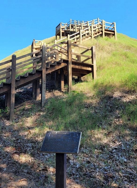
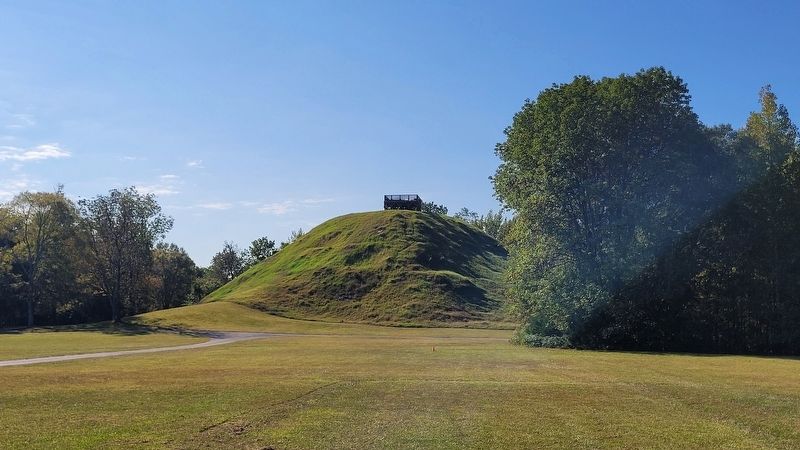
Sauls Mound is the central mound of the Pinson Complex. This ceremonial mound is 72 feet tall and has four corners that point to the cardinal directions north, south, east and west. One hypothesis suggests that the top of this mound was the observation point for observing the Summer Solstice and Equinox sunrises. We hope that you too will be intrigued by the wonder of this special monument as you climb to the top. Please use the stairs to prevent erosion.
Erected by Pinson Mounds State Archaeological Park.
Topics. This historical marker is listed in these topic lists: Anthropology & Archaeology • Indigenous Peoples and Communities • Parks & Recreational Areas. A significant historical year for this entry is 1 CE.
Location. 35° 29.709′ N, 88° 40.95′ W. Marker is in Pinson, Tennessee, in Madison County. It is on Pinson Mound Road 0.8 miles south of State Highway 197. The marker is located directly south of the Pinson Mounds State Archaeological Park Museum. Touch for map. Marker is in this post office area:
this page online

Regionally, this marker is in West Tennessee. It is also in the American South, specifically in the Deep South, and specifically in the Upper South. Globally, it is in North America, the Western Hemisphere, the Western World, and the Anglosphere. Historically, it finds itself in what was once the territory of the Mississippian Culture, one of the Confederate States of America, and the Antebellum South.
Other nearby markers. At least 8 other markers are within walking distance of this marker: A different marker also named Sauls Mound (a few steps from this marker); Mound 10 (about 400 feet away, measured in a direct line); The Barrow Pit and Mound 12 (about 600 feet away); The Barrow Pit (about 600 feet away); Mound 12 (about 700 feet away); The Pinson, Bray and Johnston Sites (approx. 0.2 miles away); Pinson Mounds in the Mid South (approx. 0.2 miles away); Pinson Mounds in the Mississippi Delta (approx. 0.2 miles away). Touch for a list and map of all markers in Pinson.
Also see . . . Pinson Mounds. Wikipedia (Submitted on October 14, 2023, by James Hulse of Medina, Texas.)
Photographed by James Hulse, October 1, 2023
2. The stairs up Sauls Mound and Marker

Photographed by James Hulse, October 1, 2023
3. A side view of Sauls Mound from the west
Photographed by James Hulse, October 1, 2023
4. The front side of Sauls Mound from the north

Photographed by James Hulse, October 1, 2023
5. The view of the top from Sauls Mound
Credits. This page was last revised on October 14, 2023. It was originally submitted on October 14, 2023, by James Hulse of Medina, Texas. This page has been viewed 265 times since then and 48 times this year. Photos: 1, 2, 3, 4, 5. submitted on October 14, 2023, by James Hulse of Medina, Texas.
