Pinson in Madison County, Tennessee — The American South (East South Central)
The Circular Enclosure
Pinson Mounds State Archaeological Park

Photographed by James Hulse, October 1, 2023
1. The Circular Enclosure Marker
Recent research has helped to show that the roughly circular enclosure at Pinson is much like mound walls in a circular form found at other Middle Woodland ceremonial sites in the eastern United States. These enclosures were not built for defense but rather as a means to define a sacred space. The 1000 foot diameter geometric enclosure is still clearly visible, although parts of the enclosure have been lost to erosion.
Mound 29, a platform mound that marks the southeast corner of the Pinson complex, is located within the enclosure.
Captions
Middle Left: The "Eastern Citadel"
Lower Left: The diameter is 1000 feet for the circular geometric enclosure at Pinson Mounds.
Lower Right: Ohio's Millford Circle (left) fits almost perfectly over the geometric enclosure at Pinson in this Dr. Robert Mainfort study. Below, the straight lines are part of the Milford map, while the Pinson circle lies almost entirely beneath the Milford circle on this topographic map of the Eastern Citadel at Pinson Mounds.
Courtesy of Dr. Robert C. Mainfort III's book, Pinson Mounds, Middle Woodland Ceremonialism in the Midsouth.
Erected by Tennessee
this page online
Topics. This historical marker is listed in these topic lists: Anthropology & Archaeology • Indigenous Peoples and Communities • Parks & Recreational Areas. A significant historical year for this entry is 1916.
Location. 35° 29.821′ N, 88° 40.284′ W. Marker is in Pinson, Tennessee, in Madison County. It is on Pinson Mounds Road 0.8 miles south of Ozier Road (Tennessee Route 197). The marker is located south of the Pinson Mounds State Archaeological Park Museum along the hiking trail. Touch for map. Marker is in this post office area: Pinson TN 38366, United States of America. Touch for directions.

Regionally, this marker is in West Tennessee. It is also in the American South, specifically in the Deep South, and specifically in the Upper South. Globally, it is in North America, the Western Hemisphere, the Western World, and the Anglosphere. Historically, it finds itself in what was once the territory of the Mississippian Culture, one of the Confederate States of America, and the Antebellum South.
Other nearby markers. At least 8 other markers are within walking distance of this marker: Geometric Enclosure

Photographed by James Hulse, October 1, 2023
2. The view of the Circular Enclosure Marker along the trail
The edge of the mound wall is just above the marker.
Also see . . . Pinson Mounds. Wikipedia (Submitted on October 16, 2023, by James Hulse of Medina, Texas.)
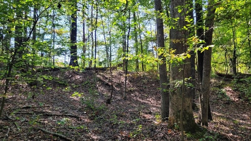
Photographed by James Hulse, October 1, 2023
3. The view of the outer edge of the circular wall
Credits. This page was last revised on October 16, 2023. It was originally submitted on October 16, 2023, by James Hulse of Medina, Texas. This page has been viewed 190 times since then and 38 times this year. Photos: 1, 2, 3. submitted on October 16, 2023, by James Hulse of Medina, Texas.
