Pinson in Madison County, Tennessee — The American South (East South Central)
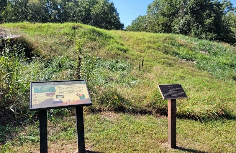
Mounds 29 & 30
Pinson Mounds State Archaeological Park

Photographed by James Hulse, October 1, 2023
1. Mounds 29 & 30 Marker
Mound 29 is a rectangular platform 161 ft. x 171 ft. at its base and 11 and half feet tall. It seems to be aligned with Saul's Mound, at the center of the complex, on the line of the Equinox Sunrise and is within the Great Circle.
Mound 30 is a bird-shaped mound that sits just outside the Great Circle to the southeast. The bird shape may, though, be due to more recent impacts on the mound's original shape. It is about 79 feet across and 3 and a third feet high.
A guide to American Indian Archaeological Traditions
Paleo
Tradition
11,500+ to 8000 BC
Archaic
Tradition
8000 to 1000 BC
Woodland
Tradition and Middle Woodland Pinson Mounds
1000 BC to AD 1000
Mississippian
Tradition
AD 1000 to 1600
Historic
Tradition
AD 1600 to present
Captions
Lower Middle: The equinox sunrise from Sauls Mound looking over Mound 29.
Erected by Tennessee State Parks.
Topics. This historical marker is listed in these topic lists: Anthropology & Archaeology • Indigenous Peoples and Communities • Parks & Recreational Areas.
Location. 35° 29.743′ N,
this page online

Regionally, this marker is in West Tennessee. It is also in the American South, specifically in the Deep South, and specifically in the Upper South. Globally, it is in North America, the Western Hemisphere, the Western World, and the Anglosphere. Historically, it finds itself in what was once the territory of the Mississippian Culture, one of the Confederate States of America, and the Antebellum South.
Other nearby markers. At least 8 other markers are within walking distance of this marker: Mound 29 (here, next to this marker); Mound 30 (about 400 feet away, measured in a direct line); Geometric Enclosure (about 400 feet away); The Circular Enclosure (about 500 feet away); Mound 28 (approx. 0.3 miles away); a different marker also named Mound 28 (approx. 0.3 miles away); Mound 10 (approx. half a
Photographed by James Hulse, October 1, 2023
2. The marker is the left marker of the two markers
Also see . . . Pinson Mounds. Wikipedia (Submitted on October 16, 2023, by James Hulse of Medina, Texas.)

Photographed by James Hulse, October 1, 2023
3. Mounds 29 with the two markers inside the geometric enclosure
Credits. This page was last revised on October 16, 2023. It was originally submitted on October 16, 2023, by James Hulse of Medina, Texas. This page has been viewed 148 times since then and 14 times this year. Photos: 1, 2, 3. submitted on October 16, 2023, by James Hulse of Medina, Texas.
