Kingman and Heritage Islands in Northeast Washington in Washington, District of Columbia — The American Northeast (Mid-Atlantic)
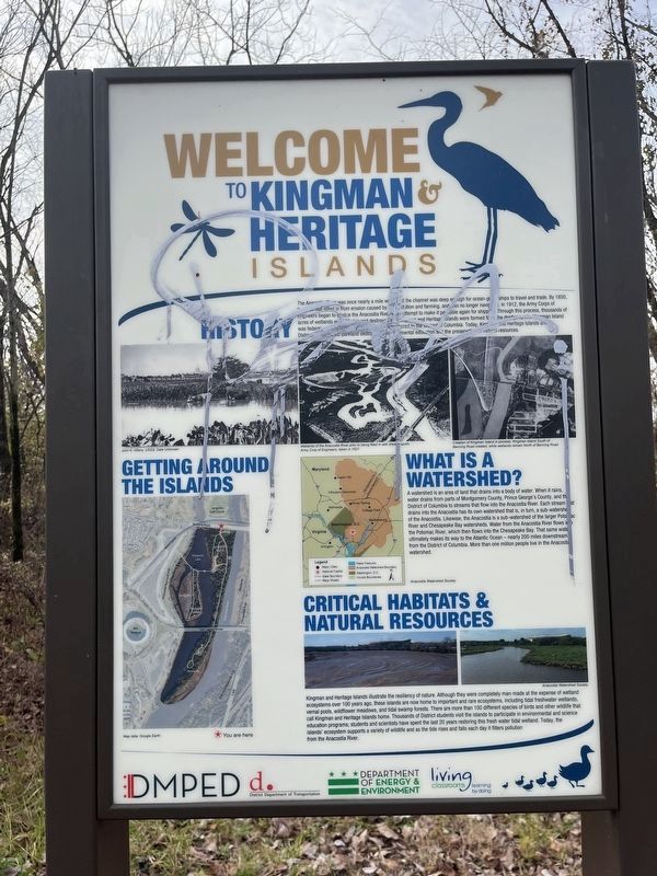
Welcome to Kingman & Heritage Islands

Photographed By Devry Becker Jones (CC0), December 2, 2023
1. Welcome to Kingman & Heritage Islands Marker
History
The Anacostia River was once nearly a mile wide, and the channel was deep enough for ocean-going ships to travel and trade. By 1850, the river had silted in from erosion caused by deforestation and farming, and was no longer navigable. In 1912, the Army Corps of Engineers began to dredge the Anacostia River in an attempt to make it passable again for shipping. through this process, thousands of acres of wetlands were filled in and destroyed and Kingman and Heritage Islands were formed from the dredge spoils. Kingman Island was federal property until 1996, when it was transferred to the District of Columbia. Today, Kingman and Heritage Islands are District-owned public parkland dedicated to environmental education and the preservation of natural resources.
What Is a Watershed?
A watershed is an area of land that drains into a body of water. When it rains, water drains from parts of Montgomery County, Prince George's County, and the District of Columbia to streams that flow into the Anacostia River. Each stream that drains into the Anacostia has its own watershed that is, in turn, a sub-watershed of the Anacostia. Likewise, the Anacostia is a sub-watershed of the larger Potomac River and Chesapeake Bay watersheds. Water from the Anacostia River flows into the Potomac River, which then flows into the Chesapeake Bay. That same water ultimately makes its way to the Atlantic Ocean — nearly 200 miles downstream from the District of Columbia. More than one million people live in the Anacostia watershed.
Critical Habitats & Natural Resources
Kingman and Heritage Islands illustrate the resiliency of nature. Although they were completely man-made at the expense of wetland ecosystems over 100 years ago, these islands are now home to important and rare ecosystems, including tidal freshwater wetlands, vernal pools, wildflower meadows, and tidal swamp forests. There are more than 100 different species of birds and other wildlife that call the Kingman and Heritage Islands home. Thousands of District students visit the islands to participate in environmental and science education programs; students and scientists have spent the last 20 years restoring this fresh water tidal wetland. Today, the islands' ecosystem supports a variety of wildlife and as the tide rises and falls each day it filters pollution from the Anacostia River.
Erected by DC Office of the Deputy Mayor for Planning and Economic Development; District Department of Transportation; DC Department of Energy and Environment; Living Classrooms Foundation.
Topics. This historical marker is listed in these topic lists: Environment

Photographed By Devry Becker Jones (CC0), December 2, 2023
2. Welcome to Kingman & Heritage Islands Marker
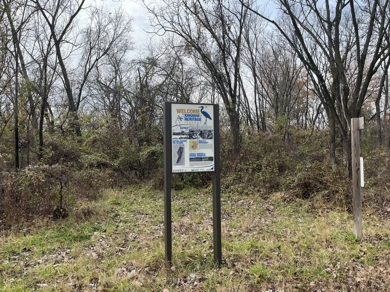
Location. 38° 53.789′ N, 76° 57.826′ W. Marker has been reported damaged. Marker is in Northeast Washington in Washington, District of Columbia. It is in Kingman and Heritage Islands. Marker is on Kingman Island Trail Northeast south of Benning Road Northeast, on the left when traveling north. Touch for map. Marker is at or near this postal address: 3101 Benning Road Northeast, Washington DC 20019, United States of America. Touch for directions.
Other nearby markers. At least 8 other markers are within walking distance of this location. Native Birds of Kingman and Heritage Islands (approx. 0.2 miles away); Native Fish of Kingman and Heritage Islands (approx. 0.2 miles away); a different marker also named Native Birds of Kingman and Heritage Islands (approx. 0.2 miles away); a different marker also named Welcome to Kingman & Heritage Islands (approx. ¼ mile away); Langston Golf Course (approx. 0.4 miles away); Langston Golf Course and Driving Range (approx. 0.4 miles away); Whitney M. Young, Jr. Memorial Bridge (approx. 0.6 miles away); Langston Terrace Dwellings / Hilyard Robinson (approx. 0.6 miles away). Touch for a list and map of all markers in Northeast Washington.
Click on the ad for more information.
Please report objectionable advertising to the Editor.
sectionhead>More about this marker. Unfortunately, the marker has been defaced, although it remains legible.Please report objectionable advertising to the Editor.
Related marker. Click here for another marker that is related to this marker. An identical marker stands elsewhere in the park.
Credits. This page was last revised on December 2, 2023. It was originally submitted on December 2, 2023, by Devry Becker Jones of Washington, District of Columbia. This page has been viewed 59 times since then and 13 times this year. Photos: 1, 2. submitted on December 2, 2023, by Devry Becker Jones of Washington, District of Columbia.