Mille Lacs Kathio State Park near Onamia in Mille Lacs County, Minnesota — The American Midwest (Upper Plains)
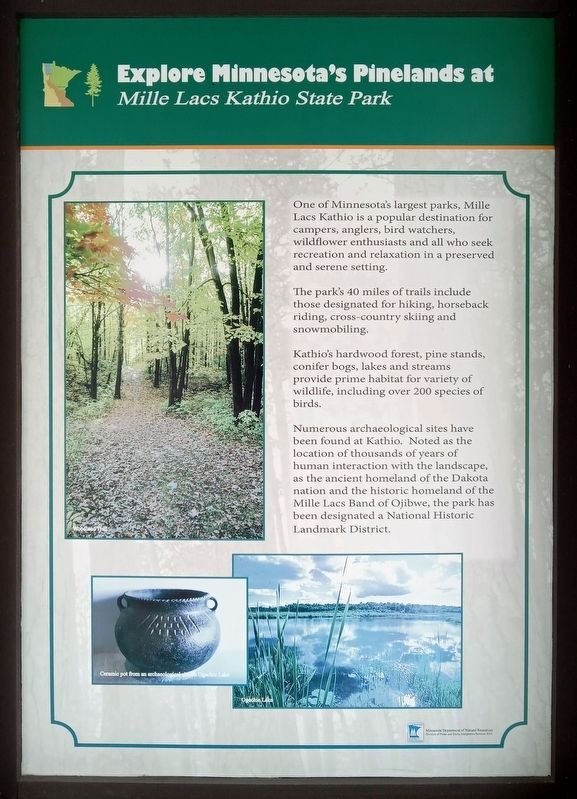
Explore Minnesota's Pinelands at Mille Lacs Kathio State Park
Photographed by McGhiever, November 26, 2023
1. Explore Minnesota's Pinelands at Mille Lacs Kathio State Park Marker
One of Minnesota's largest parks, Mille Lacs Kathio is a popular destination for campers, angles, bird watchers, wildflower enthusiasts and all who seek recreation and relaxation in a preserved and serene setting.
The park's 40 miles of trails include those designated for hiking, horseback riding, cross-country skiing and snowmobiling.
Kathio's hardwood forest, pine stands, conifer bogs, lakes and streams provide prime habitat for a variety of wildlife, including over 200 species of birds.
Numerous archaeological sites have been found at Kathio. Noted as the location of thousands of years of human interaction with the landscape, as the ancient homeland of the Dakota nation and the historic homeland of the Mille Lacs Band of Ojibwe, the park has been designated a National Historic Landmark District.
Ceramic pot from an archaeological site on Ogechie Lake
Ogechie Lake
Erected 2013 by Minnesota Department of Natural Resources.
Topics. This historical marker is listed in these topic lists: Anthropology & Archaeology • Environment • Indigenous Peoples and Communities.
Location. 46° 8.133′ N,
this page online

Regionally, this marker is in Central Minnesota. It is also in the American Midwest and in the Corn Belt. Globally, it is in North America, the Western Hemisphere, the Western World, and the Anglosphere. Historically, it finds itself in what was once Rupert’s Land, the territory of the Mississippian Culture, and the Northwest Territory.
Other nearby markers. At least 8 other markers are within 3 miles of this marker, measured as the crow flies: Family Homesteads (approx. 2.2 miles away); The Forest through Time (approx. 2.3 miles away); Removal, Restoration, Reuse (approx. 2.3 miles away); The Ice Age (approx. 2.3 miles away);
Photographed by McGhiever, November 26, 2023
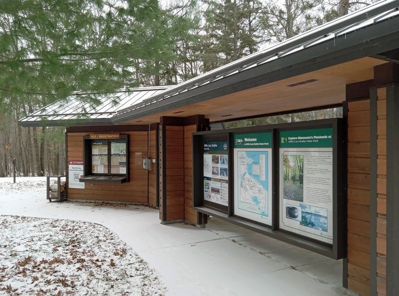
2. Marker (right) at the Mille Lacs Kathio State Park visitor contact station
Credits. This page was last revised on December 5, 2023. It was originally submitted on December 2, 2023, by McGhiever of Minneapolis, Minnesota. This page has been viewed 277 times since then and 22 times this year. Photos: 1, 2. submitted on December 2, 2023, by McGhiever of Minneapolis, Minnesota. • J. Makali Bruton was the editor who published this page.
