Menard in Menard County, Texas — The American South (West South Central)
Arroyo de Juan Lorenzo
Photographed by Richard Denney, April 3, 2010
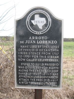
1. Arroyo de Juan Lorenzo Marker
Stone to build Presidio was quarried from bluffs along the creek, and deep banks let hostile Indians approach undiscovered, to attack the Presidio, half a mile to the southwest.
Erected 1964 by State Historical Survey Committee. (Marker Number 211.)
Topics. This historical marker is listed in these topic lists: Forts and Castles • Hispanic Americans • Indigenous Peoples and Communities • Waterways & Vessels. A significant historical year for this entry is 1757.
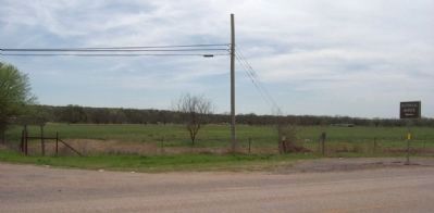
Location. 30° 55.507′ N, 99° 47.833′ W. Marker is in Menard, Texas, in Menard County. It is on U.S. 190 0.8 miles west of Frisco Avenue (Route 83). At the Celery Creek Bridge, near the entrance to the Menard Country Club. Touch for map. Marker is in this post office area: Menard TX 76859, United States of America. Touch for directions.

Regionally, this marker is in Big Country. Globally, it is in North America, a Gulf of Mexico state, the Western Hemisphere, the Western World, and the Anglosphere. Historically, it finds
this page online
Other nearby markers. At least 8 other markers are within walking distance of this marker: Bastions of Defense (approx. 0.3 miles away); Plaza (approx. 0.3 miles away); VIP Quarters (approx. 0.3 miles away); Restoration and Reconstruction (approx. 0.3 miles away); NW Bastion (approx. 0.3 miles away); Real Presidio de San Saba (approx. 0.3 miles away); Livestock Corral (approx. 0.3 miles away); Presidio de San Sabá (approx. 0.4 miles away). Touch for a list and map of all markers in Menard.
Photographed by Gregory Walker, April 3, 2010
2. Location of Arroyo de Juan Lorenzo Marker
Photographed by Gregory Walker, April 3, 2010
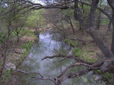
3. Arroyo de Juan Lorenzo Looking South From the Bridge.
Credits. This page was last revised on January 8, 2024. It was originally submitted on April 8, 2010, by Richard Denney of Austin, Texas. This page has been viewed 2,274 times since then and 27 times this year. Last updated on January 8, 2024, by Jeff Leichsenring of Garland, Texas. Photos: 1. submitted on April 8, 2010, by Richard Denney of Austin, Texas. 2, 3. submitted on April 19, 2010, by Gregory Walker of La Grange, Texas. • James Hulse was the editor who published this page.
