Fort Davis in Jeff Davis County, Texas — The American South (West South Central)
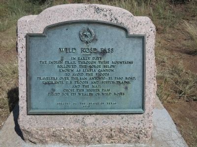
Wild Rose Pass
Photographed by Richard Denney, September 10, 2012
1. Wild Rose Pass Marker
Erected 1936 by State of Texas. (Marker Number 10490.)
Topics and series. This historical marker is listed in these topic lists: Hispanic Americans • Indigenous Peoples and Communities • Wars, US Indian. In addition, it is included in the Antonio de Espejo Entrada of 1582-1583, the San Antonio-El Paso Road, and the Texas 1936 Centennial Markers and Monuments series lists.
Location. 30° 42.893′ N, 103° 46.939′ W. Marker is in Fort Davis, Texas, in Jeff Davis County. It is on Wild Rose Pass (State Highway 17) 1.3 miles south of Powell Ranch Road, on the left when traveling south. Touch for map. Marker is in this post office area: Fort Davis TX 79734, United States of America. Touch for directions.

Regionally, this marker is in the Trans-Pecos & Big Bend Region. It is also
this page online
Other nearby markers. At least 8 other markers are within 11 miles of this marker, measured as the crow flies: Granado Mountain (approx. 9.3 miles away); Barry Scobee Mountain (approx. 9.3 miles away); Supporting the Army (approx. 10.3 miles away); The Post Chapel (approx. 10.3 miles away); Legend - Fort Davis (approx. 10.4 miles away); Commanding Officer's Quarters (approx. 10.4 miles away); St. Joseph Catholic Church (approx. 10.4 miles away); Fort Davis (approx. 10.4 miles away). Touch for a list and map of all markers in Fort Davis.
Regarding Wild Rose Pass. In reference to the Indian trail mentioned on the marker, in 1583 Spanish explorer Antonio de Espejo, on his return journey south from New Mexico, planned to follow the Pecos River from near present Pecos, Texas to the pueblos at La Junta de los Rios (where the Concho
Photographed by Richard Denney, September 10, 2012
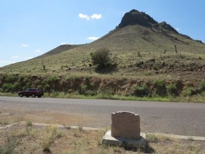
2. Wild Rose Pass Marker in context
Related markers. Click here for a list of markers that are related to this marker. Markers relating to the San Antonio - El Paso Road & Ft. Davis
Also see . . . Wild Rose Pass. Handbook of Texas Online (Submitted on September 23, 2012, by Richard Denney of Austin, Texas.)
Photographed by Richard Denney, September 10, 2012
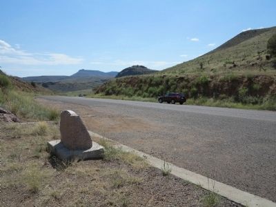
3. Marker in context
View from the marker, looking south through the pass, on the way to Fort Davis
Photographed by Bill Kirchner, October 24, 2012
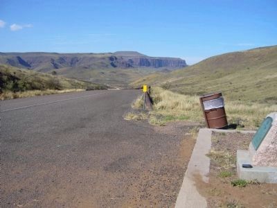
4. Wild Rose Pass Marker
View from marker looking north on State Route 17.
Credits. This page was last revised on January 17, 2024. It was originally submitted on September 23, 2012, by Richard Denney of Austin, Texas. This page has been viewed 2,975 times since then and 286 times this year. Last updated on January 16, 2024, by Jeff Leichsenring of Garland, Texas. Photos: 1, 2, 3. submitted on September 23, 2012, by Richard Denney of Austin, Texas. 4. submitted on November 19, 2012, by Bill Kirchner of Tucson, Arizona. • James Hulse was the editor who published this page.
