Eijsden in Eijsden-Margraten, Limburg, Netherlands — Northwestern Europe
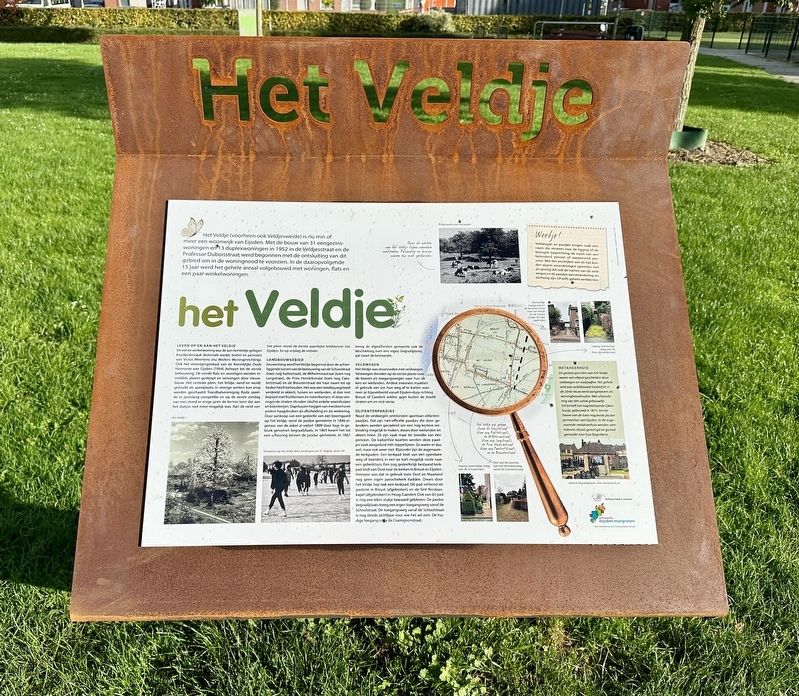
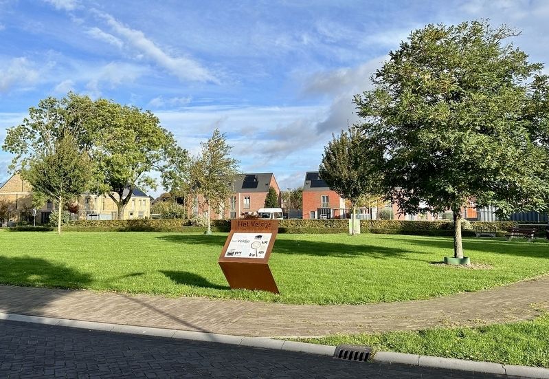
Het Veldje / The Field
Leven Op En Aan Het Veldje
De eerste winkelwoning was de aan het Veldje gelegen kruidenierszaak (koloniale waren, textiel en pension) van Victor Meertens (nu Wolters Woninginrichting). Ook het verenigingslokaal van de Koninklijke Oude Harmonie van Eijsden (1954) behoort tot de eerste bebouwing. De eerste flats en woningen werden inmiddels alweer gesloopt en vervangen door nieuwbouw. Het centrale plein, het Veldje, werd en wordt gebruikt als speelplaats. In strenge winters kon erop worden geschaatst. Handbalvereniging Roda speelde er jarenlang competitie en op de eerste zondag van mei stond er enige jaren de kermis toen dat aan het station niet meer mogelijk was. Aan de rand van het plein stond de eerste openbare telefooncel van Eijsden. En op vrijdag de visboer.
Landbouwgebied
Eeuwenlang werd het Veldje begrensd door de achterliggende tuinen van de bebouwing van de Schoolstraat (toen nog Kattestraat), de Wilhelminastraat (toen nog Langstraat), de Prins Hendrikstraat (toen nog Caestertstraat) en de Breusterstraat die haar naam tot op heden heeft behouden. Het was een landbouwgebied verdeeld in akkers, tuinen en weilanden, al dan niet beplant met fruitbomen en notenbomen. In deze omringende straten stonden slechts enkele woonhuizen en boerderijen. Daartussen heggen van meidoorns en andere haagstruiken als afscheiding en als veekering. Door aankoop van een gedeelte van een boomgaard op het Veldje, werd de joodse gemeente in 1846 eigenaar van de zeker al sedert 1809 door haar in gebruik genomen begraafplaats. In 1865 kwam het tot een scheuring binnen de joodse gemeente. In 1867 kreeg de afgescheiden gemeente ook de beschikking over een eigen begraafplaats, pal naast de bestaande.
Veldwegen
Het Veldje was doorsneden met veldwegen. Veldwegen dienden op de eerste plaats voorijsde de boeren als toegangswegen naar hun akkers en weilanden. Andere inwoners maakten er gebruik van om hun weg af te korten wanneer ze bijvoorbeeld vanuit Eijsden-dorp richting Breust of Caestert wilden gaan buiten de hoofdstraten om en vice-versa.
Olifantenpaadjes
Naast de veldwegén ontstonden spontaan olifantenpaadjes. Dat zijn nietofficiële paadjes die door gebruikers werden gecreëerd om een nog kortere verbinding mogelijk te maken, dwars door weilanden en akkers heen. Ze zijn vaak maar ter breedte van één persoon. Op kadastrale kaarten werden deze paadjes vaak aangeduid met stippellijnen. Ze waren er dus wel, maar ook weer niet. Bijzonder zijn de zogenaamde kerkpaden. Een kerkpad leidt van een openbare weg of boerderij in een zo kort mogelijk route naar een gebedshuis. Een nog gedeeltelijk bestaand kerkpad leidt van Oost naar de kerken in Breusten Eijsden. Hiervoor was dat in gebruik toen Oost en Maarland nog geen eigen parochiekerk hadden. Dwars door Veldje liep ook een kerkpad. Dit pad verbond de pastorie in Breust (afgebroken) en de Sint Nicolaaskapel (afgebroken) in Hoog-Caestert. Ook van dit pad is nog een klein stukje bewaard gebleven. De joodse begraafplaats kreeggen eigen toegangsweg vanaf de Schoolstraat. De toegangsweg vanaf de Schoolstraat is nog steeds zichtbaar voor wie het wil zien. De huidige toegang is via de Cramignonstraat.
Het Veldje (“The Field”) - formerly also Veldjesweide (“Little Meadow”) - is now more or less a residential area of Eijsden. With the construction of 31 single-family homes and 13 duplex homes in 1952 on Veldjesstraat and Professor Duboisstraat, the opening up of this area was initiated to meet the housing shortage. Over the next 15 years, the entire area was built up with houses, apartments and a few residential/commercial buildings.
Life Around and on The Field
The first mixed-use building was the grocery store (colonial goods, textiles and boarding house) of Victor Meertens (now Wolters Woningartikelen), located on the Veldje. The club room of the singing group Koninklijke Oude Harmonie van Eijsden (1954) was also one of the first buildings. The initial flats and houses have already been demolished and replaced by new construction. The central square, the Veldje, was and is used as a playground. In severe winters it could be skated on. Handball club Roda played competitions there for many years, and the fair was held there on the first Sunday in May for several years when that was no longer possible at the railway station. Eijsden’s first public phone booth stood at the edge of the square. And on Fridays there was the fish market.
Agricultural area
For centuries, the Veldje was bordered by the gardens behind the buildings of the Schoolstraat (then Kattestraat), the Wilhelminastraat (then Langstraat), the Prins Hendrikstraat (then Caestertstraat) and the Breusterstraat, which has retained its name to this day. It was an agricultural area divided into fields, gardens and meadows, with some fruit trees and nut trees. There were only a few houses and farms in these surrounding streets. In between there were hedges of hawthorns and other hedge shrubs as a partition and as a livestock barrier. In 1846, by purchasing part of an orchard on the Veldje, the Jewish community became the owner of the cemetery that had been in use since at least 1809. In 1865 there was a split within the Jewish community. In 1867, the separated community then also had its own cemetery, right next to the existing one.
Field roads
The Veldje was intersected by field roads. Field roads primarily served farmers as access roads to their fields and pastures. Other residents used them to shorten their path when, for example, they wanted to go from Eijsden village to Breust or Caestert, without using outside the main streets
“Elephant” paths
Elephant paths spontaneously emerged next to the field roads. These are unofficial paths that were created by users to enable an even shorter connection, straight through meadows and fields. They are often only the width of one person. These paths were often indicated with dotted lines on cadastral maps. So they were there, but then again they weren't. The so-called “church” paths are special. A church path leads from a public road or farm in the shortest possible route to a place of worship. A partially existing church path leads from Oost to the churches in Breusten Eijsden. It was used for this when Oost and Maarland did not yet have their own parish church. A church path also ran straight through Veldje. This path connected the parsonage in Breust (demolished) and the Sint Nicolaaskapel (demolished) in Hoog-Caestert. A small part of this path has also been preserved. The Jewish cemetery was given its own access road from Schoolstraat. The access road from Schoolstraat is still visible for those who want to see it. The current access is via Cramignonstraat.
Erected by Stichting Eijsdens Verleden, Gemeente Eijsden-Margraten.
Topics. This historical marker is listed in these topic lists: Agriculture • Cemeteries & Burial Sites • Parks & Recreational Areas • Roads & Vehicles. A significant historical year for this entry is 1952.
Location. 50° 46.497′ N, 5° 42.48′ E. Marker is in Eijsden, Limburg, in Eijsden-Margraten. Marker is on Veldje, on the left when traveling east. Touch for map. Marker is in this post office area: Eijsden, Limburg 6245 CX, Netherlands. Touch for directions.
Other nearby markers. At least 8 other markers are within walking distance of this marker. Aan de Laak / At the Border Water (approx. 0.3 kilometers away); Von Dorpsstraat tot Diepstraat / From Dorpsstraat to Diepstraat (approx. 0.3 kilometers away); Opvang Belgische vluchtelingen / Asylum for Belgian Refugees (approx. 0.3 kilometers away); De Vlucht van Keizer Wilhelm II / The Flight of Kaiser Wilhelm II (approx. 0.3 kilometers away); Martin H. Wolfs Memorial (approx. 0.3 kilometers away); Petrus Wolfs (approx. half a kilometer away); Eijsden - Gronsveld Holocaust Memorial - De Breuk (“The Break”) (approx. half a kilometer away); Verzetsmonument Eijsden / Resistance Memorial Eijsden (approx. half a kilometer away). Touch for a list and map of all markers in Eijsden.
Credits. This page was last revised on January 30, 2024. It was originally submitted on January 29, 2024, by Andrew Ruppenstein of Lamorinda, California. This page has been viewed 40 times since then. Photos: 1, 2. submitted on January 29, 2024, by Andrew Ruppenstein of Lamorinda, California.

