Williamsburg in James City County, Virginia — The American South (Mid-Atlantic)
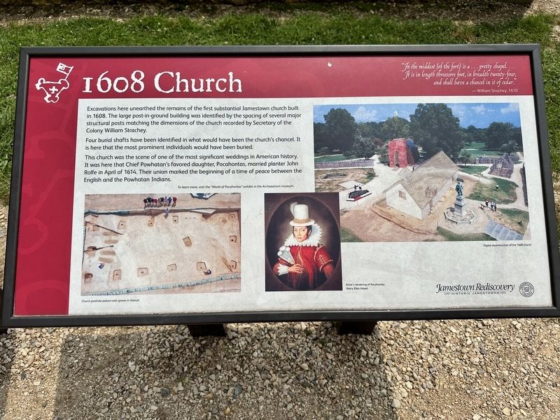
1608 Church
"In the middest {of the fort} is a…pretty chapel.... It is in length threescore foot, in breadth twenty-four, and shall have a chancel in it of cedar."
—William Strachey, 1610
Excavations here unearthed the remains of the first substantial Jamestown church built in 1608. The large post-in-ground building was identified by the spacing of several major structural posts matching the dimensions of the church recorded by Secretary of the Colony William Strachey.
Four burial shafts have been identified in what would have been the church's chancel. It is here that the most prominent individuals would have been buried.
This church was the scene of one of the most significant weddings in American history. It was here that Chief Powhatan's favored daughter, Pocahontas, married planter John Rolfe in April of 1614. Their union marked the beginning of a time of peace between the English and the Powhatan Indians.
(captions)
Church posthole pattern with graves in chancel
Artist's rendering of Pocahontas (Mary Ellen Howe)
Digital reconstruction of the 1608 church
Erected by Jamestown Rediscovery Foundation.
Topics. This historical marker is listed in these topic lists: Anthropology & Archaeology • Cemeteries & Burial Sites • Churches & Religion • Colonial Era • Settlements & Settlers. A significant historical year for this entry is 1608.
Location. 37° 12.508′ N, 76° 46.716′ W. Marker is in Williamsburg, Virginia, in James City County. Marker can be reached from Colonial National Historical Parkway, 1˝ miles south of Jamestown Road (Virginia Route 31). Touch for map. Marker is at or near this postal address: 1371 Colonial Nat'l Historical Pkwy, Williamsburg VA 23185, United States of America. Touch for directions.
Other nearby markers. At least 8 other markers are within walking distance of this marker. Church Tower (a few steps from this marker); Storehouse & First Well (a few steps from this marker); Jamestown’s Churches (a few steps from this marker); Captain John Smith (a few steps from this marker); a different marker also named Captain John Smith (within shouting distance of this marker); The Tombstones (within shouting distance of this marker); The Tombs of James and Sarah Blair (within shouting distance of this marker); Palisades (within shouting distance of this marker). Touch for a list and map of all markers in Williamsburg.
Also see . . . Jamestown Rediscovery - Historic Jamestowne . Jamestown Rediscovery Foundation (Submitted on February 1, 2024.)
Credits. This page was last revised on March 28, 2024. It was originally submitted on January 30, 2024, by Pete Skillman of Townsend, Delaware. This page has been viewed 62 times since then. Photo 1. submitted on January 30, 2024, by Pete Skillman of Townsend, Delaware. • Bernard Fisher was the editor who published this page.
Editor’s want-list for this marker. Wide shot of marker and its surroundings. • Can you help?
