Melrose in the Bronx in Bronx County, New York — The American Northeast (Mid-Atlantic)
Melrose Commons Park
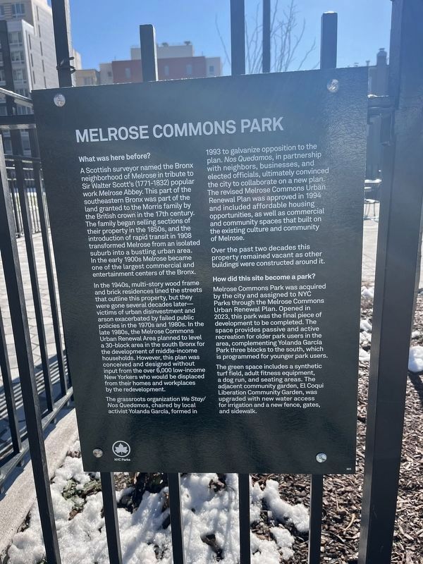
What was here before?
A Scottish surveyor named the Bronx neighborhood of Melrose in tribute to Sir Walter Scott's (1771-1832) popular work Melrose Abbey. This part of the southeastern Bronx was part of the land granted to the Morris family by the British crown in the 17th century. The family began selling sections of their property in the 1850s, and the introduction of rapid transit in 1908 transformed Melrose from an isolated suburb into a bustling urban area. In the early 1900s Melrose became one of the largest commercial and entertainment centers of the Bronx.
In the 1940s, multi-story wood frame and brick residences lined the streets that outline this property, but they were gone several decades later—victims of urban disinvestment and arson exacerbated by failed public policies in the 1970s and 1980s. In the late 1980s, the Melrose Commons Urban Renewal Area planned to level a 30-block area in the south Bronx for the development of middle-income households. However, this plan was conceived and designed without input from the over 6,000 low-income New Yorkers who would be displaced from their homes and workplaces by the redevelopment.
The grassroots organization We Stay/Nos Quedamos, chaired by local activist Yolanda García, formed in 1993 to galvanize opposition to the plan. Nos Quedamos, in partnership with neighbors, businesses, and elected officials, ultimately convinced the city to collaborate on a new plan. The revised Melrose Commons Urban Renewal Plan was approved in 1994 and included affordable housing opportunities, as well as commercial and community spaces that built on the existing culture and community of Melrose.
Over the past two decades this property remained vacant as other buildings were constructed around it.
How did this site become a park?
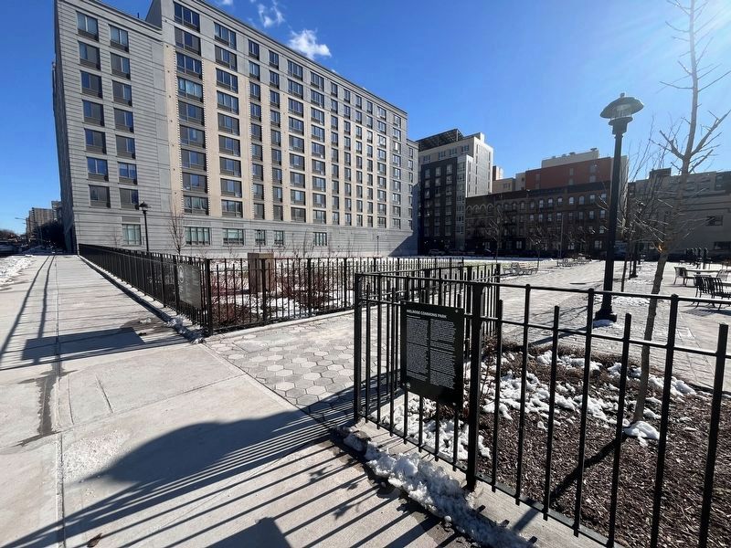
Melrose Commons Park was acquired by the city and assigned to NYC Parks through the Melrose Commons Urban Renewal Plan. Opened in 2023, this park was the final piece of development to be completed. The space provides passive and active recreation for older park users in the area, completing Yolanda García Park three blocks to the south, which is programmed for younger park users.
The green space includes a synthetic turf field, adult fitness equipment, a dog run, and seating areas. The adjacent community garden, El Coqui Liberation Community Garden, was upgraded with new water access for irrigation and a new fence, gates, and sidewalk.
Erected 2023 by NYC Parks. (Marker Number 301.)
Topics and series. This historical marker is listed in these topic lists: Colonial Era
Location. 40° 49.508′ N, 73° 54.744′ W. Marker is in Bronx, New York, in Bronx County. It is in Melrose. Marker is on East 163rd Street east of Melrose Avenue, on the right when traveling east. Touch for map. Marker is at or near this postal address: 420 E 163rd St, Bronx NY 10451, United States of America. Touch for directions.
Other nearby markers. At least 8 other markers are within walking distance of this marker. Air Quality is Being Monitored Here (a few steps from this marker); Railroad Park (approx. 0.2 miles away); Chateau Thierry (approx. 0.6 miles away); The Heinrich Heine Fountain (approx. 0.6 miles away); a different marker also named Heinrich Heine Fountain (approx. 0.6 miles away); Trees by Joyce Kilmer (approx. 0.6 miles away); Louis J. Heintz Memorial (approx. 0.6 miles away); A memorial to Roberto Enrique Clemente Walker (approx. 0.7 miles away). Touch for a list and map of all markers in Bronx.
Additional keywords.
Credits. This page was last revised on February 21, 2024. It was originally submitted on February 21, 2024, by Devry Becker Jones of Washington, District of Columbia. This page has been viewed 36 times since then. Photos: 1, 2, 3. submitted on February 21, 2024, by Devry Becker Jones of Washington, District of Columbia.


