Kingston, Ontario — Central Canada (North America)
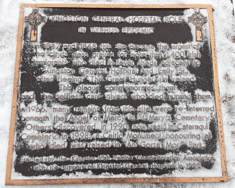
Kingston General Hospital Role in Typhus Epidemic
Inscription.
after fleeing "The Great Hunger" in Ireland.
This plaque commemorates them and the selfless care givers
who died nursing them.
In 1966, many remains from this site were re-interred beneath the Angel of Mercy in St. Mary's Cemetery. Others discovered in 1990 now rest in Cataraqui Cemetery. In 1998, a Celtic Monument honouring all who died was raised in "An Gorta Mor" Park.
Erected 1999 by the Kingston Irish Famine Commemoration Association with the support of Kingston General Hospital.
Topics. This historical marker is listed in these topic lists: Cemeteries & Burial Sites • Charity & Public Work • Immigration • Science & Medicine. A significant historical year for this entry is 1847.
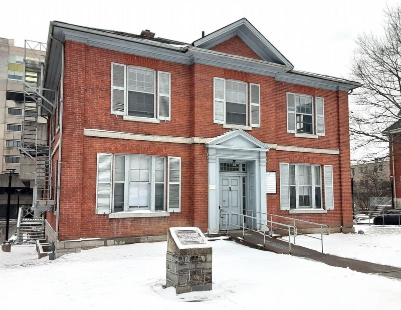
Location. 44° 13.46′ N, 76° 29.657′ W. Marker is in Kingston, Ontario. Marker is on Stuart Street, on the right when traveling east. Marker is in front of Kidd House, part of the Kingston Health Sciences Centre. Touch for map. Marker is at or near this postal address: 100 Stuart Street, Kingston ON K7L 3N6, Canada. Touch for directions.
Other nearby markers. At least 8 other markers are within walking distance of this marker. Professors' Walk (about 150 meters away, measured in a direct line); Queen's University 150th Anniversary (about 240 meters away); University Avenue Beautification (about 240 meters away); Indigenous Pasts and Futures at Queen's/Passés et futurs autochtones à l'Université Queens (approx. 0.3 kilometers away); Queen's University's Royal Charter (approx. 0.3 kilometers away); War Memorial (approx. 0.4 kilometers away); Murney Martello Tower (approx. 0.4 kilometers away); The Kingston Observatory / L’Observatoire de Kingston (approx. 0.4 kilometers away). Touch for a list and map of all markers in Kingston.
More about this marker. Kingston is independent from the surrounding Frontenac County.
Also see . . . Archeological dig to relocate remains from Irish burial site at KGH (2021). (Submitted on March 27, 2024, by William Fischer, Jr. of Scranton, Pennsylvania.)
Credits. This page was last revised on March 27, 2024. It was originally submitted on March 27, 2024, by William Fischer, Jr. of Scranton, Pennsylvania. This page has been viewed 47 times since then. Photos: 1, 2. submitted on March 27, 2024, by William Fischer, Jr. of Scranton, Pennsylvania.
Editor’s want-list for this marker. Clear snow-free photo of the marker. • Can you help?

