Montgomery in Montgomery County, Alabama — The American South (East South Central)
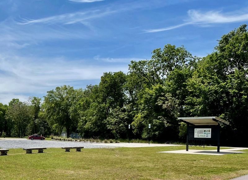
Welcome to Shady Street Trailhead & Park

Photographed by Mark Hilton, April 6, 2024
1. Welcome to Shady Street Trailhead & Park Marker
[Top Row - Left to Right:]
Many more than 200 years ago, Montgomery's history began along a hard bend of the Alabama River in south central Alabama. Long before it was the capital, indeed before the founding of the country, the area was home to indigenous people many of whom spoke Muscogee languages. The diverse tribes of the Creek Confederacy made good use of the fertile land and rivers, founded self-governed towns and lived self-sufficiently, and left behind earthen works and mounds. At first they traded with Europeans but eventually as their land became desirable in the expansion of the United States, native people were forcibly removed. Some walked the Trail of Tears to reservations as far away as Oklahoma and other Creek people relocated south to a reservation in Escambia County, Alabama. They persist and thrive today respectively as the Muscogee Nation and the Poach Band of Creek Indians.
With western expansion came a wave of settlers pursuing the rich Black Belt soil for growing cotton, a lucrative enterprise in a slave-based economy. This rush of people into Central Alabama was described then as
this page online
Billingslea School, built in 1923 was named by the State Board of Education after Alfred Billingslea (1830-1900), one of the most essential, historic African American leaders of Montgomery. A barber in the basement of the Exchange Hotel, Mr. Billingslea was also an accomplished real estate developer and served on the City Council. The school educated children in Old Field as well surrounding neighborhoods, with children crossing the railroad tracks from North Court Street. In the 1950s, Principal Ms. Smart was affiliated with Dr. Martin Luther King. By 1972, the Kindergarten- 6th-grade school, as the adjacent
Photographed by Mark Hilton, April 6, 2024
2. Marker is on the reverse side of the sign.
St. James Baptist Church Old Field was established in 1900 and its parish consisted of members of the surrounding neighborhood. It grew to become a large congregation with the EL Marlow Singers- a choir so exceptional that they travelled across the state to perform. During the Civil Rights Era, the Church conducted voter education and registration drives. Famed jazz and blues musician and educator, Henry Pugh, played at the church as well. He founded Sous La Terre, in downtown Montgomery and was known as the Minister of Music. The northern bypass was built in the 1980s destroying much of the remaining homes, many of which were single and double "shotguns". Yet, the Church still stands as a testament to neighborhood memory and the congregation still convenes. Church members

Photographed by Mark Hilton, April 6, 2024
3. Shady Street Park
St. James Baptist Church Old Field was established in 1900 and its parish consisted of members of the surrounding neighborhood. It grew to become a large congregation with the E.I. Marlow Singers- a choir so exceptional that they travelled across the state to perform. During the Civil Rights Era, the Church conducted voter education and registration drives. Famed jazz and blues musician and educator, Henry Pugh, played at the church as well. He founded Sous La Terre, in downtown Montgomery and was known as the Minister of Music. The northern bypass was built in the 1980s destroying much of the remaining homes, many of which were single and double "shotguns". Yet, the Church still stands as a testament to neighborhood memory and the congregation still convenes. Church members have participated in oral history documentation with students from Auburn University Montgomery's Center for Experiential Learning and Engagement.
Old Field was a lovely, loving neighborhood: Billingslea School, Walker Street, Shady, Joseph, Eva, Lenore, Alaga Syrup with the sweetest syrup in the world, Whitfield Foods, St James Old Field Church... We had a Candy Factory, our very own Willy Wonka's. This little community was full of heart and soul. The neighbors, from one end of the street to another everyone had a story. We are talking about the smaller shotgun houses, we are talking about 5,6,7, 8 people in those, but it was family. The fruit in this neighborhood! We had so much fun back then with all the peaches and pears, the fruit in this place! Everybody knew everybody by name.
Memories shared by St.James Baptist Church Old Field Community Members in 2021, during oral history sessions with students at Auburn University Montgomery.
[Bottom

Photographed by Mark Hilton, April 6, 2024
4. Welcome to Shady Street Trailhead & Park Marker on reverse side.
Undated map of North Montgomery neighborhoods. Note the proximity to railyards, fertilizer and stockyards, and industrial areas surrounding these neighborhoods. Shady St. neighborhood circled in red. (City of Montgomery 1910).
This 1967 photograph features 8 Lafayette Street which had been the Leach Conch Bedding & Furniture Manufacture building and later became the Hollywood Candy Company. It is located next to Montgomery Water Works. Far north at the top of the photo, you can see the chimney of the AL Power Steam plant, now called the Power and Traction Building, in the background. (Photo courtesy of Alabama Department of Archives and History)
The Power & Traction Building was originally built in the late 1800s to provide steam power to run the City's electric street car The Lightening Route. The building even served as hub for the street cars and still retains the tracks, roundabout and repair spaces. The Lightening Route was the first municipally-organized electric street car in the country. For a while the building was a storage space for the State Archives. In December 2020 BastCore, Alabama's first hemp processing plant open there. (Photograph, courtesy of Alabama State Archives, 1985).
The former steam plant that once powered the first electric street car powers a new American trend: the rise of the nation's industrial hemp business. "Federal and state laws now allow for the growing and production of industrial-quality hemp. The 60,000-square-foot BastCore plant at 715 Shady St. takes in hemp stalks from nearby farms to process into fiber, chips and other materials for use across different industries. Those fibers can wind up in a wide variety of products, from carpets, to face masks, to building materials, to diapers. It's already used to make car parts for one of Alabama's automakers. (Brad Harper, Montgomery Advertiser, 12.2020)
Erected by City of Montgomery.
Topics. This historical marker is listed in these topic lists: Indigenous Peoples and Communities • Parks & Recreational Areas • Settlements & Settlers. A significant historical month for this entry is December 2020.
Location. 32° 23.597′ N, 86° 18.829′ W. Marker is in Montgomery, Alabama, in Montgomery County. It is at the intersection of Walker Street and Shady Street, on the right when traveling south on Walker Street. Touch for map. Marker is at or near this postal address: 1037 Walker St, Montgomery AL 36104, United States of America. Touch for directions.

Regionally, this marker is in the Tri-Counties River Region. It is also in the American South, specifically in the Deep South, and in the Black Belt. Globally, it is in North America, a Gulf of Mexico state, the Western Hemisphere, the Western World, and the Anglosphere. Historically, it finds itself in what was once the territory of the Mississippian Culture, one of the Confederate States of America, and the Antebellum South.
Other nearby markers. At least 8 other markers are within walking distance of this marker: Janney Foundry Co. (approx. ¾ mile away); Montgomery's Panel Project (approx. ¾ mile away); High Red Bluff (approx. 0.8 miles away); Major Charles W. Davis, Infantry United States Army / "Above and Beyond" (approx. 0.8 miles away); Montgomery (approx. 0.8 miles away); Struggle For Colonial Empire (approx. 0.8 miles away); Transportation and Commerce (approx. 0.8 miles away); The Domestic Slave Trade / Slave Transportation to Montgomery (approx. 0.8 miles away). Touch for a list and map of all markers in Montgomery.
Additional commentary.
1.
I was a part of St. James MBC. My first wife from the Stinson family was from Old Field. I was licensed to preach at St. James in 1977.
— Submitted March 29, 2026, by Willie J. Smith of Montgomery, Alabama.
Credits. This page was last revised on April 1, 2026. It was originally submitted on April 7, 2024, by Mark Hilton of Montgomery, Alabama. This page has been viewed 890 times since then and 99 times this year. Photos: 1, 2, 3, 4. submitted on April 7, 2024, by Mark Hilton of Montgomery, Alabama.
