Near Williamsburg in James City County, Virginia — The American South (Mid-Atlantic)
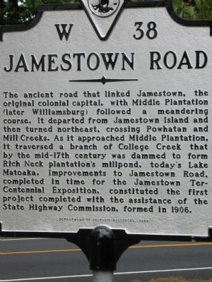
Jamestown Road
Erected 1998 by Department of Historic Resources. (Marker Number W-38.)
Topics and series. This historical marker is listed in these topic lists: Colonial Era • Roads & Vehicles. In addition, it is included in the Virginia Department of Historic Resources (DHR) series list. A significant historical year for this entry is 1906.
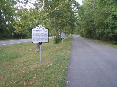
Location. 37° 13.797′ N, 76° 46.807′ W. Marker is near Williamsburg, Virginia, in James City County. Marker is on Jamestown Road (Virginia Route 31) near Colonial National Historical Parkway. This marker sits on a road that runs parallel to Jamestown Rd. and can be accessed off of Colonial Pkwy. Touch for map . Marker is in this post office area: Williamsburg VA 23185, United States of America. Touch for directions.
Other nearby markers. At least 8 other markers are within walking distance of this marker. First Germans at Jamestown (a few steps from this marker); Pocahontas (a few steps from this marker); First Africans In Jamestown (within shouting distance of this marker); First Africans in English America (within shouting distance of this marker); Samuel H. Yonge, Civil Engineer (1843-1935) (within shouting distance of this marker); Jamestown (within shouting distance of this marker); First Poles Arrive (within shouting distance of this marker); Angelo (fl. 1619-1625) (about 700 feet away, measured in a direct line). Touch for a list and map of all markers in Williamsburg.
More about this marker. This marker sits with 4 others V44,WT1,WT2,V45.
Credits. This page was last revised on April 5, 2022. It was originally submitted on September 11, 2007, by Laura Troy of Burke, Virginia. This page has been viewed 1,568 times since then and 58 times this year. Last updated on April 5, 2022, by Carl Gordon Moore Jr. of North East, Maryland. Photos: 1. submitted on September 11, 2007, by Laura Troy of Burke, Virginia. 2. submitted on August 14, 2008, by Bill Coughlin of Woodland Park, New Jersey. • Bernard Fisher was the editor who published this page.

